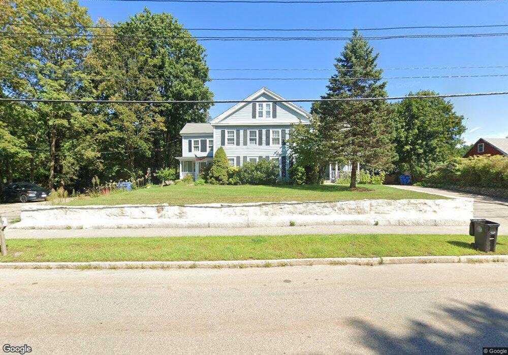
135 East St Wrentham, MA 02093
Estimated Value: $616,000 - $673,000
2
Beds
2
Baths
1,890
Sq Ft
$342/Sq Ft
Est. Value
About This Home
This home is located at 135 East St, Wrentham, MA 02093 and is currently estimated at $645,501, approximately $341 per square foot. 135 East St is a home located in Norfolk County with nearby schools including Delaney Elementary School, Charles E Roderick, and The Sage School.
Ownership History
Date
Name
Owned For
Owner Type
Purchase Details
Closed on
Nov 30, 2017
Sold by
Veilleux Paul A
Bought by
Luce Catherine M and Luce Darryl L
Current Estimated Value
Purchase Details
Closed on
Sep 27, 1994
Sold by
Schensnol Leon P and Schensnol Theodore A
Bought by
Luce Catherine M and Luce Darryl L
Create a Home Valuation Report for This Property
The Home Valuation Report is an in-depth analysis detailing your home's value as well as a comparison with similar homes in the area
Home Values in the Area
Average Home Value in this Area
Purchase History
| Date | Buyer | Sale Price | Title Company |
|---|---|---|---|
| Luce Catherine M | $18,500 | -- | |
| Luce Catherine M | $20,000 | -- |
Source: Public Records
Mortgage History
| Date | Status | Borrower | Loan Amount |
|---|---|---|---|
| Previous Owner | Luce Catherine M | $255,000 | |
| Previous Owner | Luce Catherine M | $125,600 | |
| Previous Owner | Luce Catherine M | $18,000 |
Source: Public Records
Tax History Compared to Growth
Tax History
| Year | Tax Paid | Tax Assessment Tax Assessment Total Assessment is a certain percentage of the fair market value that is determined by local assessors to be the total taxable value of land and additions on the property. | Land | Improvement |
|---|---|---|---|---|
| 2025 | $6,445 | $556,100 | $284,800 | $271,300 |
| 2024 | $6,298 | $524,800 | $284,800 | $240,000 |
| 2023 | $6,132 | $485,900 | $259,900 | $226,000 |
| 2022 | $5,863 | $428,900 | $235,000 | $193,900 |
| 2021 | $5,580 | $396,600 | $211,200 | $185,400 |
| 2020 | $5,783 | $405,800 | $193,700 | $212,100 |
| 2019 | $5,359 | $379,500 | $177,100 | $202,400 |
| 2018 | $5,042 | $354,100 | $175,700 | $178,400 |
| 2017 | $4,738 | $332,500 | $172,300 | $160,200 |
| 2016 | $4,632 | $324,400 | $167,300 | $157,100 |
| 2015 | $4,479 | $299,000 | $160,900 | $138,100 |
| 2014 | $4,679 | $305,600 | $154,700 | $150,900 |
Source: Public Records
Map
Nearby Homes
- 10 Nature View Dr
- 15 Nature View Dr
- 362 East St
- 1 Lorraine Metcalf Dr
- 155 Clark Rd Unit 155
- 270 Dedham St
- 319 Taunton St
- 131 Creek St Unit 7
- 11 Earle Stewart Ln
- Lot 3 - 14 Earle Stewart Ln
- Lot 1 - Blueberry 2 Car Plan at King Philip Estates
- Lot 8 - Blueberry 2 Car Plan at King Philip Estates
- Lot 5 - Hughes 2 car Plan at King Philip Estates
- Lot 6 - Blueberry 3 Car Plan at King Philip Estates
- Lot 2 - Camden 2 Car Plan at King Philip Estates
- Lot 7 - Cedar Plan at King Philip Estates
- Lot 4 - Hemingway 2 Car Plan at King Philip Estates
- Lot 3 - Blueberry 2 Car Plan at King Philip Estates
- 65 Pond St
- 120 Hawes St
- 133 East St
- 139 East St
- 145 East St
- 121 East St
- 121 East St Unit A
- 21 Sleepy Hollow Ln
- 21 Sleepy Hollow Ln Unit 1
- 151 East St
- 1 Lot St E
- 35 Sleepy Hollow Ln
- 109 East St
- 118 East St
- 130 East St
- 150 East St
- 128 East St
- 128 East St Unit B
- 128 East St Unit 1
- 24 Sleepy Hollow Ln
- 146 East St
- 12 Sleepy Hollow Ln