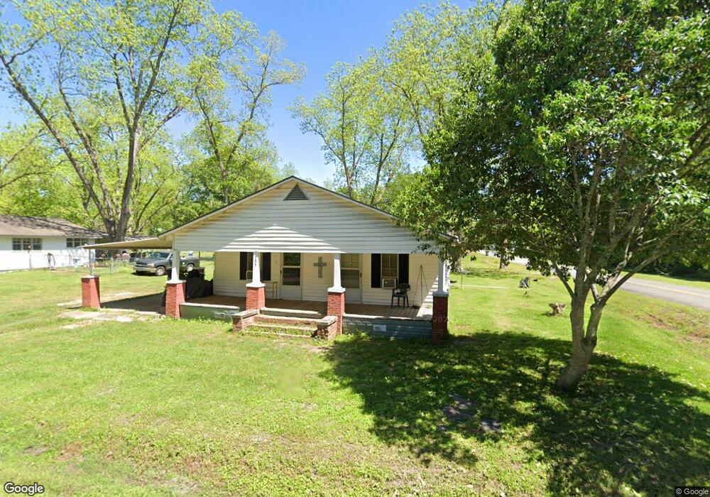
135 Flint St SW Poulan, GA 31781
Estimated Value: $60,000 - $108,000
2
Beds
1
Bath
1,320
Sq Ft
$68/Sq Ft
Est. Value
About This Home
This home is located at 135 Flint St SW, Poulan, GA 31781 and is currently estimated at $90,400, approximately $68 per square foot. 135 Flint St SW is a home located in Worth County with nearby schools including Worth County Primary School, Worth County Elementary School, and Worth County Middle School.
Ownership History
Date
Name
Owned For
Owner Type
Purchase Details
Closed on
Sep 27, 2017
Sold by
Douglas Linda Elaine
Bought by
Wilson Brittany Nicole
Current Estimated Value
Purchase Details
Closed on
Sep 21, 2016
Sold by
Charles Rodney
Bought by
Douglas Linda Elaine
Home Financials for this Owner
Home Financials are based on the most recent Mortgage that was taken out on this home.
Original Mortgage
$30,600
Interest Rate
3.43%
Mortgage Type
Purchase Money Mortgage
Purchase Details
Closed on
Feb 23, 1995
Bought by
Hutchinson Charles
Create a Home Valuation Report for This Property
The Home Valuation Report is an in-depth analysis detailing your home's value as well as a comparison with similar homes in the area
Home Values in the Area
Average Home Value in this Area
Purchase History
| Date | Buyer | Sale Price | Title Company |
|---|---|---|---|
| Wilson Brittany Nicole | -- | -- | |
| Douglas Linda Elaine | $30,600 | -- | |
| Hutchinson Charles | -- | -- |
Source: Public Records
Mortgage History
| Date | Status | Borrower | Loan Amount |
|---|---|---|---|
| Previous Owner | Douglas Linda Elaine | $30,600 |
Source: Public Records
Tax History Compared to Growth
Tax History
| Year | Tax Paid | Tax Assessment Tax Assessment Total Assessment is a certain percentage of the fair market value that is determined by local assessors to be the total taxable value of land and additions on the property. | Land | Improvement |
|---|---|---|---|---|
| 2024 | $545 | $16,017 | $2,100 | $13,917 |
| 2023 | $545 | $15,617 | $2,100 | $13,517 |
| 2022 | $532 | $15,617 | $2,100 | $13,517 |
| 2021 | $532 | $15,617 | $2,100 | $13,517 |
| 2020 | $533 | $15,617 | $2,100 | $13,517 |
| 2019 | $533 | $15,617 | $2,100 | $13,517 |
| 2018 | $533 | $15,617 | $2,100 | $13,517 |
| 2017 | $533 | $15,617 | $2,100 | $13,517 |
| 2016 | $533 | $15,617 | $2,100 | $13,517 |
| 2015 | $228 | $15,617 | $2,100 | $13,517 |
| 2014 | $227 | $15,617 | $2,100 | $13,517 |
| 2013 | -- | $15,617 | $2,100 | $13,517 |
| 2012 | -- | $15,617 | $2,100 | $13,517 |
Source: Public Records
Map
Nearby Homes
- 565 Sands Dr Unit 8
- 565 Sands Dr
- 0 Sands Dr
- 0 P T Salter Rd Unit 138997
- 196 Griffin Houston Rd
- 376 West Rd
- 107 Dunbar Cir
- 103 Dunbar Cir
- 0 Multiple Lots Unit 138826
- 314 E Hobson St
- 302 Sadler St
- 307 E Hobson St
- 202A E Welch St
- 101 Pecan St
- 000 Georgia 256
- 106 Rosewood Dr
- 104 Lynn Cir
- 0 Ga Hwy 82 Unit 913408
- 117 Donna Dr
- 402 N McPhaul St
- 127 Flint St SW
- 516 Broad St SW
- 503 W Church St
- 505 Broad St SW
- 428 Broad St SW
- 425 Broad St SW
- 119 McGirt St SW
- 420 Broad St SW
- 433 W Church St
- 417 Broad St SW
- 427 W Church St
- 534 W Church St
- 215 McGirt St SW
- 414 Broad St SW
- 540 W Church St
- 413 Broad St SW
- 431 Railroad St SW
- 413 W Church St
- 413 W Church St
- 465 Railroad St SW