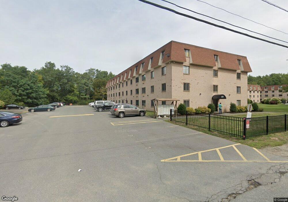
135 Grove St Unit 144 Rockland, MA 02370
Estimated Value: $256,000 - $331,000
2
Beds
1
Bath
906
Sq Ft
$306/Sq Ft
Est. Value
About This Home
This home is located at 135 Grove St Unit 144, Rockland, MA 02370 and is currently estimated at $277,438, approximately $306 per square foot. 135 Grove St Unit 144 is a home located in Plymouth County with nearby schools including Rockland Senior High School, Calvary Chapel Academy, and St Bridget School.
Ownership History
Date
Name
Owned For
Owner Type
Purchase Details
Closed on
Sep 23, 2021
Sold by
Lewis Anne M
Bought by
Akec 1 Llc
Current Estimated Value
Purchase Details
Closed on
May 9, 1997
Sold by
Aspessi Michael S and Aspessi Claire M
Bought by
Lewis Kenneth E and Lewis Ann M
Purchase Details
Closed on
Jan 28, 1988
Sold by
Stac William R
Bought by
Aspessi Michael S
Home Financials for this Owner
Home Financials are based on the most recent Mortgage that was taken out on this home.
Original Mortgage
$80,000
Interest Rate
10.65%
Mortgage Type
Purchase Money Mortgage
Create a Home Valuation Report for This Property
The Home Valuation Report is an in-depth analysis detailing your home's value as well as a comparison with similar homes in the area
Home Values in the Area
Average Home Value in this Area
Purchase History
| Date | Buyer | Sale Price | Title Company |
|---|---|---|---|
| Akec 1 Llc | -- | None Available | |
| Lewis Kenneth E | $34,300 | -- | |
| Aspessi Michael S | $89,000 | -- |
Source: Public Records
Mortgage History
| Date | Status | Borrower | Loan Amount |
|---|---|---|---|
| Previous Owner | Aspessi Michael S | $80,000 |
Source: Public Records
Tax History Compared to Growth
Tax History
| Year | Tax Paid | Tax Assessment Tax Assessment Total Assessment is a certain percentage of the fair market value that is determined by local assessors to be the total taxable value of land and additions on the property. | Land | Improvement |
|---|---|---|---|---|
| 2025 | $3,431 | $251,000 | $0 | $251,000 |
| 2024 | $3,362 | $239,100 | $0 | $239,100 |
| 2023 | $2,864 | $188,200 | $0 | $188,200 |
| 2022 | $2,722 | $162,500 | $0 | $162,500 |
| 2021 | $2,658 | $153,800 | $0 | $153,800 |
| 2020 | $2,615 | $149,400 | $0 | $149,400 |
| 2019 | $2,301 | $128,400 | $0 | $128,400 |
| 2018 | $1,858 | $102,000 | $0 | $102,000 |
| 2017 | $1,798 | $97,300 | $0 | $97,300 |
| 2016 | $1,442 | $78,000 | $0 | $78,000 |
| 2015 | $1,427 | $75,000 | $0 | $75,000 |
| 2014 | $1,383 | $75,400 | $0 | $75,400 |
Source: Public Records
Map
Nearby Homes
- 135 Grove St Unit 110
- 119 Grove St Unit 238
- 119 Grove St Unit 223
- 103 Grove St Unit 337
- 225 W Water St
- 140 W Water St
- 50 Linden Park
- 122 Reed St
- 28 Nevens Cir
- 100 North Ave
- 46 Wardson Cir
- 11 Chestnut Cir
- 45-47 Park St
- 6 Chestnut Cir
- 94-96 Crescent St
- 63 Webster St
- 1 Canterbury Ln
- 20 Birch St
- 133 Crescent St
- 40 Fir Rd Unit 386
- 135 Grove St Unit 149
- 135 Grove St Unit 148
- 135 Grove St Unit 147
- 135 Grove St Unit 146
- 135 Grove St Unit 143
- 135 Grove St Unit 142
- 135 Grove St Unit 141
- 135 Grove St Unit 140
- 135 Grove St Unit 139
- 135 Grove St Unit 138
- 135 Grove St Unit 137
- 135 Grove St
- 135 Grove St Unit 134
- 135 Grove St Unit 133
- 135 Grove St Unit 132
- 135 Grove St Unit 131
- 135 Grove St Unit 130
- 135 Grove St Unit 129
- 135 Grove St Unit 128
- 135 Grove St Unit 127