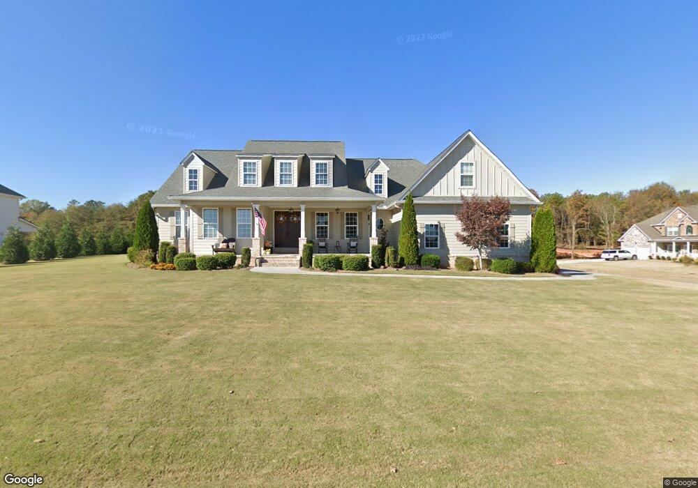
135 Harbor Trail SW Adairsville, GA 30103
Estimated Value: $528,000 - $656,507
4
Beds
4
Baths
4,121
Sq Ft
$141/Sq Ft
Est. Value
About This Home
This home is located at 135 Harbor Trail SW, Adairsville, GA 30103 and is currently estimated at $581,127, approximately $141 per square foot. 135 Harbor Trail SW is a home with nearby schools including Swain Elementary School, Ashworth Middle School, and Gordon Central High School.
Ownership History
Date
Name
Owned For
Owner Type
Purchase Details
Closed on
Nov 14, 2017
Sold by
Trek Custom Homes Llc
Bought by
Smith Andrew Q and Smith Allyson C
Current Estimated Value
Home Financials for this Owner
Home Financials are based on the most recent Mortgage that was taken out on this home.
Original Mortgage
$417,312
Outstanding Balance
$349,964
Interest Rate
3.88%
Mortgage Type
VA
Estimated Equity
$231,163
Purchase Details
Closed on
Sep 6, 2013
Sold by
Bank Of The Ozarks
Bought by
Jhj Millers Ferry 65 Llc
Purchase Details
Closed on
Mar 6, 2012
Sold by
C & M Construction
Bought by
Bank Of The Ozarks
Create a Home Valuation Report for This Property
The Home Valuation Report is an in-depth analysis detailing your home's value as well as a comparison with similar homes in the area
Home Values in the Area
Average Home Value in this Area
Purchase History
| Date | Buyer | Sale Price | Title Company |
|---|---|---|---|
| Smith Andrew Q | $417,312 | -- | |
| Jhj Millers Ferry 65 Llc | $3,600 | -- | |
| Bank Of The Ozarks | -- | -- |
Source: Public Records
Mortgage History
| Date | Status | Borrower | Loan Amount |
|---|---|---|---|
| Open | Smith Andrew Q | $417,312 |
Source: Public Records
Tax History Compared to Growth
Tax History
| Year | Tax Paid | Tax Assessment Tax Assessment Total Assessment is a certain percentage of the fair market value that is determined by local assessors to be the total taxable value of land and additions on the property. | Land | Improvement |
|---|---|---|---|---|
| 2024 | $6,186 | $245,480 | $11,760 | $233,720 |
| 2023 | $5,769 | $229,080 | $11,760 | $217,320 |
| 2022 | $5,438 | $203,280 | $11,200 | $192,080 |
| 2021 | $4,645 | $167,800 | $11,200 | $156,600 |
| 2020 | $4,029 | $167,800 | $11,200 | $156,600 |
| 2019 | $5,355 | $187,920 | $4,480 | $183,440 |
| 2018 | $129 | $167,280 | $4,480 | $162,800 |
| 2017 | $133 | $4,480 | $4,480 | $0 |
| 2016 | $133 | $4,480 | $4,480 | $0 |
| 2015 | $243 | $4,480 | $4,480 | $0 |
| 2014 | -- | $9,520 | $9,520 | $0 |
Source: Public Records
Map
Nearby Homes
- 178 Harbor Trail
- Woodridge Plan at The Landing at Miller’s Ferry
- Kensington Plan at The Landing at Miller’s Ferry
- Northwyck Plan at The Landing at Miller’s Ferry
- Richmond Plan at The Landing at Miller’s Ferry
- Brookhaven Plan at The Landing at Miller’s Ferry
- Newport I Plan at The Landing at Miller’s Ferry
- Wesley Plan at The Landing at Miller’s Ferry
- Newport II Plan at The Landing at Miller’s Ferry
- Richardson Plan at The Landing at Miller’s Ferry
- Dewhurst Plan at The Landing at Miller’s Ferry
- 365 Riverboat Dr
- 238 Lighthouse Cove SW
- 269 Riverboat Dr
- 0 Woody Rd NW Unit 10634615
- 51 Robin Rd
- 315 Woody Rd NW
- 58 Thacker Trail
- 172 Graham Cir
- 166 Graham Cir
- 204 Harbor Trail SW
- 201 Harbor Trail SW
- 0 Harbor Trail
- 114 Harbor Trail SW
- 166 Harbor Trail SW
- 158 Harbor Trail SW
- 190 Harbor Trail SW
- 148 Harbor Trail SW
- 132 Harbor Trail SW
- 185 Harbor Trail SW
- 117 Harbor Trail SW
- 168 Harbor Trail
- 195 Harbor Trail SW
- 107 Harbor Trail SW
- 217 Lighthouse Cove SW
- 108 Harbor Trail
- 228 Riverboat Dr SW
- 344 Riverboat Dr SW
- 216 Riverboat Dr SW
- 354 Riverboat Dr SW