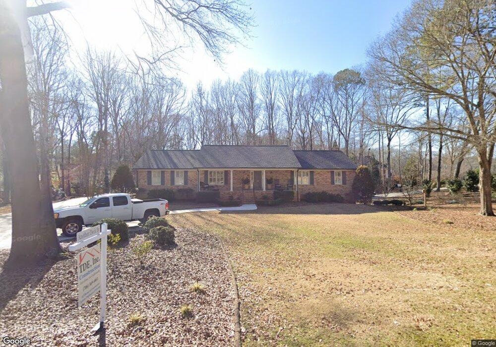
135 High Ridge Dr Athens, GA 30606
Estimated Value: $566,228 - $632,000
5
Beds
3
Baths
3,386
Sq Ft
$176/Sq Ft
Est. Value
About This Home
This home is located at 135 High Ridge Dr, Athens, GA 30606 and is currently estimated at $596,557, approximately $176 per square foot. 135 High Ridge Dr is a home located in Clarke County with nearby schools including Timothy Elementary School, Clarke Middle School, and Clarke Central High School.
Ownership History
Date
Name
Owned For
Owner Type
Purchase Details
Closed on
Sep 14, 2005
Sold by
Reynolds Sandra G
Bought by
Edenfield Brian and Edenfield Sharon
Current Estimated Value
Home Financials for this Owner
Home Financials are based on the most recent Mortgage that was taken out on this home.
Original Mortgage
$140,000
Outstanding Balance
$74,063
Interest Rate
5.77%
Mortgage Type
New Conventional
Estimated Equity
$522,494
Purchase Details
Closed on
Aug 30, 2002
Sold by
Mccarty James L and Trudy Mccart
Bought by
Reynolds Sandra G
Purchase Details
Closed on
Jun 24, 1997
Sold by
Draper Donald C and Draper Nancy L
Bought by
Mccarty James L and Trudy Mccarty
Create a Home Valuation Report for This Property
The Home Valuation Report is an in-depth analysis detailing your home's value as well as a comparison with similar homes in the area
Home Values in the Area
Average Home Value in this Area
Purchase History
| Date | Buyer | Sale Price | Title Company |
|---|---|---|---|
| Edenfield Brian | $280,000 | -- | |
| Reynolds Sandra G | $270,000 | -- | |
| Mccarty James L | $185,000 | -- |
Source: Public Records
Mortgage History
| Date | Status | Borrower | Loan Amount |
|---|---|---|---|
| Open | Edenfield Brian | $140,000 |
Source: Public Records
Tax History Compared to Growth
Tax History
| Year | Tax Paid | Tax Assessment Tax Assessment Total Assessment is a certain percentage of the fair market value that is determined by local assessors to be the total taxable value of land and additions on the property. | Land | Improvement |
|---|---|---|---|---|
| 2025 | $5,624 | $202,894 | $20,000 | $182,894 |
| 2024 | $5,624 | $200,218 | $20,000 | $180,218 |
| 2023 | $5,659 | $194,992 | $20,000 | $174,992 |
| 2022 | $4,713 | $157,736 | $20,000 | $137,736 |
| 2021 | $4,344 | $138,888 | $20,000 | $118,888 |
| 2020 | $4,261 | $136,442 | $20,000 | $116,442 |
| 2019 | $4,245 | $135,032 | $20,000 | $115,032 |
| 2018 | $4,023 | $128,511 | $20,000 | $108,511 |
| 2017 | $3,607 | $116,248 | $20,000 | $96,248 |
| 2016 | $3,564 | $114,986 | $20,000 | $94,986 |
| 2015 | $3,591 | $115,618 | $20,000 | $95,618 |
| 2014 | $3,550 | $114,230 | $20,000 | $94,230 |
Source: Public Records
Map
Nearby Homes
- 134 Bent Tree Dr
- 184 Hillsborough Dr
- 164 Lucy Ln
- 115 Woodhaven St
- 125 Mitchell Bluff
- 124 Pin Oak Ct
- 860 Mitchell Bridge Rd Unit 8
- 860 Mitchell Bridge Rd Unit 8
- 450 River Bottom Rd
- 43 River Shoals Dr
- 150 The Preserve Dr Unit H2
- 575 Vaughn Rd
- 225 Sherwood Dr
- 275 Westchester Cir
- 377 Chalfont Dr
- 379 Chalfont Dr
- 205 Tremont Cir
- 809 Forest Heights Dr
- 125 High Ridge Dr
- 123 Bent Tree Dr
- 145 High Ridge Dr
- 130 High Ridge Dr
- 136 Woodhaven Cir
- 146 Woodhaven Cir
- 120 High Ridge Dr
- 115 High Ridge Dr
- 124 Bent Tree Dr
- 133 Bent Tree Dr
- 126 Woodhaven Cir
- 110 High Ridge Dr
- 150 Woodhaven Cir
- 150 High Ridge Dr
- 150 High Ridge Dr Unit 1
- 155 High Ridge Dr
- 137 Woodhaven Cir
- 147 Woodhaven Cir
- 120 Woodhaven Cir
- 105 High Ridge Dr