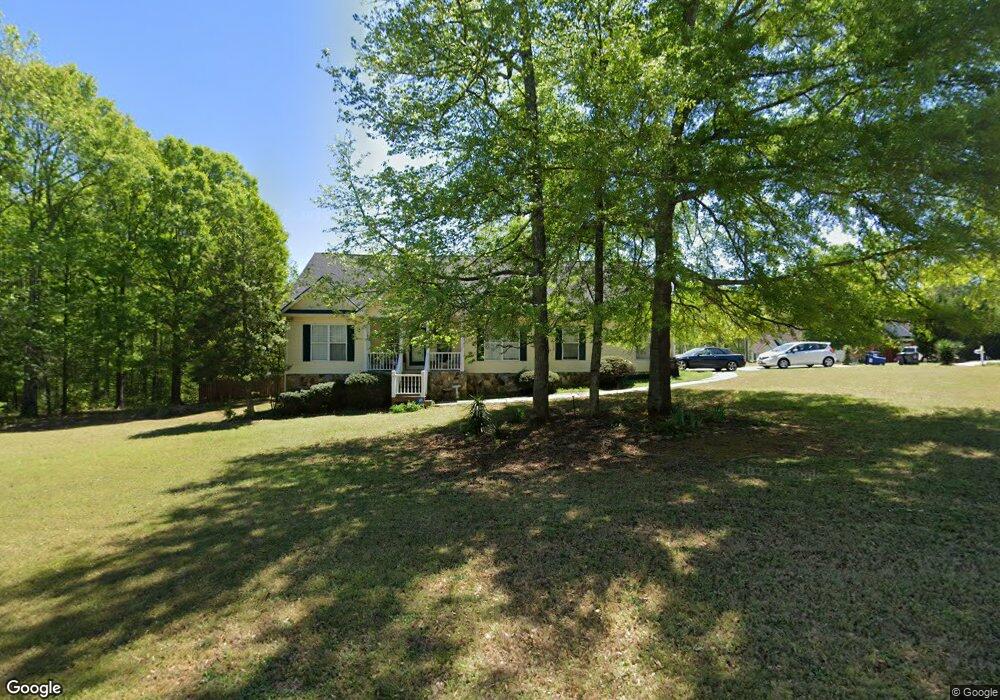
135 Ivory Ln Carrollton, GA 30116
Abilene NeighborhoodEstimated Value: $271,000 - $290,000
3
Beds
2
Baths
1,710
Sq Ft
$166/Sq Ft
Est. Value
About This Home
This home is located at 135 Ivory Ln, Carrollton, GA 30116 and is currently estimated at $283,140, approximately $165 per square foot. 135 Ivory Ln is a home located in Carroll County with nearby schools including Sharp Creek Elementary School, Bay Springs Middle School, and Villa Rica High School.
Ownership History
Date
Name
Owned For
Owner Type
Purchase Details
Closed on
Mar 7, 2017
Sold by
Landrum Tiffany Lasha
Bought by
Terry Cindy
Current Estimated Value
Home Financials for this Owner
Home Financials are based on the most recent Mortgage that was taken out on this home.
Original Mortgage
$120,183
Outstanding Balance
$99,662
Interest Rate
4.17%
Mortgage Type
New Conventional
Estimated Equity
$183,478
Purchase Details
Closed on
Oct 30, 2002
Sold by
Vaughn Mark Mitchell
Bought by
Landrum Tiffany L and Landrum David A
Purchase Details
Closed on
Mar 6, 2001
Sold by
Jacob Development In
Bought by
Vaughn Mark Mitchell
Purchase Details
Closed on
Oct 1, 2000
Bought by
Jacob Development In
Create a Home Valuation Report for This Property
The Home Valuation Report is an in-depth analysis detailing your home's value as well as a comparison with similar homes in the area
Home Values in the Area
Average Home Value in this Area
Purchase History
| Date | Buyer | Sale Price | Title Company |
|---|---|---|---|
| Terry Cindy | $123,900 | -- | |
| Landrum Tiffany L | $119,900 | -- | |
| Vaughn Mark Mitchell | $20,000 | -- | |
| Jacob Development In | -- | -- |
Source: Public Records
Mortgage History
| Date | Status | Borrower | Loan Amount |
|---|---|---|---|
| Open | Terry Cindy | $120,183 |
Source: Public Records
Tax History Compared to Growth
Tax History
| Year | Tax Paid | Tax Assessment Tax Assessment Total Assessment is a certain percentage of the fair market value that is determined by local assessors to be the total taxable value of land and additions on the property. | Land | Improvement |
|---|---|---|---|---|
| 2024 | $1,926 | $102,732 | $6,000 | $96,732 |
| 2023 | $1,926 | $93,980 | $6,000 | $87,980 |
| 2022 | $1,652 | $76,557 | $6,000 | $70,557 |
| 2021 | $1,510 | $66,476 | $6,000 | $60,476 |
| 2020 | $1,381 | $59,272 | $6,000 | $53,272 |
| 2019 | $1,305 | $54,412 | $6,000 | $48,412 |
| 2018 | $1,301 | $49,568 | $6,000 | $43,568 |
| 2017 | $1,079 | $49,568 | $6,000 | $43,568 |
| 2016 | $1,080 | $49,568 | $6,000 | $43,568 |
| 2015 | $869 | $35,064 | $6,000 | $29,064 |
| 2014 | $873 | $35,064 | $6,000 | $29,064 |
Source: Public Records
Map
Nearby Homes
- 255 Emerald Pointe Dr
- 0 Shady Grove Rd Unit 10601173
- 0 Shady Grove Rd Unit 10601172
- 201 Deerfield Ln
- 133 Deerfield Ln
- 10 Deerfield Ln
- 0 Frashier Rd Unit 7549781
- 0 Frashier Rd Unit 10488685
- 0 Knight Dr W
- 1890 Shady Grove Rd
- 0 Old Airport Rd Unit 10599783
- 0 Old Airport Rd Unit 7642336
- 0 Old Airport Rd Unit 10599779
- 183 Muse Bridge Rd
- The McGinnis Plan at Morgan Landing
- 00 Old Airport Rd
- 3279 Shady Grove Rd
- 255 Morgan Rd
- 221 Turtle Cove
- 211 Greystone Dr
- 236 Emerald Pointe Dr
- 236 Emerald Pointe Dr
- 244 Emerald Pointe Dr
- 0 Emerald Pointe Dr Unit 8670349
- 0 Emerald Pointe Dr Unit 8457391
- 0 Emerald Pointe Dr Unit 8457385
- 0 Emerald Pointe Dr Unit 8457374
- 0 Emerald Pointe Dr Unit 8252985
- 0 Emerald Pointe Dr Unit 8763842
- 0 Emerald Pointe Dr Unit 8551743
- 0 Emerald Pointe Dr Unit 8460853
- 0 Emerald Pointe Dr Unit 8351931
- 0 Emerald Pointe Dr Unit 8250082
- 0 Emerald Pointe Dr Unit 8265594
- 0 Emerald Pointe Dr Unit 8158636
- 0 Emerald Pointe Dr
- 150 Ivory Ln
- 102 Opal Ln
- 105 Onyx Ct
- 211 Emerald Pointe Dr Unit 43