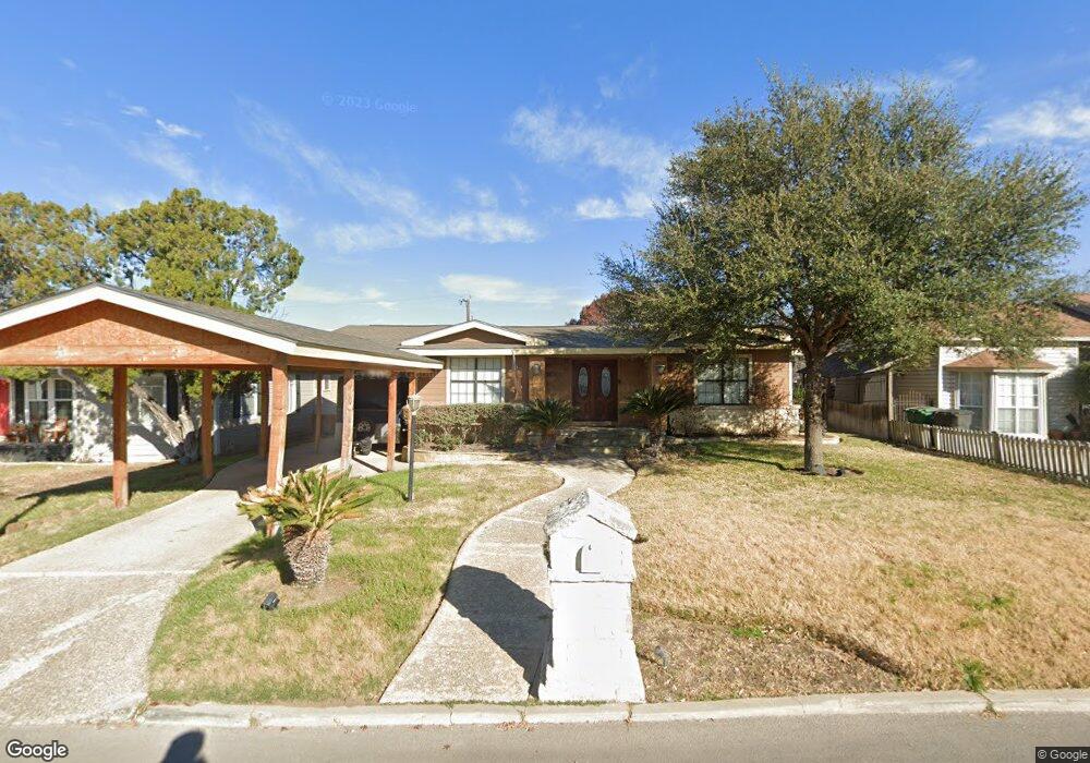
135 Jade Dr San Antonio, TX 78209
Lincoln Heights NeighborhoodEstimated Value: $315,000 - $361,000
2
Beds
2
Baths
1,874
Sq Ft
$181/Sq Ft
Est. Value
About This Home
This home is located at 135 Jade Dr, San Antonio, TX 78209 and is currently estimated at $339,105, approximately $180 per square foot. 135 Jade Dr is a home located in Bexar County with nearby schools including Woodridge Elementary School, Alamo Heights Junior School, and Alamo Heights High School.
Ownership History
Date
Name
Owned For
Owner Type
Purchase Details
Closed on
Mar 19, 2025
Sold by
Rangel Arturo
Bought by
Rangel Arturo and Rangel Krystal Lorraine
Current Estimated Value
Purchase Details
Closed on
May 11, 2010
Sold by
Hortencia G Rangel Trust
Bought by
Raul A Rangel Trust
Purchase Details
Closed on
Jan 15, 2009
Sold by
Rangel Hortencia G
Bought by
Hortencia G Rangel Trust
Create a Home Valuation Report for This Property
The Home Valuation Report is an in-depth analysis detailing your home's value as well as a comparison with similar homes in the area
Home Values in the Area
Average Home Value in this Area
Purchase History
| Date | Buyer | Sale Price | Title Company |
|---|---|---|---|
| Rangel Arturo | -- | None Listed On Document | |
| Raul A Rangel Trust | -- | None Available | |
| Hortencia G Rangel Trust | -- | None Available |
Source: Public Records
Tax History Compared to Growth
Tax History
| Year | Tax Paid | Tax Assessment Tax Assessment Total Assessment is a certain percentage of the fair market value that is determined by local assessors to be the total taxable value of land and additions on the property. | Land | Improvement |
|---|---|---|---|---|
| 2025 | $5,277 | $287,330 | $177,070 | $110,260 |
| 2024 | $5,277 | $309,272 | $177,070 | $139,510 |
| 2023 | $5,277 | $281,156 | $177,070 | $130,260 |
| 2022 | $6,188 | $255,596 | $122,300 | $143,240 |
| 2021 | $5,799 | $232,360 | $106,310 | $126,050 |
| 2020 | $6,048 | $242,090 | $85,620 | $156,470 |
| 2019 | $6,196 | $242,180 | $68,490 | $173,690 |
| 2018 | $5,515 | $220,150 | $68,490 | $151,660 |
| 2017 | $5,677 | $226,650 | $48,910 | $177,740 |
| 2016 | $6,135 | $244,920 | $41,350 | $203,570 |
| 2015 | $5,404 | $237,490 | $41,350 | $196,140 |
| 2014 | $5,404 | $213,770 | $0 | $0 |
Source: Public Records
Map
Nearby Homes
- 222 Conway Dr
- 915 Rexford Dr
- 910 Rexford Dr
- 702 Everest Ave
- 139 Belfast Dr
- 127 Belfast Dr
- 1531 W Lawndale Dr
- 1511 E Sandalwood Ln
- 206 Ridgecrest Dr
- 111 Belfast Dr
- 647 Simple Way
- 8117 Scottshill
- 8109 Scottshill
- 8112 Scottshill
- 1618 W Lawndale Dr
- 1802 Edgehill Dr
- 1835 Flamingo Dr
- 1815 Edgehill Dr
- 8058 Broadway Unit 138N
- 8058 Broadway Unit 251U