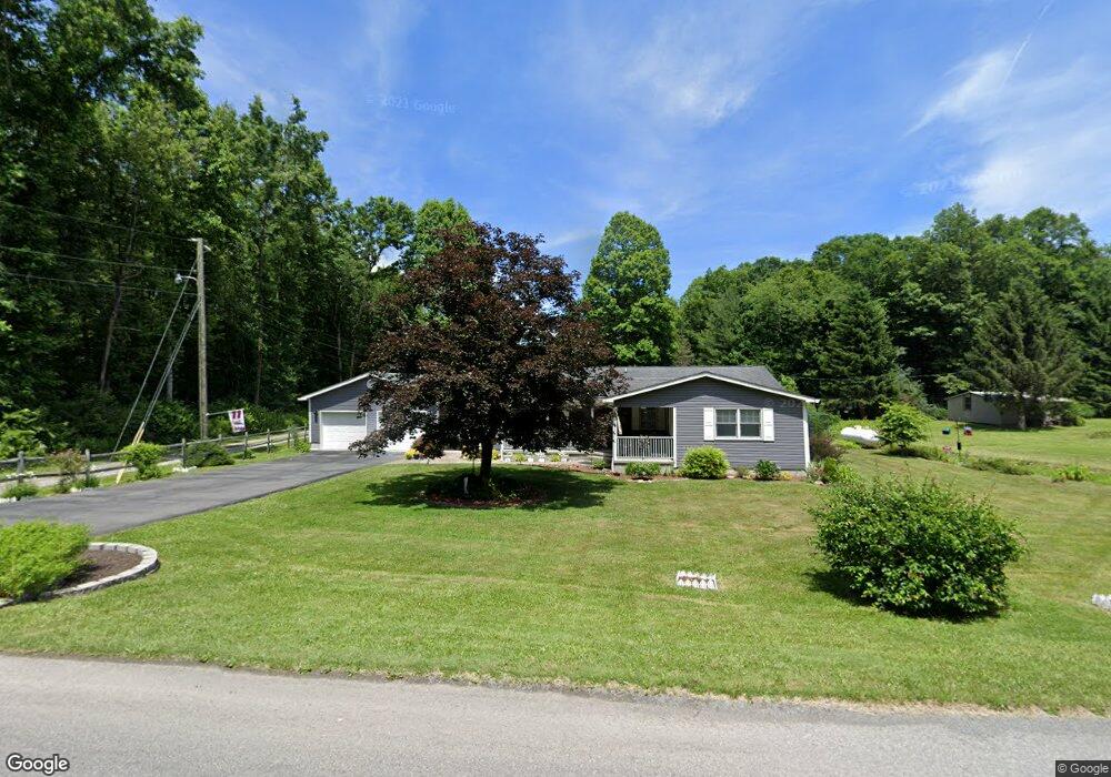
135 Maple Meadow Mining Rd Lester, WV 25865
Estimated Value: $223,000
3
Beds
2
Baths
1,296
Sq Ft
$172/Sq Ft
Est. Value
About This Home
This home is located at 135 Maple Meadow Mining Rd, Lester, WV 25865 and is currently estimated at $223,000, approximately $172 per square foot. 135 Maple Meadow Mining Rd is a home with nearby schools including Fairdale Elementary School, Trap Hill Middle School, and Liberty High School.
Ownership History
Date
Name
Owned For
Owner Type
Purchase Details
Closed on
Nov 6, 2023
Sold by
Flint Sandra
Bought by
Toler Jamie M
Current Estimated Value
Home Financials for this Owner
Home Financials are based on the most recent Mortgage that was taken out on this home.
Original Mortgage
$186,000
Outstanding Balance
$181,700
Interest Rate
6.25%
Mortgage Type
Construction
Estimated Equity
$41,300
Create a Home Valuation Report for This Property
The Home Valuation Report is an in-depth analysis detailing your home's value as well as a comparison with similar homes in the area
Purchase History
| Date | Buyer | Sale Price | Title Company |
|---|---|---|---|
| Toler Jamie M | $18,600 | Attorney Only |
Source: Public Records
Mortgage History
| Date | Status | Borrower | Loan Amount |
|---|---|---|---|
| Open | Toler Jamie M | $186,000 |
Source: Public Records
Tax History Compared to Growth
Tax History
| Year | Tax Paid | Tax Assessment Tax Assessment Total Assessment is a certain percentage of the fair market value that is determined by local assessors to be the total taxable value of land and additions on the property. | Land | Improvement |
|---|---|---|---|---|
| 2024 | $657 | $54,660 | $4,980 | $49,680 |
| 2023 | $597 | $49,680 | $4,980 | $44,700 |
| 2022 | $874 | $72,780 | $4,980 | $67,800 |
| 2021 | $867 | $72,180 | $4,980 | $67,200 |
| 2020 | $872 | $72,180 | $4,980 | $67,200 |
| 2019 | $883 | $73,080 | $4,980 | $68,100 |
| 2018 | $614 | $50,820 | $4,980 | $45,840 |
| 2017 | $614 | $50,820 | $4,980 | $45,840 |
| 2016 | $634 | $51,600 | $4,980 | $46,620 |
| 2015 | $540 | $49,680 | $4,980 | $44,700 |
| 2014 | $540 | $43,980 | $5,160 | $38,820 |
Source: Public Records
Map
Nearby Homes
- 00 Bolt Rd
- 409 Granite Ln
- 0 Rock House Rd
- 152 Granny Mae Rd
- 125 Breezewood Way
- 644 Coal River Rd
- 821 Pine Branch Rd
- 119 Cody Ct
- 151
- 1940 Coal River Rd
- 113 Cody Ct
- 0 Rt 54 Unit 93239
- 0 Stephens Lake Rd
- 106 Jenny Ln
- 3512 Coal River Rd
- 120 Horizon Ln
- 2191 Lester Hwy
- 4239 Coal River Rd
- 214 Cook St
- 103 Church St
- 155 Maple Meadow Mining Rd
- 173 Maple Meadow Mining Rd
- 1380 Bolt Rd
- 165 Maple Meadow Mining Rd
- 770 Bolt Rd
- 1218 Bolt Rd
- 1233 Bolt Rd
- 1239 Bolt Rd
- 131 MacGyver Ln
- 156 Deerfield Ln
- 1210 Bolt Rd
- 1255 Bolt Rd
- 208 Maple Meadow Mining Rd
- 1101 Bolt Rd
- 1228 Bolt Rd
- 126 Deerfield Ln
- 135 Maple Meadow Mine Rd
- 1124 Bolt Rd
- 1268 Bolt Rd
- 1278 Bolt Rd