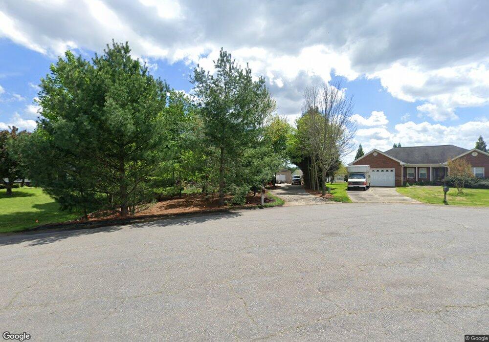
135 Marian Ln Statesville, NC 28625
Estimated Value: $339,000 - $362,000
3
Beds
2
Baths
3,048
Sq Ft
$115/Sq Ft
Est. Value
About This Home
This home is located at 135 Marian Ln, Statesville, NC 28625 and is currently estimated at $350,193, approximately $114 per square foot. 135 Marian Ln is a home located in Iredell County with nearby schools including Cloverleaf Elementary School, East Iredell Middle School, and Statesville High School.
Ownership History
Date
Name
Owned For
Owner Type
Purchase Details
Closed on
Oct 9, 2001
Sold by
Winthrop Samuel B
Bought by
Benfield Ralph Scott and Benfield Sandra Johnston
Current Estimated Value
Home Financials for this Owner
Home Financials are based on the most recent Mortgage that was taken out on this home.
Original Mortgage
$133,950
Outstanding Balance
$66,326
Interest Rate
10.62%
Estimated Equity
$283,867
Purchase Details
Closed on
Jul 1, 1994
Purchase Details
Closed on
Dec 1, 1992
Purchase Details
Closed on
Apr 1, 1992
Create a Home Valuation Report for This Property
The Home Valuation Report is an in-depth analysis detailing your home's value as well as a comparison with similar homes in the area
Home Values in the Area
Average Home Value in this Area
Purchase History
| Date | Buyer | Sale Price | Title Company |
|---|---|---|---|
| Benfield Ralph Scott | $141,000 | -- | |
| -- | $102,500 | -- | |
| -- | $104,000 | -- | |
| -- | $10,000 | -- |
Source: Public Records
Mortgage History
| Date | Status | Borrower | Loan Amount |
|---|---|---|---|
| Open | Benfield Ralph Scott | $133,950 |
Source: Public Records
Tax History Compared to Growth
Tax History
| Year | Tax Paid | Tax Assessment Tax Assessment Total Assessment is a certain percentage of the fair market value that is determined by local assessors to be the total taxable value of land and additions on the property. | Land | Improvement |
|---|---|---|---|---|
| 2024 | $1,429 | $232,060 | $20,000 | $212,060 |
| 2023 | $1,429 | $232,060 | $20,000 | $212,060 |
| 2022 | $1,223 | $185,410 | $20,000 | $165,410 |
| 2021 | $1,219 | $185,410 | $20,000 | $165,410 |
| 2020 | $1,219 | $185,410 | $20,000 | $165,410 |
| 2019 | $1,201 | $185,410 | $20,000 | $165,410 |
| 2018 | $1,066 | $169,700 | $20,000 | $149,700 |
| 2017 | $1,066 | $169,700 | $20,000 | $149,700 |
| 2016 | $1,066 | $169,700 | $20,000 | $149,700 |
| 2015 | $1,066 | $169,700 | $20,000 | $149,700 |
| 2014 | $835 | $141,020 | $20,000 | $121,020 |
Source: Public Records
Map
Nearby Homes
- 160 Tarrington Dr
- 139 Valencia Ln
- 141 Altondale Dr
- 105 Rock Ave
- 201 Tarrington Dr
- 109 Oconee Trail
- Lawson Plan at Sullivan Farm
- Frost Plan at Sullivan Farm
- Dickenson Plan at Sullivan Farm
- Whitman Plan at Sullivan Farm
- Crane Plan at Sullivan Farm
- Emerson Plan at Sullivan Farm
- 150 Oconee Trail
- 145 Oconee Trail
- 495&501 Turnersburg Hwy
- 472 Turnersburg Hwy
- 142 Catawba Walk Way
- 678 Turnersburg Hwy
- 136 Rimmer Rd
- 103 Oaklawn Rd
- 131 Marian Ln
- 139 Marian Ln
- 120 Tarrington Dr
- 116 Tarrington Dr
- 124 Tarrington Dr
- 443 James Farm Rd
- 112 Tarrington Dr
- 437 James Farm Rd
- 447 James Farm Rd
- 128 Tarrington Dr
- 127 Marian Ln
- 108 Tarrington Dr
- 140 Marian Ln
- 118 Marian Ln
- 132 Tarrington Dr
- 451 James Farm Rd
- 136 Marian Ln
- 117 Tarrington Dr
- 121 Tarrington Dr
- 125 Tarrington Dr