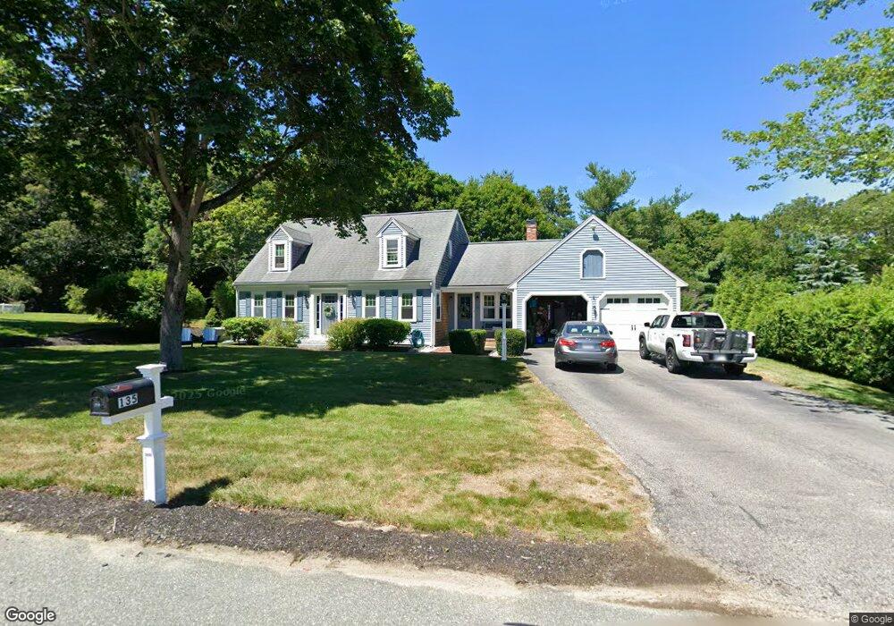
135 New St Marshfield, MA 02050
Estimated Value: $690,000 - $868,000
3
Beds
3
Baths
1,906
Sq Ft
$419/Sq Ft
Est. Value
About This Home
This home is located at 135 New St, Marshfield, MA 02050 and is currently estimated at $798,404, approximately $418 per square foot. 135 New St is a home located in Plymouth County with nearby schools including South River, Furnace Brook Middle School, and Marshfield High School.
Ownership History
Date
Name
Owned For
Owner Type
Purchase Details
Closed on
Jan 4, 2002
Sold by
Wood Paul M and Wood Patricia A
Bought by
Mailloux Mark P and Mailloux Patricia L
Current Estimated Value
Purchase Details
Closed on
Mar 31, 1997
Sold by
Robicheau Donna E
Bought by
Wood Paul M and Wood Patricia A
Purchase Details
Closed on
Sep 6, 1991
Sold by
Melvin Mark W and Melvin Sharon A
Bought by
Robicheau Donald R and Robicheau Donna E
Create a Home Valuation Report for This Property
The Home Valuation Report is an in-depth analysis detailing your home's value as well as a comparison with similar homes in the area
Home Values in the Area
Average Home Value in this Area
Purchase History
| Date | Buyer | Sale Price | Title Company |
|---|---|---|---|
| Mailloux Mark P | $344,900 | -- | |
| Mailloux Mark P | $344,900 | -- | |
| Wood Paul M | $207,500 | -- | |
| Wood Paul M | $207,500 | -- | |
| Robicheau Donald R | $180,000 | -- |
Source: Public Records
Mortgage History
| Date | Status | Borrower | Loan Amount |
|---|---|---|---|
| Open | Robicheau Donald R | $344,965 |
Source: Public Records
Tax History Compared to Growth
Tax History
| Year | Tax Paid | Tax Assessment Tax Assessment Total Assessment is a certain percentage of the fair market value that is determined by local assessors to be the total taxable value of land and additions on the property. | Land | Improvement |
|---|---|---|---|---|
| 2025 | $6,887 | $695,700 | $267,900 | $427,800 |
| 2024 | $6,747 | $649,400 | $257,600 | $391,800 |
| 2023 | $6,404 | $570,200 | $237,000 | $333,200 |
| 2022 | $6,404 | $494,500 | $206,100 | $288,400 |
| 2021 | $6,139 | $465,400 | $206,100 | $259,300 |
| 2020 | $6,066 | $455,100 | $195,800 | $259,300 |
| 2019 | $5,794 | $433,000 | $195,800 | $237,200 |
| 2018 | $5,646 | $422,300 | $195,800 | $226,500 |
| 2017 | $5,419 | $395,000 | $185,400 | $209,600 |
| 2016 | $5,360 | $386,200 | $185,400 | $200,800 |
| 2015 | $5,133 | $386,200 | $185,400 | $200,800 |
| 2014 | $5,073 | $381,700 | $185,400 | $196,300 |
Source: Public Records
Map
Nearby Homes
- 235 Main St
- 341 Furnace St
- 167 Planting Field Rd
- 311 S River St
- 14 Red Pony Path
- 92 Salt Meadow Waye
- 2 Proprietors Dr Unit 23
- 5 Maple Ln Unit 5
- 39 High Beacon Way
- 480 Ferry St
- 61 North St
- 20 Amado Way
- 8 Duxbury St
- 713 Webster St
- 30 Chandler Dr
- 2 Secret Pond Way Unit 35
- 1 Secret Pond Way Unit 36
- 3 Harlow Brook Way Unit 3
- 2 Harlow Brook Way Unit 2
- 848 Plain St Unit 23