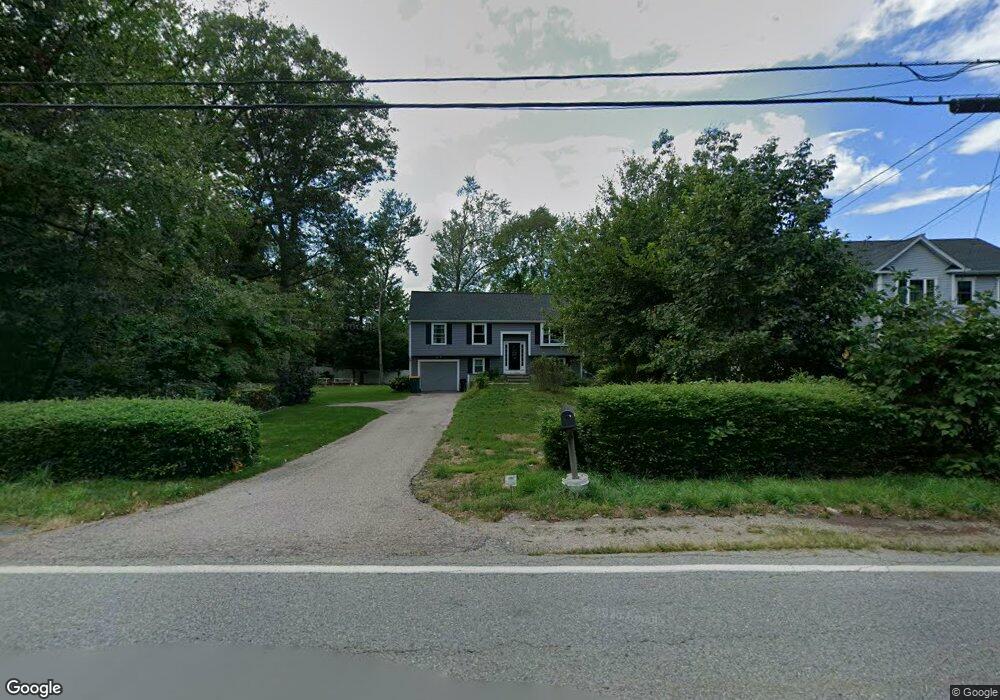
135 Old Post Rd North Attleboro, MA 02760
North Attleboro NeighborhoodEstimated Value: $518,405 - $588,000
3
Beds
1
Bath
1,080
Sq Ft
$506/Sq Ft
Est. Value
About This Home
This home is located at 135 Old Post Rd, North Attleboro, MA 02760 and is currently estimated at $546,101, approximately $505 per square foot. 135 Old Post Rd is a home located in Bristol County with nearby schools including North Attleboro High School.
Ownership History
Date
Name
Owned For
Owner Type
Purchase Details
Closed on
Dec 2, 1996
Sold by
Meyer Clifford J
Bought by
Dumont Michael R and Hanson Donna L
Current Estimated Value
Purchase Details
Closed on
Jul 30, 1996
Sold by
Commercial Rt
Bought by
Meyer Clifford J
Create a Home Valuation Report for This Property
The Home Valuation Report is an in-depth analysis detailing your home's value as well as a comparison with similar homes in the area
Home Values in the Area
Average Home Value in this Area
Purchase History
| Date | Buyer | Sale Price | Title Company |
|---|---|---|---|
| Dumont Michael R | $144,900 | -- | |
| Meyer Clifford J | $50,000 | -- |
Source: Public Records
Mortgage History
| Date | Status | Borrower | Loan Amount |
|---|---|---|---|
| Open | Meyer Clifford J | $25,000 | |
| Closed | Meyer Clifford J | $25,000 | |
| Open | Meyer Clifford J | $111,000 |
Source: Public Records
Tax History Compared to Growth
Tax History
| Year | Tax Paid | Tax Assessment Tax Assessment Total Assessment is a certain percentage of the fair market value that is determined by local assessors to be the total taxable value of land and additions on the property. | Land | Improvement |
|---|---|---|---|---|
| 2025 | $5,362 | $454,800 | $134,400 | $320,400 |
| 2024 | $5,160 | $447,100 | $134,400 | $312,700 |
| 2023 | $5,323 | $416,200 | $134,400 | $281,800 |
| 2022 | $4,999 | $358,900 | $127,600 | $231,300 |
| 2021 | $3,740 | $262,100 | $134,400 | $127,700 |
| 2020 | $4,411 | $307,400 | $134,400 | $173,000 |
| 2019 | $4,148 | $291,300 | $116,100 | $175,200 |
| 2018 | $3,686 | $276,300 | $116,100 | $160,200 |
| 2017 | $3,435 | $259,800 | $110,000 | $149,800 |
| 2016 | $3,338 | $252,500 | $122,200 | $130,300 |
| 2015 | $3,173 | $241,500 | $129,000 | $112,500 |
| 2014 | $3,106 | $234,600 | $125,100 | $109,500 |
Source: Public Records
Map
Nearby Homes
- 11 Primrose Terrace
- 82 Reservoir St
- 25 Gregory Way
- 49 Hoppin Hill Ave
- 121 E Washington St Unit 8
- 121 E Washington St Unit 12
- 121 E Washington St Unit 6
- 121 E Washington St Unit 13
- 121 E Washington St Unit 11
- 31 Walnut Rd
- 0 Anawan Rd
- 90 Walnut Rd
- 47 Juniper Rd Unit F9
- 334 S Washington St
- 30 Juniper Rd Unit 37
- 130 E Washington St Unit 84
- 130 E Washington St Unit 71
- 130 E Washington St Unit 36
- 50 Metcalf Rd
- 30 Sperry Ln Unit Lot 15
- 196 Old Post Rd
- 145 Old Post Rd
- 125 Old Post Rd
- 132 Old Post Rd
- 122 Old Post Rd
- 122 Old Post Rd Unit 1
- 122 Old Post Rd Unit 122
- 142 Old Post Rd
- 115 Old Post Rd
- 161 Old Post Rd
- 116 Old Post Rd
- 641 S Washington St Unit 5
- 641 S Washington St Unit 9
- 641 S Washington St Unit 17R
- 641 S Washington St Unit 16R
- 641 S Washington St Unit 15R
- 641 S Washington St Unit 13R
- 641 S Washington St Unit 12R
- 641 S Washington St Unit 11R
- 641 S Washington St Unit 10R