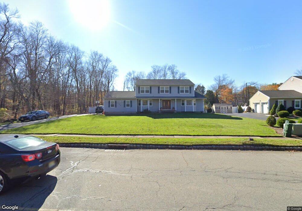
135 Righter Rd Succasunna, NJ 07876
Estimated Value: $664,972 - $724,000
--
Bed
--
Bath
2,184
Sq Ft
$321/Sq Ft
Est. Value
About This Home
This home is located at 135 Righter Rd, Succasunna, NJ 07876 and is currently estimated at $700,993, approximately $320 per square foot. 135 Righter Rd is a home located in Morris County with nearby schools including Eisenhower Middle School, Lincoln Roosevelt Elementary School, and Roxbury High School.
Ownership History
Date
Name
Owned For
Owner Type
Purchase Details
Closed on
Mar 31, 2003
Sold by
Schwartz Helene
Bought by
Gramp Robert and Gramp Irene
Current Estimated Value
Home Financials for this Owner
Home Financials are based on the most recent Mortgage that was taken out on this home.
Original Mortgage
$300,000
Outstanding Balance
$127,837
Interest Rate
5.64%
Estimated Equity
$573,156
Purchase Details
Closed on
Jul 2, 2002
Sold by
Schwartz Donald
Bought by
Schwartz Helene
Create a Home Valuation Report for This Property
The Home Valuation Report is an in-depth analysis detailing your home's value as well as a comparison with similar homes in the area
Home Values in the Area
Average Home Value in this Area
Purchase History
| Date | Buyer | Sale Price | Title Company |
|---|---|---|---|
| Gramp Robert | $375,000 | -- | |
| Schwartz Helene | -- | -- |
Source: Public Records
Mortgage History
| Date | Status | Borrower | Loan Amount |
|---|---|---|---|
| Open | Gramp Robert | $300,000 |
Source: Public Records
Tax History Compared to Growth
Tax History
| Year | Tax Paid | Tax Assessment Tax Assessment Total Assessment is a certain percentage of the fair market value that is determined by local assessors to be the total taxable value of land and additions on the property. | Land | Improvement |
|---|---|---|---|---|
| 2025 | $11,557 | $420,400 | $112,600 | $307,800 |
| 2024 | $11,376 | $420,400 | $112,600 | $307,800 |
| 2023 | $11,376 | $420,400 | $112,600 | $307,800 |
| 2022 | $11,073 | $420,400 | $112,600 | $307,800 |
| 2021 | $11,073 | $420,400 | $112,600 | $307,800 |
| 2020 | $11,052 | $420,400 | $112,600 | $307,800 |
| 2019 | $10,846 | $420,400 | $112,600 | $307,800 |
| 2018 | $11,943 | $277,100 | $84,000 | $193,100 |
| 2017 | $11,879 | $277,100 | $84,000 | $193,100 |
| 2016 | $11,647 | $277,100 | $84,000 | $193,100 |
| 2015 | $11,358 | $277,100 | $84,000 | $193,100 |
| 2014 | $11,178 | $277,100 | $84,000 | $193,100 |
Source: Public Records
Map
Nearby Homes
- 11 Unneberg Ave
- 54 Mapledale Ave
- 17 Unneberg Ave
- 34 Hunter St
- 1 Gail Dr
- 29 Mapledale Ave
- 1 Mekeel Dr
- 209 Woods Edge Dr Unit 209
- 219 Woods Edge Dr Unit 219
- 117 Woods Edge Dr
- 148 Eyland Ave
- 14 Honeyman Dr
- 94 Woods Edge Dr
- 51 Main St Succ
- 111 Main St Succ
- 30 Woods Edge Dr
- 26 Woods Edge Dr
- 3 Beechwood Dr
- 33 N Hillside Ave
- 6 Henry St
- 137 Righter Rd
- 30 Clearfield Rd
- 32 Clearfield Rd
- 28 Clearfield Rd
- 36 Clearfield Rd
- 34 Clearfield Rd
- 26 Clearfield Rd
- 140 Righter Rd
- 23 Clearfield Rd
- 21 Clearfield Rd
- 141 Righter Rd
- 24 Clearfield Rd
- 29 Clearfield Rd
- 23 Regina Rd
- 29 Brookside Rd
- 27 Clearfield Rd
- 14 Regina Rd
- 19 Clearfield Rd
- 27 Brookside Rd
- 22 Clearfield Rd