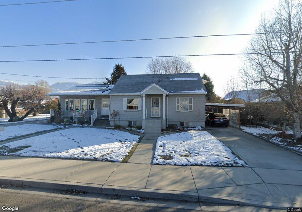
135 S 300 W American Fork, UT 84003
Estimated Value: $552,000 - $585,000
3
Beds
2
Baths
2,028
Sq Ft
$283/Sq Ft
Est. Value
About This Home
This home is located at 135 S 300 W, American Fork, UT 84003 and is currently estimated at $574,122, approximately $283 per square foot. 135 S 300 W is a home located in Utah County with nearby schools including Greenwood Elementary School, American Fork Junior High School, and American Fork High School.
Ownership History
Date
Name
Owned For
Owner Type
Purchase Details
Closed on
Jul 6, 2023
Sold by
Sondra Lynn Green Family Trust
Bought by
Sondra Lynn Green Family Trust and Green
Current Estimated Value
Purchase Details
Closed on
Feb 28, 2020
Sold by
Green Sondra Lynn and The Sondra Lynn Green Family T
Bought by
Green Sondra Lynn and The Sondra Lynn Green Family T
Purchase Details
Closed on
Oct 14, 2014
Sold by
Green Jess L and Green Sondra R
Bought by
Green Sondra Lynn and The Sondra Lynn Green Family T
Create a Home Valuation Report for This Property
The Home Valuation Report is an in-depth analysis detailing your home's value as well as a comparison with similar homes in the area
Home Values in the Area
Average Home Value in this Area
Purchase History
| Date | Buyer | Sale Price | Title Company |
|---|---|---|---|
| Sondra Lynn Green Family Trust | -- | None Listed On Document | |
| Sondra Lynn Green Family Trust | -- | None Listed On Document | |
| Green Sondra Lynn | -- | Vanguard Title Ins Agcy | |
| Green Sondra Lynn | -- | None Available |
Source: Public Records
Tax History Compared to Growth
Tax History
| Year | Tax Paid | Tax Assessment Tax Assessment Total Assessment is a certain percentage of the fair market value that is determined by local assessors to be the total taxable value of land and additions on the property. | Land | Improvement |
|---|---|---|---|---|
| 2025 | $2,517 | $291,005 | $251,800 | $277,300 |
| 2024 | $2,517 | $279,620 | $0 | $0 |
| 2023 | $2,320 | $273,350 | $0 | $0 |
| 2022 | $2,350 | $273,185 | $0 | $0 |
| 2021 | $2,004 | $363,900 | $180,700 | $183,200 |
| 2020 | $1,870 | $329,400 | $161,300 | $168,100 |
| 2019 | $1,682 | $306,300 | $138,200 | $168,100 |
| 2018 | $1,554 | $270,600 | $124,400 | $146,200 |
| 2017 | $1,538 | $144,595 | $0 | $0 |
| 2016 | $1,386 | $121,000 | $0 | $0 |
| 2015 | $1,345 | $111,485 | $0 | $0 |
| 2014 | $1,231 | $100,650 | $0 | $0 |
Source: Public Records
Map
Nearby Homes
- 351 Washington Ave
- 82 S Lincoln Ave
- 55 S 200 W
- 271 S Barratt Cir
- 55 Roosevelt Ave
- 217 W Main St
- 382 W 330 S
- 120 N 350 W Unit 127
- 120 N 350 W Unit 133
- 120 N 350 W Unit 130
- 365 W 370 S
- 316 W 390 S
- 129 W Pacific Dr
- 195 S Center St
- Evergreen Plan at Storrs Court
- Juniper Plan at Storrs Court
- Redwood Plan at Storrs Court
- Ashwood Plan at Storrs Court
- 105 N 100 W
- 429 S Storrs Ave
- 143 S 300 W
- 162 S 270 West Cir Unit 102
- 162 S 270 West Cir
- 158 S 270 West Cir Unit 103
- 158 S 270 West Cir
- 285 W 100 S
- 107 S 300 W
- 263 W 100 S
- 153 S 300 W
- 174 S 270 West Cir Unit 101
- 174 S 270 West Cir
- 148 S 270 Cir W Unit 104
- 148 S 270 Cir W
- 146 S 270 West Cir
- 134 S 300 W Unit & 138
- 134 S 300 W
- 251 W 100 S
- 183 S 300 W
- 130 S 300 W
- 163 S 300 W