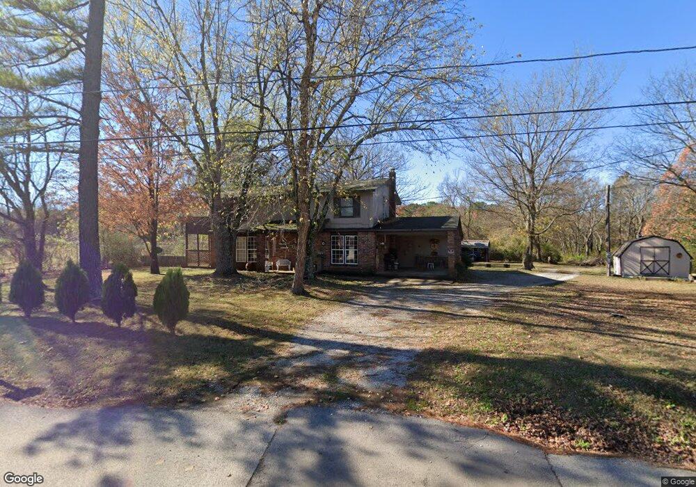
135 S Campbell Ave West Fork, AR 72774
4
Beds
2
Baths
2,094
Sq Ft
0.77
Acres
About This Home
This home is located at 135 S Campbell Ave, West Fork, AR 72774. 135 S Campbell Ave is a home located in Washington County with nearby schools including West Fork Elementary School, West Fork Middle School, and West Fork High School.
Ownership History
Date
Name
Owned For
Owner Type
Purchase Details
Closed on
Jan 18, 2016
Bought by
Taylor Evelyn
Purchase Details
Closed on
Jul 29, 2008
Sold by
Hud
Bought by
Sheehan Michael and Sheehan Tami
Home Financials for this Owner
Home Financials are based on the most recent Mortgage that was taken out on this home.
Original Mortgage
$72,216
Interest Rate
6.4%
Mortgage Type
Purchase Money Mortgage
Purchase Details
Closed on
Feb 16, 2007
Sold by
Wells Fargo Bank Na
Bought by
Hud
Purchase Details
Closed on
Jan 22, 2007
Sold by
Murphy Bernadette J and Baker Rachel Lynn
Bought by
Wells Fargo Bank Na
Purchase Details
Closed on
Dec 7, 1990
Bought by
Smith William Garland and Smith Mary
Purchase Details
Closed on
Jan 1, 1985
Bought by
Sams Harlan and Sams Betty
Create a Home Valuation Report for This Property
The Home Valuation Report is an in-depth analysis detailing your home's value as well as a comparison with similar homes in the area
Home Values in the Area
Average Home Value in this Area
Purchase History
| Date | Buyer | Sale Price | Title Company |
|---|---|---|---|
| Taylor Evelyn | $128,500 | -- | |
| Sheehan Michael | -- | Three Rivers Title Svcs Inc | |
| Hud | -- | None Available | |
| Wells Fargo Bank Na | $107,534 | None Available | |
| Smith William Garland | $50,000 | -- | |
| Sams Harlan | -- | -- |
Source: Public Records
Mortgage History
| Date | Status | Borrower | Loan Amount |
|---|---|---|---|
| Previous Owner | Sheehan Michael | $72,216 |
Source: Public Records
Tax History Compared to Growth
Tax History
| Year | Tax Paid | Tax Assessment Tax Assessment Total Assessment is a certain percentage of the fair market value that is determined by local assessors to be the total taxable value of land and additions on the property. | Land | Improvement |
|---|---|---|---|---|
| 2025 | $665 | $43,660 | $6,000 | $37,660 |
| 2024 | $762 | $43,660 | $6,000 | $37,660 |
| 2023 | $845 | $43,660 | $6,000 | $37,660 |
| 2022 | $895 | $31,550 | $3,000 | $28,550 |
| 2021 | $895 | $31,550 | $3,000 | $28,550 |
| 2020 | $895 | $31,550 | $3,000 | $28,550 |
| 2019 | $895 | $23,910 | $3,000 | $20,910 |
| 2018 | $920 | $23,910 | $3,000 | $20,910 |
| 2017 | $884 | $23,910 | $3,000 | $20,910 |
| 2016 | $884 | $23,910 | $3,000 | $20,910 |
| 2015 | $760 | $23,910 | $3,000 | $20,910 |
| 2014 | $719 | $20,720 | $2,800 | $17,920 |
Source: Public Records
Map
Nearby Homes
- 0000 Highway 170
- 302 Mcknight Ave
- 121 & 129 Main St
- 185 Wheeler St
- 321 Cedar Springs Place
- 106 Pleasant St
- 340 W Smith St
- 327 W Smith St
- 385 W Smith St
- 393 W Smith St
- 365 W Smith St
- 359 W Smith St
- 339 W Smith St
- Springs 1445 Plan at Rolling Plains
- Eureka 1536 Plan at Rolling Plains
- Oak 1463 Plan at Rolling Plains
- Magnolia 1556 Plan at Rolling Plains
- Ashton 1496 Plan at Rolling Plains
- Ouachita 1669 Plan at Rolling Plains
- Osage 1567 Plan at Rolling Plains
- 135 Campbell Ave
- 119 Campbell Ave
- Rt 1 Campbell
- 109 Campbell Ave
- 365 Cemetary Ave
- 365 Cemetary Ave
- 105 Maple Ave
- 77 Campbell Ave
- 350 Cemetary Ave
- 147 Maple Ave
- 121 Maple Ave
- 362 Cemetary Ave
- 153 Maple Ave
- 381 Cemetary Ave
- 55 Maple Ave
- 138 Clifton Place
- 128 Clifton Place
- 65 Campbell Ave
- 148 Clifton Place
- 95 Maple Ave