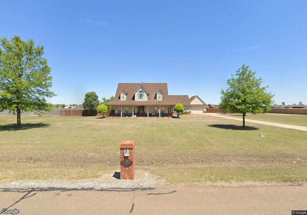
135 S George Cir Marion, AR 72364
Estimated Value: $337,000 - $402,000
3
Beds
3
Baths
2,700
Sq Ft
$136/Sq Ft
Est. Value
About This Home
This home is located at 135 S George Cir, Marion, AR 72364 and is currently estimated at $366,291, approximately $135 per square foot. 135 S George Cir is a home located in Crittenden County with nearby schools including Herbert Carter Global Community Magnet School, Marion Visual Performing Arts Magnet, and Marion Junior High School.
Ownership History
Date
Name
Owned For
Owner Type
Purchase Details
Closed on
Apr 16, 2020
Sold by
Tanner Carl Glen and Tanner Pamela J
Bought by
Moore Michael K and Moore Shelby J
Current Estimated Value
Home Financials for this Owner
Home Financials are based on the most recent Mortgage that was taken out on this home.
Original Mortgage
$251,750
Outstanding Balance
$223,854
Interest Rate
3.6%
Mortgage Type
New Conventional
Estimated Equity
$142,437
Purchase Details
Closed on
Nov 21, 2006
Sold by
Not Provided
Bought by
Tanner Carl G and Tanner Pamela J
Purchase Details
Closed on
Nov 16, 2006
Sold by
Mom'S Land Co Llc
Bought by
Tanner Carl Glen
Create a Home Valuation Report for This Property
The Home Valuation Report is an in-depth analysis detailing your home's value as well as a comparison with similar homes in the area
Home Values in the Area
Average Home Value in this Area
Purchase History
| Date | Buyer | Sale Price | Title Company |
|---|---|---|---|
| Moore Michael K | $265,000 | None Available | |
| Tanner Carl G | $264,000 | -- | |
| Tanner Carl Glen | -- | -- |
Source: Public Records
Mortgage History
| Date | Status | Borrower | Loan Amount |
|---|---|---|---|
| Open | Moore Michael K | $251,750 |
Source: Public Records
Tax History Compared to Growth
Tax History
| Year | Tax Paid | Tax Assessment Tax Assessment Total Assessment is a certain percentage of the fair market value that is determined by local assessors to be the total taxable value of land and additions on the property. | Land | Improvement |
|---|---|---|---|---|
| 2024 | $2,857 | $48,610 | $7,200 | $41,410 |
| 2023 | $2,857 | $48,610 | $7,200 | $41,410 |
| 2022 | $2,857 | $48,610 | $7,200 | $41,410 |
| 2021 | $2,857 | $48,610 | $7,200 | $41,410 |
| 2020 | $2,608 | $48,610 | $7,200 | $41,410 |
| 2019 | $2,263 | $44,280 | $6,000 | $38,280 |
| 2018 | $2,032 | $44,280 | $6,000 | $38,280 |
| 2017 | $2,125 | $46,020 | $6,000 | $40,020 |
| 2016 | $2,370 | $46,020 | $6,000 | $40,020 |
| 2015 | $2,143 | $46,020 | $6,000 | $40,020 |
| 2014 | $2,266 | $48,280 | $6,800 | $41,480 |
Source: Public Records
Map
Nearby Homes
- 144 Brandon Cove
- 190 Jameson Cove
- 198 N George Cir
- 121 Allen Cove
- 511 Rustling Oaks Cove
- 635 Robinson Dr
- 634 Robinson Dr
- 564 Evelyn Rd
- 606 Julia Dr
- 324 Gannt St
- 318 Gannt St
- 310 Gannt St
- 308 Gannt St
- 102 Gannt St
- 804 Winston Cove
- 614 N East Lake Dr N
- 152 Barton Cove
- 130 Barton Cove
- 84 Henry St
- 104 Hunter's Ln
- 133 S George Cir
- 137 S George Cir
- 136 S George Cir
- 134 S George Cir
- 131 S George Cir
- 138 S George Cir
- 139 S George Cir
- 132 S George Cir
- 140 S George Cir
- 156 Boston Cove
- 117 Miller Dr
- 158 Boston Cove
- 119 Miller Dr
- 154 Boston Cove
- 152 Boston Cove
- 142 Brandon Cove
- 115 Miller Dr
- 100 Dorothy Dr
- 102 Dorothy Dr
- 124 Miller Dr