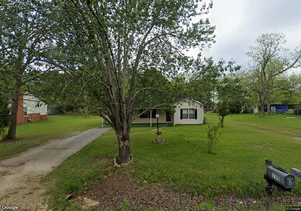
135 Shady Grove Rd Moultrie, GA 31768
Estimated Value: $123,000 - $155,000
2
Beds
1
Bath
1,164
Sq Ft
$118/Sq Ft
Est. Value
About This Home
This home is located at 135 Shady Grove Rd, Moultrie, GA 31768 and is currently estimated at $137,846, approximately $118 per square foot. 135 Shady Grove Rd is a home located in Colquitt County with nearby schools including Okapilco Elementary School, C.A. Gray Junior High School, and Willie J. Williams Middle School.
Ownership History
Date
Name
Owned For
Owner Type
Purchase Details
Closed on
Jun 14, 2024
Sold by
Stone Legacy Holdings Llc
Bought by
Humphrey Eric F and Humphrey Kimberly A
Current Estimated Value
Home Financials for this Owner
Home Financials are based on the most recent Mortgage that was taken out on this home.
Original Mortgage
$110,000
Outstanding Balance
$108,596
Interest Rate
7.02%
Mortgage Type
New Conventional
Estimated Equity
$29,250
Create a Home Valuation Report for This Property
The Home Valuation Report is an in-depth analysis detailing your home's value as well as a comparison with similar homes in the area
Home Values in the Area
Average Home Value in this Area
Purchase History
| Date | Buyer | Sale Price | Title Company |
|---|---|---|---|
| Humphrey Eric F | $135,000 | -- |
Source: Public Records
Mortgage History
| Date | Status | Borrower | Loan Amount |
|---|---|---|---|
| Open | Humphrey Eric F | $110,000 |
Source: Public Records
Tax History Compared to Growth
Tax History
| Year | Tax Paid | Tax Assessment Tax Assessment Total Assessment is a certain percentage of the fair market value that is determined by local assessors to be the total taxable value of land and additions on the property. | Land | Improvement |
|---|---|---|---|---|
| 2024 | $945 | $33,714 | $1,980 | $31,734 |
| 2023 | $590 | $25,968 | $1,980 | $23,988 |
| 2022 | $368 | $21,644 | $1,980 | $19,664 |
| 2021 | $239 | $16,109 | $1,980 | $14,129 |
| 2020 | $244 | $16,109 | $1,980 | $14,129 |
| 2019 | $333 | $18,360 | $1,980 | $16,380 |
| 2018 | $470 | $18,360 | $1,980 | $16,380 |
| 2017 | $329 | $18,360 | $1,980 | $16,380 |
| 2016 | $306 | $17,328 | $1,380 | $15,948 |
| 2015 | $309 | $17,328 | $1,380 | $15,948 |
| 2014 | $301 | $17,328 | $1,380 | $15,948 |
| 2013 | -- | $17,328 | $1,380 | $15,948 |
Source: Public Records
Map
Nearby Homes
- 0 S U Highway 319 N
- 3233 Sylvester Dr
- 107 30th Ave NW
- 0 Doc Darbyshire Rd
- 1208 Maple St
- 273 Seminole Dr
- 514 Indian Lake Dr
- LL261 Rowland Dr
- 131 Seminole Dr
- 615 1st St NW
- 614 2nd St NW
- 503 2nd St NW
- 316 5th Ave NW
- 178 Cool Breeze Dr
- 521 5th Ave NW
- 722 Martin Luther King jr Dr
- 441 Cherokee Dr
- 209 Cherokee Dr
- 218 Gusty Rd
- 619 E Central Ave
- 147 Shady Grove Rd
- 115 Shady Grove Rd
- 134 Shady Grove Rd
- 159 Shady Grove Rd
- 148 Shady Grove Rd
- 625 Us Highway 319 N
- 605 Us Highway 319 N
- 265 Ruth St
- 164 Shady Grove Rd
- 173 Shady Grove Rd
- 669 Us Highway 319 N
- 595 Us Highway 319 N
- 628 Us Highway 319 N
- 178 Shady Grove Rd
- 292 Ruth St
- 585 Us Highway 319 N
- 247 Ruth St
- 687 Us Highway 319 N
- 254 Ruth St
- 552 Us Highway 319 N