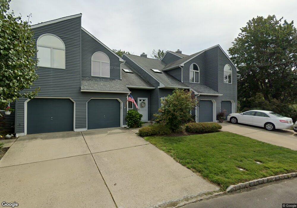
135 Shore Dr Unit CO35 Long Branch, NJ 07740
Estimated Value: $498,000 - $561,000
2
Beds
3
Baths
1,460
Sq Ft
$367/Sq Ft
Est. Value
About This Home
This home is located at 135 Shore Dr Unit CO35, Long Branch, NJ 07740 and is currently estimated at $535,366, approximately $366 per square foot. 135 Shore Dr Unit CO35 is a home located in Monmouth County with nearby schools including Long Branch High School and Holy Trinity School.
Ownership History
Date
Name
Owned For
Owner Type
Purchase Details
Closed on
Jan 25, 2010
Sold by
Palatucci Armand L and Palatucci Patricia A
Bought by
Palatucci Brian
Current Estimated Value
Home Financials for this Owner
Home Financials are based on the most recent Mortgage that was taken out on this home.
Original Mortgage
$150,000
Outstanding Balance
$96,608
Interest Rate
4.5%
Mortgage Type
New Conventional
Estimated Equity
$438,758
Purchase Details
Closed on
Nov 19, 1999
Sold by
Spataro Ellen
Bought by
Palatucci Armand and Palatucci Patricia
Home Financials for this Owner
Home Financials are based on the most recent Mortgage that was taken out on this home.
Original Mortgage
$80,000
Interest Rate
7.73%
Create a Home Valuation Report for This Property
The Home Valuation Report is an in-depth analysis detailing your home's value as well as a comparison with similar homes in the area
Home Values in the Area
Average Home Value in this Area
Purchase History
| Date | Buyer | Sale Price | Title Company |
|---|---|---|---|
| Palatucci Brian | $200,000 | First American Title Ins Co | |
| Palatucci Armand | $130,000 | -- |
Source: Public Records
Mortgage History
| Date | Status | Borrower | Loan Amount |
|---|---|---|---|
| Open | Palatucci Brian | $150,000 | |
| Previous Owner | Palatucci Armand | $80,000 |
Source: Public Records
Tax History Compared to Growth
Tax History
| Year | Tax Paid | Tax Assessment Tax Assessment Total Assessment is a certain percentage of the fair market value that is determined by local assessors to be the total taxable value of land and additions on the property. | Land | Improvement |
|---|---|---|---|---|
| 2025 | $7,176 | $481,700 | $275,000 | $206,700 |
| 2024 | $6,321 | $466,900 | $270,000 | $196,900 |
| 2023 | $6,321 | $407,000 | $200,000 | $207,000 |
| 2022 | $6,613 | $332,400 | $150,000 | $182,400 |
| 2021 | $6,613 | $330,500 | $160,000 | $170,500 |
| 2020 | $6,573 | $314,500 | $145,000 | $169,500 |
| 2019 | $6,026 | $286,700 | $125,000 | $161,700 |
| 2018 | $5,723 | $270,700 | $115,000 | $155,700 |
| 2017 | $5,354 | $259,800 | $107,000 | $152,800 |
| 2016 | $5,079 | $251,300 | $102,500 | $148,800 |
| 2015 | $5,494 | $246,700 | $105,000 | $141,700 |
| 2014 | $5,234 | $247,700 | $122,000 | $125,700 |
Source: Public Records
Map
Nearby Homes
- 165 Kingsley St
- 16 Shore Dr
- 164 Airsdale Ave
- 154 Atlantic Ave
- 9 Manahassett Park Dr
- 28 Patten Ln
- 392 Florence Ave
- 381 Long Branch Ave
- 50 Valentine St Unit 27A
- 50 Valentine St Unit 22A
- 50 Valentine St Unit 12B
- 323 Florence Ave
- 580 Patten Ave Unit 47
- 580 Patten Ave Unit 48
- 580 Patten Ave Unit 62
- 580 Patten Ave Unit 86
- 580 Patten Ave Unit 31
- 8 Mann Ct
- 43 Valentine St
- 188 Chelton Ave
- 133 Shore Dr
- 137 Shore Dr
- 137 Shore Dr Unit CO13
- 131 Shore Dr
- 129 Shore Dr
- 127 Shore Dr
- 125 Shore Dr
- 123 Shore Dr
- 128 Shore Dr
- 130 Shore Dr Unit CO41
- 121 Shore Dr
- 132 Shore Dr
- 126 Shore Dr
- 134 Shore Dr
- 119 Shore Dr Unit O31
- 124 Shore Dr
- 136 Shore Dr Unit CO44
- 117 Shore Dr
- 122 Shore Dr Unit CO67
- 120 Shore Dr