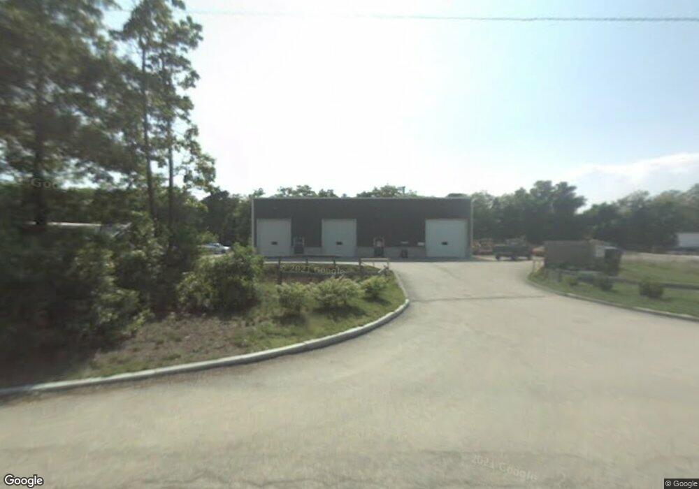
135 State Rd Bourne, MA 02562
Estimated Value: $1,424,283
Studio
--
Bath
6,400
Sq Ft
$223/Sq Ft
Est. Value
About This Home
This home is located at 135 State Rd, Bourne, MA 02562 and is currently estimated at $1,424,283, approximately $222 per square foot. 135 State Rd is a home located in Barnstable County with nearby schools including Bourne High School, Bridgeview Montessori School, and New Testament Christian School.
Ownership History
Date
Name
Owned For
Owner Type
Purchase Details
Closed on
Jun 27, 2017
Sold by
Rfc Realty Enterprises
Bought by
135 State Road Llc
Current Estimated Value
Home Financials for this Owner
Home Financials are based on the most recent Mortgage that was taken out on this home.
Original Mortgage
$725,000
Outstanding Balance
$602,098
Interest Rate
4.05%
Mortgage Type
Commercial
Estimated Equity
$822,185
Purchase Details
Closed on
Jan 12, 2015
Sold by
Clark Richard F and Clark Patricia K
Bought by
Rfc Realty Enterprises
Purchase Details
Closed on
Dec 6, 2002
Sold by
Alm Rt and Nickinello Anthony P
Bought by
Clark Richard F and Clark Patricia K
Home Financials for this Owner
Home Financials are based on the most recent Mortgage that was taken out on this home.
Original Mortgage
$288,000
Interest Rate
6.34%
Mortgage Type
Commercial
Purchase Details
Closed on
Dec 30, 1997
Sold by
Read Brothers Rt and Read William
Bought by
Alm Rt and Mitchell Marie T
Create a Home Valuation Report for This Property
The Home Valuation Report is an in-depth analysis detailing your home's value as well as a comparison with similar homes in the area
Home Values in the Area
Average Home Value in this Area
Purchase History
| Date | Buyer | Sale Price | Title Company |
|---|---|---|---|
| 135 State Road Llc | $725,000 | -- | |
| Rfc Realty Enterprises | -- | -- | |
| Rfc Realty Enterprises | -- | -- | |
| Clark Richard F | $150,000 | -- | |
| Clark Richard F | $150,000 | -- | |
| Alm Rt | $150,000 | -- |
Source: Public Records
Mortgage History
| Date | Status | Borrower | Loan Amount |
|---|---|---|---|
| Open | 135 State Road Llc | $725,000 | |
| Closed | Alm Rt | $725,000 | |
| Previous Owner | Alm Rt | $288,000 |
Source: Public Records
Tax History
| Year | Tax Paid | Tax Assessment Tax Assessment Total Assessment is a certain percentage of the fair market value that is determined by local assessors to be the total taxable value of land and additions on the property. | Land | Improvement |
|---|---|---|---|---|
| 2025 | $6,387 | $817,800 | $457,000 | $360,800 |
| 2024 | $6,313 | $787,200 | $435,300 | $351,900 |
| 2023 | $6,520 | $740,100 | $418,500 | $321,600 |
| 2022 | $7,029 | $696,600 | $393,500 | $303,100 |
| 2021 | $7,301 | $677,900 | $382,000 | $295,900 |
| 2020 | $7,185 | $669,000 | $374,600 | $294,400 |
| 2019 | $6,885 | $655,100 | $367,200 | $287,900 |
| 2018 | $5,459 | $517,900 | $353,100 | $164,800 |
| 2017 | $5,291 | $513,700 | $349,600 | $164,100 |
| 2016 | $5,255 | $517,200 | $349,600 | $167,600 |
| 2015 | $5,208 | $517,200 | $349,600 | $167,600 |
Source: Public Records
Map
Nearby Homes
- 0 State Rd
- 16 Ocean Pines Dr Unit B
- 17 Ridgehill Ln
- 11 Village Green Dr Unit B
- 8 Driftwood Ln
- 10 Tecumseh Rd
- 4 Andrew Rd
- 133 Phillips Rd
- 30 Pawtuxet Rd
- 38 Siasconset Dr
- 150 Herring Pond Rd
- 40 Menotomy Rd
- 92 Cliffside Dr Unit hole 2
- 18 Gibbs Rd
- 110 Valley Rd
- 6 Aspen Rd Unit 6
- 6 Aspen Rd
- 7 Swamp Rd
- 11 Womponoag Rd
- 2 Womponoag Rd
- 135 State Rd Unit 4
- 135 State Rd Unit 5
- 135 State Rd
- 133 State Rd
- 141 State Rd
- 141 State Rd
- 127 State Rd
- 24 Sycamore Ave
- 147 State Rd
- 146 State Rd
- 23 Sycamore Ave
- 117 State Rd
- 116 State Rd Unit 7
- 116 State Rd Unit 1A
- 116 State Rd Unit 2
- 116 State Rd Unit 1
- 116 State Rd Unit 5
- 116 State Rd Unit 10
- 116 State Rd
- 116 State Rd Unit Rear
Your Personal Tour Guide
Ask me questions while you tour the home.