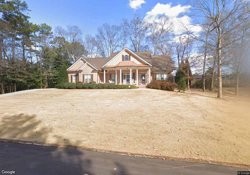
135 Stonehedge Dr Buford, GA 30518
Estimated Value: $525,000 - $613,000
4
Beds
3
Baths
2,580
Sq Ft
$225/Sq Ft
Est. Value
About This Home
This home is located at 135 Stonehedge Dr, Buford, GA 30518 and is currently estimated at $580,113, approximately $224 per square foot. 135 Stonehedge Dr is a home located in Gwinnett County with nearby schools including Buford Elementary School, Buford Senior Academy, and Buford Academy.
Ownership History
Date
Name
Owned For
Owner Type
Purchase Details
Closed on
Aug 22, 2007
Sold by
Simpson James W
Bought by
Kell Lawrence B and Kell Laura S
Current Estimated Value
Create a Home Valuation Report for This Property
The Home Valuation Report is an in-depth analysis detailing your home's value as well as a comparison with similar homes in the area
Home Values in the Area
Average Home Value in this Area
Purchase History
| Date | Buyer | Sale Price | Title Company |
|---|---|---|---|
| Kell Lawrence B | -- | -- |
Source: Public Records
Tax History Compared to Growth
Tax History
| Year | Tax Paid | Tax Assessment Tax Assessment Total Assessment is a certain percentage of the fair market value that is determined by local assessors to be the total taxable value of land and additions on the property. | Land | Improvement |
|---|---|---|---|---|
| 2025 | $1,156 | $231,520 | $40,000 | $191,520 |
| 2024 | $1,156 | $231,720 | $33,600 | $198,120 |
| 2023 | $1,156 | $194,960 | $26,000 | $168,960 |
| 2022 | $1,156 | $194,960 | $26,000 | $168,960 |
| 2021 | $1,156 | $143,320 | $16,800 | $126,520 |
| 2020 | $1,156 | $143,320 | $16,800 | $126,520 |
| 2019 | $1,044 | $135,360 | $16,800 | $118,560 |
| 2018 | $982 | $84,440 | $5,600 | $78,840 |
| 2016 | $959 | $84,440 | $5,600 | $78,840 |
| 2015 | $993 | $84,440 | $5,600 | $78,840 |
| 2014 | $962 | $80,840 | $8,000 | $72,840 |
Source: Public Records
Map
Nearby Homes
- 157 Shadburn Ferry Rd
- 48 Stonehedge Ct
- 25 Stonehedge Dr
- 5789 Creek Indian Dr
- 1481 Buice Crest Dr
- 10 Shadburn Ferry Rd
- 550 Gwinnett St
- 304 E Jackson St
- 120 Gwinnett St
- 5450 N Richland Creek Rd
- 408 Bona Rd
- 130 Legion Dr
- 4942 Greenard Watson Ln
- 4933 Greenard Watson Ln
- 286 Oakland Ave
- 282 Oakland Ave
- 110 Jackson St
- 151 N Church St
- 1098 Caruso Dr
- 5571 Shadburn Ferry Rd
- 160 Victor Dr
- 125 Stonehedge Dr
- 170 Victor Dr
- 150 Victor Dr
- 150 Stonehedge Dr
- 140 Victor Dr
- 130 Stonehedge Dr
- 105 Stonehedge Dr
- 135 Victor Dr
- 145 Victor Dr
- 155 Victor Dr
- 130 Victor Dr
- 120 Stonehedge Dr
- 125 Victor Dr
- 95 Stonehedge Dr
- 200 Shadburn Ferry Rd
- 120 Victor Dr
- 220 Shadburn Ferry Rd
- 230 Shadburn Ferry Rd
- 46 Stonehedge Ct