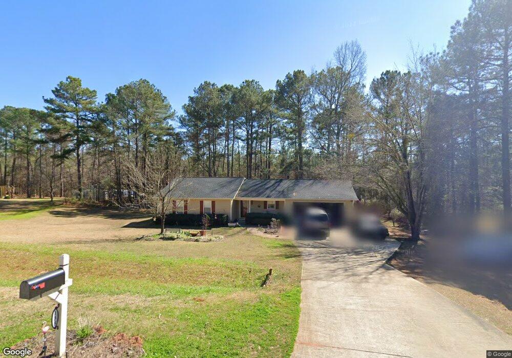
135 Stoneview Cir Covington, GA 30016
Estimated Value: $242,445 - $258,000
Studio
2
Baths
1,280
Sq Ft
$197/Sq Ft
Est. Value
About This Home
This home is located at 135 Stoneview Cir, Covington, GA 30016 and is currently estimated at $252,611, approximately $197 per square foot. 135 Stoneview Cir is a home located in Newton County with nearby schools including Livingston Elementary School, Indian Creek Middle School, and Alcovy High School.
Ownership History
Date
Name
Owned For
Owner Type
Purchase Details
Closed on
Apr 28, 2004
Sold by
Cannon Richard K and Cannon Tifany E
Bought by
Leija Eleuterio and Leija Hermelinda
Current Estimated Value
Home Financials for this Owner
Home Financials are based on the most recent Mortgage that was taken out on this home.
Original Mortgage
$107,340
Interest Rate
6.24%
Mortgage Type
VA
Purchase Details
Closed on
Apr 24, 1996
Sold by
Mckenzie Herman
Bought by
Cannon Richard K Tiffany
Create a Home Valuation Report for This Property
The Home Valuation Report is an in-depth analysis detailing your home's value as well as a comparison with similar homes in the area
Home Values in the Area
Average Home Value in this Area
Purchase History
| Date | Buyer | Sale Price | Title Company |
|---|---|---|---|
| Leija Eleuterio | $111,400 | -- | |
| Cannon Richard K Tiffany | $71,900 | -- |
Source: Public Records
Mortgage History
| Date | Status | Borrower | Loan Amount |
|---|---|---|---|
| Previous Owner | Leija Eleuterio | $107,340 | |
| Closed | Cannon Richard K Tiffany | $0 |
Source: Public Records
Tax History
| Year | Tax Paid | Tax Assessment Tax Assessment Total Assessment is a certain percentage of the fair market value that is determined by local assessors to be the total taxable value of land and additions on the property. | Land | Improvement |
|---|---|---|---|---|
| 2025 | $2,446 | $102,360 | $15,200 | $87,160 |
| 2024 | $2,361 | $94,800 | $15,200 | $79,600 |
| 2023 | $2,254 | $84,840 | $8,800 | $76,040 |
| 2022 | $1,750 | $66,240 | $7,200 | $59,040 |
| 2021 | $1,391 | $47,880 | $7,200 | $40,680 |
| 2020 | $1,272 | $40,120 | $7,200 | $32,920 |
| 2019 | $1,295 | $40,240 | $7,200 | $33,040 |
| 2018 | $1,120 | $34,920 | $5,600 | $29,320 |
| 2017 | $1,153 | $35,880 | $5,600 | $30,280 |
| 2016 | $908 | $28,720 | $3,800 | $24,920 |
| 2015 | $793 | $25,400 | $3,200 | $22,200 |
| 2014 | $792 | $25,400 | $0 | $0 |
Source: Public Records
Map
Nearby Homes
- 10 Lamar Ln
- 1752 Highway 162
- 0 Chestnut Rd Unit 10696786
- 0 Chestnut Rd Unit 7723609
- 20 Mountainview Ct Unit 2
- 115 Mountainview Dr
- 185 Mountain Ridge
- 25 Shady Oaks Trail
- 125 Shelby Oaks Trail
- 220 Harville Rd
- 240 Harville Rd
- 0 Spring Hill Dr Unit 7725409
- 0 Spring Hill Dr Unit 10699182
- 1599 Lower River Rd
- 230 Barcelona Dr
- 674 Lower River Rd
- 179 Ellis Trail
- 10 Barberry Cir
- 0 Highway 81 S Unit 7670352
- 0 Tempie Ln
- 145 Stoneview Cir
- 140 Stoneview Cr
- 140 Stoneview Cir Unit 32
- 140 Stoneview Cir
- 125 Stoneview Cir
- 150 Stoneview Cir
- 110 Stoneview Cir
- 115 Stoneview Cir
- 155 Stoneview Cir
- 25 Stoneview Terrace
- 160 Stoneview Cir
- 35 Stoneview Terrace
- 105 Stoneview Cir
- 165 Stoneview Cir
- 45 Stoneview Terrace
- 20 Stoneview Terrace
- 95 Stoneview Cir
- 30 Stoneview Terrace
- 10 Stoneview Terrace
- 170 Stoneview Cir
Your Personal Tour Guide
Ask me questions while you tour the home.