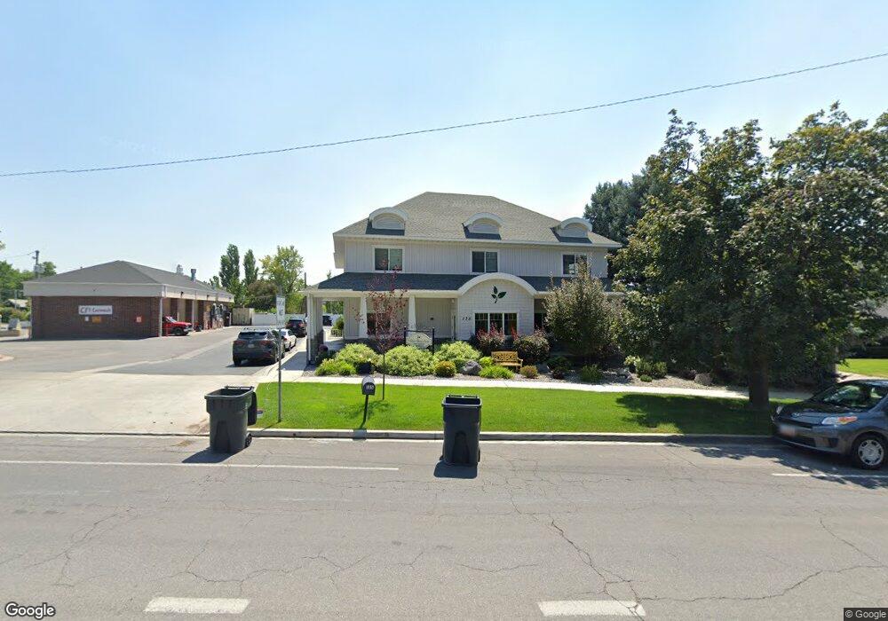
135 W Center St Pleasant Grove, UT 84062
--
Bed
--
Bath
5,259
Sq Ft
0.45
Acres
About This Home
This home is located at 135 W Center St, Pleasant Grove, UT 84062. 135 W Center St is a home located in Utah County with nearby schools including Central Elementary School, Pleasant Grove Junior High School, and Pleasant Grove High School.
Ownership History
Date
Name
Owned For
Owner Type
Purchase Details
Closed on
Apr 4, 2003
Sold by
Horsley Rick and Horsley Richard B
Bought by
Horsley Richard J
Home Financials for this Owner
Home Financials are based on the most recent Mortgage that was taken out on this home.
Original Mortgage
$71,000
Interest Rate
5.73%
Mortgage Type
Commercial
Purchase Details
Closed on
Dec 9, 2002
Sold by
Horsley Richard B and Horsley Shirley S
Bought by
Horsley Richard B and Horsley Shirley S
Home Financials for this Owner
Home Financials are based on the most recent Mortgage that was taken out on this home.
Original Mortgage
$150,300
Interest Rate
6.06%
Mortgage Type
Commercial
Purchase Details
Closed on
Dec 6, 2002
Sold by
Hewitt Elma and Elma Hewitt Trust
Bought by
Horsley Rick and Horsley Richard B
Home Financials for this Owner
Home Financials are based on the most recent Mortgage that was taken out on this home.
Original Mortgage
$150,300
Interest Rate
6.06%
Mortgage Type
Commercial
Purchase Details
Closed on
Jul 29, 2002
Sold by
Magnum Management Corp
Bought by
Stone Family Enterprises Inc
Home Financials for this Owner
Home Financials are based on the most recent Mortgage that was taken out on this home.
Original Mortgage
$615,500
Interest Rate
6.7%
Mortgage Type
Commercial
Purchase Details
Closed on
Feb 23, 1998
Sold by
Barrett Doyle
Bought by
Magnum Management
Purchase Details
Closed on
Dec 31, 1997
Sold by
Water Gardens Development Corp
Bought by
Water Gardens Development Corp
Purchase Details
Closed on
Dec 11, 1996
Sold by
Dawe Ian M and Dawe Marlo E
Bought by
Water Gardens Development Corp
Purchase Details
Closed on
Nov 17, 1992
Sold by
Smith Jerry P and Smith Barbara J
Bought by
Attachment Center Llc
Home Financials for this Owner
Home Financials are based on the most recent Mortgage that was taken out on this home.
Original Mortgage
$120,000
Interest Rate
3.37%
Mortgage Type
Commercial
Create a Home Valuation Report for This Property
The Home Valuation Report is an in-depth analysis detailing your home's value as well as a comparison with similar homes in the area
Home Values in the Area
Average Home Value in this Area
Purchase History
| Date | Buyer | Sale Price | Title Company |
|---|---|---|---|
| Horsley Richard J | -- | Century Title | |
| Horsley Richard B | -- | First American Title Co | |
| Horsley Rick | -- | First American Title Co | |
| Stone Family Enterprises Inc | -- | Century Title | |
| Magnum Management | -- | -- | |
| Water Gardens Development Corp | -- | Provo Land Title Company | |
| Water Gardens Development Corp | -- | Provo Land Title Company | |
| Water Gardens Development Corp | -- | Provo Land Title Company | |
| Water Gardens Development Corp | -- | Provo Land Title Company | |
| Water Gardens Development Corp | -- | Provo Land Title Company | |
| Water Gardens Development Corp | -- | Provo Land Title Company | |
| Water Gardens Development Corp | -- | Provo Land Title Company | |
| Water Gardens Development Corp | -- | Provo Land Title Company | |
| Smith Jerry | -- | Provo Land Title Company | |
| Water Gardens Development Corp | -- | Provo Land Title | |
| Water Gardens Development Corp | -- | Provo Land Title | |
| Attachment Center Llc | -- | Bartlett Title Insurance |
Source: Public Records
Mortgage History
| Date | Status | Borrower | Loan Amount |
|---|---|---|---|
| Previous Owner | Horsley Richard J | $71,000 | |
| Previous Owner | Horsley Rick | $150,300 | |
| Previous Owner | Stone Family Enterprises Inc | $615,500 | |
| Previous Owner | Attachment Center Llc | $120,000 |
Source: Public Records
Tax History Compared to Growth
Tax History
| Year | Tax Paid | Tax Assessment Tax Assessment Total Assessment is a certain percentage of the fair market value that is determined by local assessors to be the total taxable value of land and additions on the property. | Land | Improvement |
|---|---|---|---|---|
| 2025 | $9,249 | $1,106,100 | $379,600 | $726,500 |
| 2024 | $9,249 | $1,079,300 | $0 | $0 |
| 2023 | $8,530 | $1,042,200 | $0 | $0 |
| 2022 | $7,753 | $942,500 | $304,900 | $637,600 |
| 2021 | $7,034 | $716,100 | $252,800 | $463,300 |
| 2020 | $7,397 | $738,200 | $252,800 | $485,400 |
| 2019 | $6,927 | $714,900 | $229,500 | $485,400 |
| 2018 | $7,214 | $704,000 | $218,600 | $485,400 |
| 2017 | $4,837 | $456,900 | $0 | $0 |
| 2016 | $4,901 | $447,000 | $0 | $0 |
| 2015 | -- | $437,800 | $0 | $0 |
| 2014 | $5,013 | $428,900 | $0 | $0 |
Source: Public Records
Map
Nearby Homes