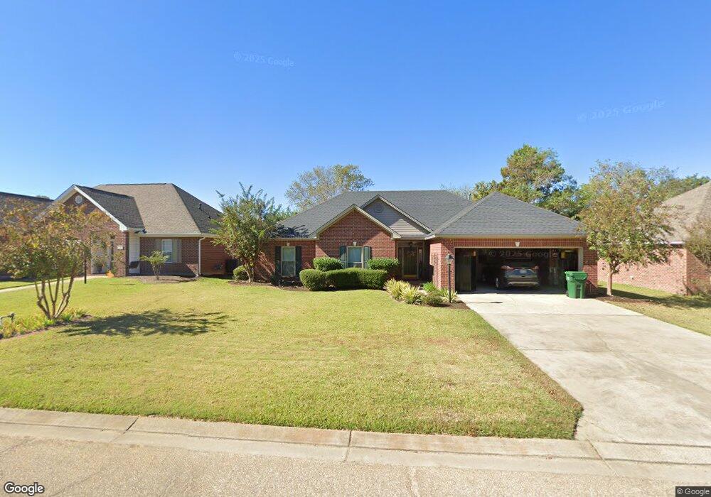
135 Watson Cir West Monroe, LA 71291
Claiborne NeighborhoodEstimated Value: $254,469 - $292,000
3
Beds
2
Baths
2,391
Sq Ft
$113/Sq Ft
Est. Value
About This Home
This home is located at 135 Watson Cir, West Monroe, LA 71291 and is currently estimated at $271,117, approximately $113 per square foot. 135 Watson Cir is a home located in Ouachita Parish with nearby schools including Claiborne School, West Monroe High School, and Northeast Baptist School.
Ownership History
Date
Name
Owned For
Owner Type
Purchase Details
Closed on
Aug 31, 2009
Sold by
Cerniglia Bernard Andrew and Cerniglia Tamara Lyn
Bought by
James Jimmy Dale and James Jenifred Lyn
Current Estimated Value
Home Financials for this Owner
Home Financials are based on the most recent Mortgage that was taken out on this home.
Original Mortgage
$169,600
Outstanding Balance
$110,749
Interest Rate
5.16%
Mortgage Type
Unknown
Estimated Equity
$160,368
Purchase Details
Closed on
Feb 1, 2006
Sold by
Wilson Jesse David and Wilson Krystal Gaye Compton
Bought by
Cerniglia Bernard Andrew and Cerniglia Tamara Lyn Tidwell
Home Financials for this Owner
Home Financials are based on the most recent Mortgage that was taken out on this home.
Original Mortgage
$163,500
Interest Rate
6.24%
Mortgage Type
Unknown
Create a Home Valuation Report for This Property
The Home Valuation Report is an in-depth analysis detailing your home's value as well as a comparison with similar homes in the area
Home Values in the Area
Average Home Value in this Area
Purchase History
| Date | Buyer | Sale Price | Title Company |
|---|---|---|---|
| James Jimmy Dale | $212,000 | None Available | |
| Cerniglia Bernard Andrew | $173,500 | None Available |
Source: Public Records
Mortgage History
| Date | Status | Borrower | Loan Amount |
|---|---|---|---|
| Open | James Jimmy Dale | $169,600 | |
| Previous Owner | Cerniglia Bernard Andrew | $163,500 |
Source: Public Records
Tax History Compared to Growth
Tax History
| Year | Tax Paid | Tax Assessment Tax Assessment Total Assessment is a certain percentage of the fair market value that is determined by local assessors to be the total taxable value of land and additions on the property. | Land | Improvement |
|---|---|---|---|---|
| 2024 | $1,325 | $21,200 | $3,000 | $18,200 |
| 2023 | $1,325 | $21,200 | $3,000 | $18,200 |
| 2022 | $1,944 | $21,200 | $3,000 | $18,200 |
| 2021 | $1,967 | $21,200 | $3,000 | $18,200 |
| 2020 | $1,967 | $21,200 | $3,000 | $18,200 |
| 2019 | $1,962 | $21,200 | $3,000 | $18,200 |
| 2018 | $1,227 | $21,200 | $3,000 | $18,200 |
| 2017 | $1,899 | $21,200 | $3,000 | $18,200 |
| 2016 | $1,898 | $21,200 | $3,000 | $18,200 |
| 2015 | $1,224 | $21,200 | $3,000 | $18,200 |
| 2014 | $1,224 | $21,200 | $3,000 | $18,200 |
| 2013 | $1,220 | $21,200 | $3,000 | $18,200 |
Source: Public Records
Map
Nearby Homes
- 121 Hillcrest Ave
- 106 Sadie Ln
- 502 Wallace Rd
- 260 Defreese Rd Unit Wallace Dean Roa
- 298 Defreese Rd
- 146 Hillcrest Ave
- 221 Westside Dr
- 735 Wallace Dean Rd
- 113 Crocker Ln
- 429 Laird St
- 439 Laird St
- 00 Avant Rd
- 0000 Avant Rd
- 2211 Wellerman Rd
- 115 Wellington Place
- 3709 Cypress St Unit Tract 3
- 302 Paula Dr
- 212 Paula Dr
- Roses V C Plan at Chloe Estates
- Nolana IV B Plan at Chloe Estates