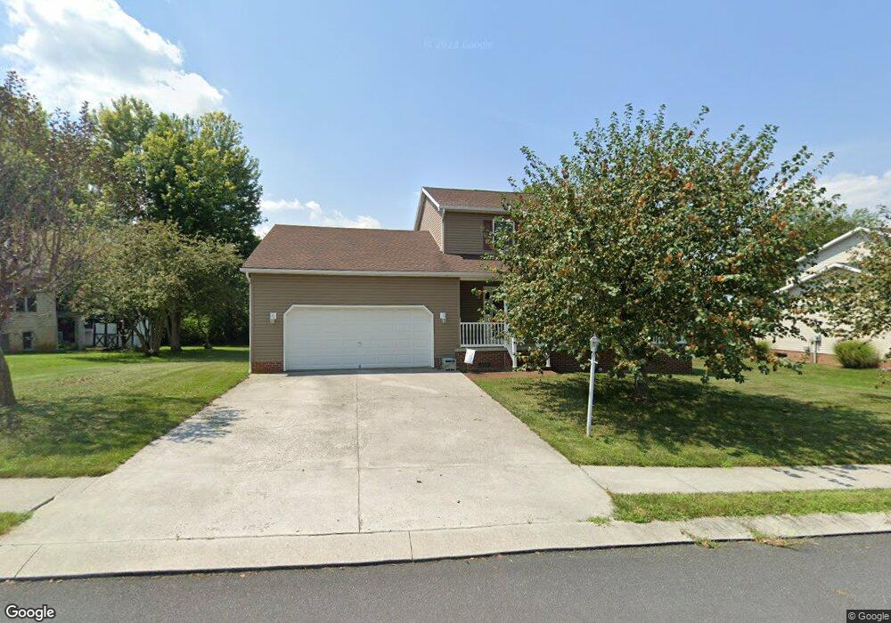
135 Wheaton Dr Unit 110 Littlestown, PA 17340
Estimated Value: $387,138 - $431,000
3
Beds
3
Baths
2,228
Sq Ft
$185/Sq Ft
Est. Value
About This Home
This home is located at 135 Wheaton Dr Unit 110, Littlestown, PA 17340 and is currently estimated at $412,535, approximately $185 per square foot. 135 Wheaton Dr Unit 110 is a home located in Adams County with nearby schools including Rolling Acres El School, Maple Avenue Middle School, and Littlestown Senior High School.
Ownership History
Date
Name
Owned For
Owner Type
Purchase Details
Closed on
Jun 18, 2003
Bought by
Frock Richard E and Frock Dorothy M
Current Estimated Value
Create a Home Valuation Report for This Property
The Home Valuation Report is an in-depth analysis detailing your home's value as well as a comparison with similar homes in the area
Home Values in the Area
Average Home Value in this Area
Purchase History
| Date | Buyer | Sale Price | Title Company |
|---|---|---|---|
| Frock Richard E | -- | -- |
Source: Public Records
Tax History Compared to Growth
Tax History
| Year | Tax Paid | Tax Assessment Tax Assessment Total Assessment is a certain percentage of the fair market value that is determined by local assessors to be the total taxable value of land and additions on the property. | Land | Improvement |
|---|---|---|---|---|
| 2025 | $4,935 | $260,700 | $47,000 | $213,700 |
| 2024 | $4,717 | $260,700 | $47,000 | $213,700 |
| 2023 | $4,624 | $260,700 | $47,000 | $213,700 |
| 2022 | $4,621 | $260,700 | $47,000 | $213,700 |
| 2021 | $4,458 | $260,700 | $47,000 | $213,700 |
| 2020 | $4,394 | $260,700 | $47,000 | $213,700 |
| 2019 | $4,300 | $260,700 | $47,000 | $213,700 |
| 2018 | $4,207 | $260,700 | $47,000 | $213,700 |
| 2017 | $4,062 | $260,700 | $47,000 | $213,700 |
| 2016 | -- | $260,700 | $47,000 | $213,700 |
| 2015 | -- | $260,700 | $47,000 | $213,700 |
| 2014 | -- | $260,700 | $47,000 | $213,700 |
Source: Public Records
Map
Nearby Homes
- 41 Smith Cir
- 5 Manor Cir Unit 103
- 449 Glenwyn Dr
- 535 Lumber St
- 559 Lumber St
- 567 Lumber St
- 349 Basehoar School Rd Unit 5
- 211 E King St
- 43 Ashfield Dr Unit 14
- 162 Newark St
- 61 E King St
- 440 N Queen St
- 115 Charles St
- 140 Apple Grove Ln Unit 425
- 117 Charles St
- 135 Apple Grove Ln Unit 438
- 129 W King St
- 0 Locust Dr Unit PAAD2015910
- 20c Locust Dr
- 20 Locust Dr
- 137 Wheaton Dr
- 137 Wheaton Dr Unit 109
- 133 Wheaton Dr Unit 111
- 136 Wheaton Dr Unit 123
- 134 Wheaton Dr Unit 122
- 131 Wheaton Dr Unit 112
- 139 Wheaton Dr Unit 58
- 138 Wheaton Dr Unit 124
- 512 Parkway Dr Unit 57
- 132 Wheaton Dr Unit 121
- 602 Parkway Dr Unit 86
- 129 Wheaton Dr Unit 113
- 510 Parkway Dr Unit 4
- 106 Wheaton Dr Unit 135
- 108 Wheaton Dr Unit 134
- 130 Wheaton Dr Unit 120
- 104 Wheaton Dr Unit 136
- 604 Parkway Dr Unit 85
- 110 Wheaton Dr Unit 133
- 127 Wheaton Dr Unit 114