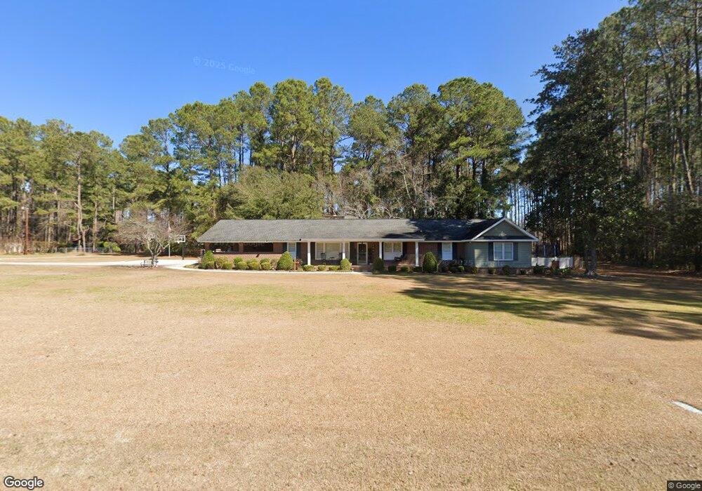
1350 Bennett Cir Holly Hill, SC 29059
Estimated Value: $280,000 - $302,000
3
Beds
2
Baths
2,847
Sq Ft
$102/Sq Ft
Est. Value
About This Home
This home is located at 1350 Bennett Cir, Holly Hill, SC 29059 and is currently estimated at $290,718, approximately $102 per square foot. 1350 Bennett Cir is a home located in Orangeburg County with nearby schools including Holly Hill Elementary School, Holly Hill Elementary, and Holly Hill-Roberts Middle.
Ownership History
Date
Name
Owned For
Owner Type
Purchase Details
Closed on
Jul 7, 2006
Sold by
Arias Andres and Jaques Verma M
Bought by
Brown William Marvin and Brown Dorothy Amanda Westbury
Current Estimated Value
Home Financials for this Owner
Home Financials are based on the most recent Mortgage that was taken out on this home.
Original Mortgage
$158,000
Outstanding Balance
$93,230
Interest Rate
6.54%
Mortgage Type
Purchase Money Mortgage
Estimated Equity
$197,488
Purchase Details
Closed on
Apr 20, 2001
Sold by
Reaves Valerie L and Reaves Jerry T
Bought by
Arias Andres J and Jaquez Virma M
Create a Home Valuation Report for This Property
The Home Valuation Report is an in-depth analysis detailing your home's value as well as a comparison with similar homes in the area
Home Values in the Area
Average Home Value in this Area
Purchase History
| Date | Buyer | Sale Price | Title Company |
|---|---|---|---|
| Brown William Marvin | $158,000 | None Available | |
| Arias Andres J | $124,000 | -- |
Source: Public Records
Mortgage History
| Date | Status | Borrower | Loan Amount |
|---|---|---|---|
| Open | Brown William Marvin | $158,000 |
Source: Public Records
Tax History Compared to Growth
Tax History
| Year | Tax Paid | Tax Assessment Tax Assessment Total Assessment is a certain percentage of the fair market value that is determined by local assessors to be the total taxable value of land and additions on the property. | Land | Improvement |
|---|---|---|---|---|
| 2024 | $2,181 | $15,480 | $2,004 | $13,476 |
| 2023 | $1,924 | $11,688 | $1,596 | $10,092 |
| 2022 | $1,889 | $11,688 | $1,596 | $10,092 |
| 2021 | $1,868 | $11,688 | $1,596 | $10,092 |
| 2020 | $1,840 | $11,688 | $0 | $0 |
| 2019 | $1,847 | $11,688 | $0 | $0 |
| 2018 | $1,741 | $9,666 | $0 | $0 |
| 2017 | $1,729 | $9,666 | $0 | $0 |
| 2016 | $1,418 | $8,130 | $0 | $0 |
| 2015 | $1,378 | $8,130 | $0 | $0 |
| 2014 | $1,378 | $8,130 | $1,596 | $6,534 |
| 2013 | -- | $0 | $0 | $0 |
Source: Public Records
Map
Nearby Homes
- 1301 Bennett Cir
- 264 Walters Rd
- 0 Lindstedt Ln
- 220 Brooks Dr
- 1000 Holly St
- BRANDON Plan at Evergreen
- CALI Plan at Evergreen
- HELENA Plan at Evergreen
- DOWNING Plan at Evergreen
- SULLIVAN Plan at Evergreen
- 123 Hopkins St
- 130 Culbertson Ct
- 114 Culbertson Ct
- 414 Brooks Dr
- 128 Culbertson Ct
- 129 Culbertson Cir
- 132 Brooks Dr
- 129 Culbertson Ct
- 0 Peake St
- 1691 Bennett Cir
- 1400 Bennett Cir
- 1333 Bennett Cir
- 1333 Bennett Cir
- 1129 Mccoy St
- 1217 Mccoy St
- 1132 Mccoy St
- 1319 Bennett Cir
- 1249 Bennett Cir
- 1415 Bennett Cir
- 1422 Bennett Cir
- 1111 Mccoy St
- 1312 Bennett Cir
- 1423 Bennett Cir
- 1402 Brant Ave
- 1432 Bennett Cir
- 1422 Brant Ave
- 1340 Dogwood Ln
- 1101 Mccoy St
- 1433 Bennett Cir
- 1435 Bennett Cir