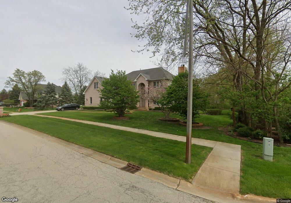
1350 Creekside Ct New Lenox, IL 60451
Estimated Value: $486,000 - $685,000
5
Beds
4
Baths
3,525
Sq Ft
$173/Sq Ft
Est. Value
About This Home
This home is located at 1350 Creekside Ct, New Lenox, IL 60451 and is currently estimated at $608,744, approximately $172 per square foot. 1350 Creekside Ct is a home located in Will County with nearby schools including Oster-Oakview School, Haines Elementary School, and Lincoln Way West.
Ownership History
Date
Name
Owned For
Owner Type
Purchase Details
Closed on
Jul 3, 2002
Sold by
Nlsb
Bought by
Harrington Marcus O and Harrington Glynda C
Current Estimated Value
Home Financials for this Owner
Home Financials are based on the most recent Mortgage that was taken out on this home.
Original Mortgage
$391,500
Interest Rate
6.63%
Mortgage Type
Construction
Create a Home Valuation Report for This Property
The Home Valuation Report is an in-depth analysis detailing your home's value as well as a comparison with similar homes in the area
Home Values in the Area
Average Home Value in this Area
Purchase History
| Date | Buyer | Sale Price | Title Company |
|---|---|---|---|
| Harrington Marcus O | $70,000 | -- |
Source: Public Records
Mortgage History
| Date | Status | Borrower | Loan Amount |
|---|---|---|---|
| Previous Owner | Harrington Marcus O | $391,500 |
Source: Public Records
Tax History Compared to Growth
Tax History
| Year | Tax Paid | Tax Assessment Tax Assessment Total Assessment is a certain percentage of the fair market value that is determined by local assessors to be the total taxable value of land and additions on the property. | Land | Improvement |
|---|---|---|---|---|
| 2024 | $16,402 | $210,117 | $30,696 | $179,421 |
| 2023 | $16,402 | $191,538 | $27,982 | $163,556 |
| 2022 | $14,748 | $176,451 | $25,778 | $150,673 |
| 2021 | $14,018 | $165,946 | $24,243 | $141,703 |
| 2020 | $13,629 | $160,025 | $23,378 | $136,647 |
| 2019 | $13,053 | $155,063 | $22,653 | $132,410 |
| 2018 | $12,762 | $149,718 | $21,872 | $127,846 |
| 2017 | $12,134 | $145,414 | $21,243 | $124,171 |
| 2016 | $11,786 | $141,522 | $20,674 | $120,848 |
| 2015 | $11,423 | $137,067 | $20,023 | $117,044 |
| 2014 | $11,423 | $135,375 | $19,776 | $115,599 |
| 2013 | $11,423 | $137,200 | $20,043 | $117,157 |
Source: Public Records
Map
Nearby Homes
- 1301 Silver Cross Blvd
- 338 Willow St
- 133 Barbara Ln
- 0 Silver Cross Blvd
- 1999 Silver Cross Blvd
- 331 Old Hickory Rd
- 1344 N Cedar Rd
- Vacant W Maple St
- 1500 Ramp
- 217 Aspen Dr
- 125 Kimber Dr
- 200 Redwood Ave
- 208 Redwood Ave
- 218 Manor Dr Unit A
- 203 Fir St
- 224 Hauser Ct
- 416 Manor Ct Unit B
- 513 Pueblo Dr
- 3420 Avondale Ln
- 14119 W Maple Rd
- 1380 Creekside Ct
- 402 W Francis Rd
- 364 W Francis Rd
- 424 W Francis Rd
- 428 W Francis Rd
- 360 W Francis Rd
- 1410 Creekside Ct
- 353 W Francis Rd Unit 1
- 430 W Francis Rd
- 767 Sunburst Ct
- 1263 Green St
- 1440 Creekside Ct
- 349 W Francis Rd
- 814 Sunburst Ct
- 1268 Gordon St
- 1257 Green St
- 356 W Francis Rd
- 1262 Green St
- 347 W Francis Rd Unit 1
- 797 Sunburst Ct