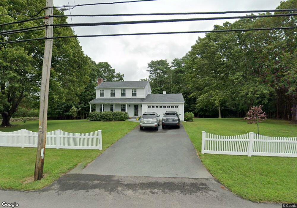
1350 Drift Rd Westport, MA 02790
Westport Point NeighborhoodEstimated Value: $820,000 - $963,000
3
Beds
2
Baths
1,700
Sq Ft
$512/Sq Ft
Est. Value
About This Home
This home is located at 1350 Drift Rd, Westport, MA 02790 and is currently estimated at $870,011, approximately $511 per square foot. 1350 Drift Rd is a home located in Bristol County with nearby schools including Alice A. Macomber Primary School and Westport Elementary School.
Ownership History
Date
Name
Owned For
Owner Type
Purchase Details
Closed on
May 28, 2004
Sold by
Leahy John J
Bought by
Medeiros Lisa Jayne and Medeiros Paul T
Current Estimated Value
Home Financials for this Owner
Home Financials are based on the most recent Mortgage that was taken out on this home.
Original Mortgage
$300,000
Interest Rate
6.32%
Purchase Details
Closed on
Aug 31, 2000
Sold by
Wolock Fred
Bought by
Leahy John J
Purchase Details
Closed on
Jul 7, 1989
Sold by
Sec Atlantic Rt
Bought by
Wolock Fred W
Create a Home Valuation Report for This Property
The Home Valuation Report is an in-depth analysis detailing your home's value as well as a comparison with similar homes in the area
Home Values in the Area
Average Home Value in this Area
Purchase History
| Date | Buyer | Sale Price | Title Company |
|---|---|---|---|
| Medeiros Lisa Jayne | $425,000 | -- | |
| Leahy John J | $246,000 | -- | |
| Wolock Fred W | $85,000 | -- |
Source: Public Records
Mortgage History
| Date | Status | Borrower | Loan Amount |
|---|---|---|---|
| Open | Wolock Fred W | $277,100 | |
| Closed | Wolock Fred W | $300,000 | |
| Closed | Wolock Fred W | $300,000 |
Source: Public Records
Tax History Compared to Growth
Tax History
| Year | Tax Paid | Tax Assessment Tax Assessment Total Assessment is a certain percentage of the fair market value that is determined by local assessors to be the total taxable value of land and additions on the property. | Land | Improvement |
|---|---|---|---|---|
| 2025 | $4,587 | $615,700 | $404,800 | $210,900 |
| 2024 | $4,493 | $581,200 | $375,100 | $206,100 |
| 2023 | $4,522 | $554,200 | $357,200 | $197,000 |
| 2022 | $4,508 | $531,600 | $357,200 | $174,400 |
| 2021 | $3,827 | $444,000 | $269,600 | $174,400 |
| 2020 | $3,652 | $433,200 | $258,800 | $174,400 |
| 2019 | $3,898 | $471,300 | $305,900 | $165,400 |
| 2018 | $3,185 | $389,900 | $226,600 | $163,300 |
| 2017 | $3,273 | $410,700 | $245,100 | $165,600 |
| 2016 | $3,273 | $413,800 | $266,200 | $147,600 |
| 2015 | $3,106 | $391,700 | $247,600 | $144,100 |
Source: Public Records
Map
Nearby Homes