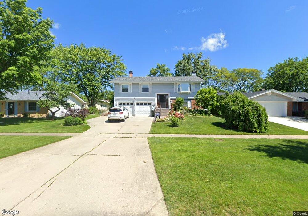
1350 Hassell Rd Hoffman Estates, IL 60169
High Point Park NeighborhoodEstimated Value: $348,628 - $401,000
3
Beds
1
Bath
1,171
Sq Ft
$316/Sq Ft
Est. Value
About This Home
This home is located at 1350 Hassell Rd, Hoffman Estates, IL 60169 and is currently estimated at $370,157, approximately $316 per square foot. 1350 Hassell Rd is a home located in Cook County with nearby schools including MacArthur International Spanish Academy, Dwight D Eisenhower Junior High School, and Hoffman Estates High School.
Ownership History
Date
Name
Owned For
Owner Type
Purchase Details
Closed on
Jan 30, 2004
Sold by
Wilson Denise K
Bought by
Wilson Denise K
Current Estimated Value
Home Financials for this Owner
Home Financials are based on the most recent Mortgage that was taken out on this home.
Original Mortgage
$78,400
Interest Rate
5.96%
Mortgage Type
New Conventional
Purchase Details
Closed on
May 14, 2001
Sold by
Wilson Denise K
Bought by
Wilson Denise K and Denise K Wilson Living Trust
Create a Home Valuation Report for This Property
The Home Valuation Report is an in-depth analysis detailing your home's value as well as a comparison with similar homes in the area
Home Values in the Area
Average Home Value in this Area
Purchase History
| Date | Buyer | Sale Price | Title Company |
|---|---|---|---|
| Wilson Denise K | -- | -- | |
| Wilson Denise K | -- | -- |
Source: Public Records
Mortgage History
| Date | Status | Borrower | Loan Amount |
|---|---|---|---|
| Closed | Wilson Denise K | $78,400 |
Source: Public Records
Tax History
| Year | Tax Paid | Tax Assessment Tax Assessment Total Assessment is a certain percentage of the fair market value that is determined by local assessors to be the total taxable value of land and additions on the property. | Land | Improvement |
|---|---|---|---|---|
| 2025 | $6,879 | $35,000 | $8,443 | $26,557 |
| 2024 | $6,879 | $28,383 | $7,036 | $21,347 |
| 2023 | $7,081 | $30,000 | $7,036 | $22,964 |
| 2022 | $7,081 | $30,000 | $7,036 | $22,964 |
| 2021 | $4,914 | $20,662 | $4,690 | $15,972 |
| 2020 | $4,934 | $20,662 | $4,690 | $15,972 |
| 2019 | $4,914 | $22,958 | $4,690 | $18,268 |
| 2018 | $4,382 | $19,623 | $3,986 | $15,637 |
| 2017 | $5,204 | $19,623 | $3,986 | $15,637 |
| 2016 | $5,102 | $19,623 | $3,986 | $15,637 |
| 2015 | $4,868 | $17,780 | $3,517 | $14,263 |
| 2014 | $4,799 | $17,780 | $3,517 | $14,263 |
| 2013 | $4,658 | $17,780 | $3,517 | $14,263 |
Source: Public Records
Map
Nearby Homes
- 1410 Nottingham Ln
- 1095 Lancaster Ct
- 1930 Kenilworth Cir Unit E
- 1938 Huntington Blvd
- 1665 Chippendale Rd
- 1360 Devonshire Ln
- 1834 Jamestown Cir Unit 3114
- 1712 Fayette Walk Unit D
- 1724 Fayette Walk Unit J
- 1769 Sessions Walk Unit C
- 2021 Kensington Ln Unit 3004
- 2027 Kensington Ln Unit 3001
- 2025 Kensington Ln Unit 3002
- 2023 Kensington Ln Unit 3003
- 730 Ashley Ct
- 2051 Kettering Rd Unit 2
- 1880 Bonnie Ln Unit 416
- 1880 Bonnie Ln Unit 112
- 1659 Islandview Ct
- 1365 Newcastle Ln
- 1340 Hassell Rd
- 1370 Hassell Rd
- 1345 Mayfield Ln
- 1330 Hassell Rd
- 1335 Mayfield Ln
- 1390 Hassell Rd
- 1365 Mayfield Ln
- 1325 Mayfield Ln
- 1365 Hassell Dr
- 1995 Oakdale Rd
- 1315 Mayfield Ln
- 1325 Hassell Dr
- 1361 Hassell Dr
- 1300 Hassell Rd
- 1350 Mayfield Ln
- 1340 Mayfield Ln
- 1400 Hassell Rd
- 1305 Mayfield Ln
- 1329 Hassell Dr
- 1330 Mayfield Ln
Your Personal Tour Guide
Ask me questions while you tour the home.