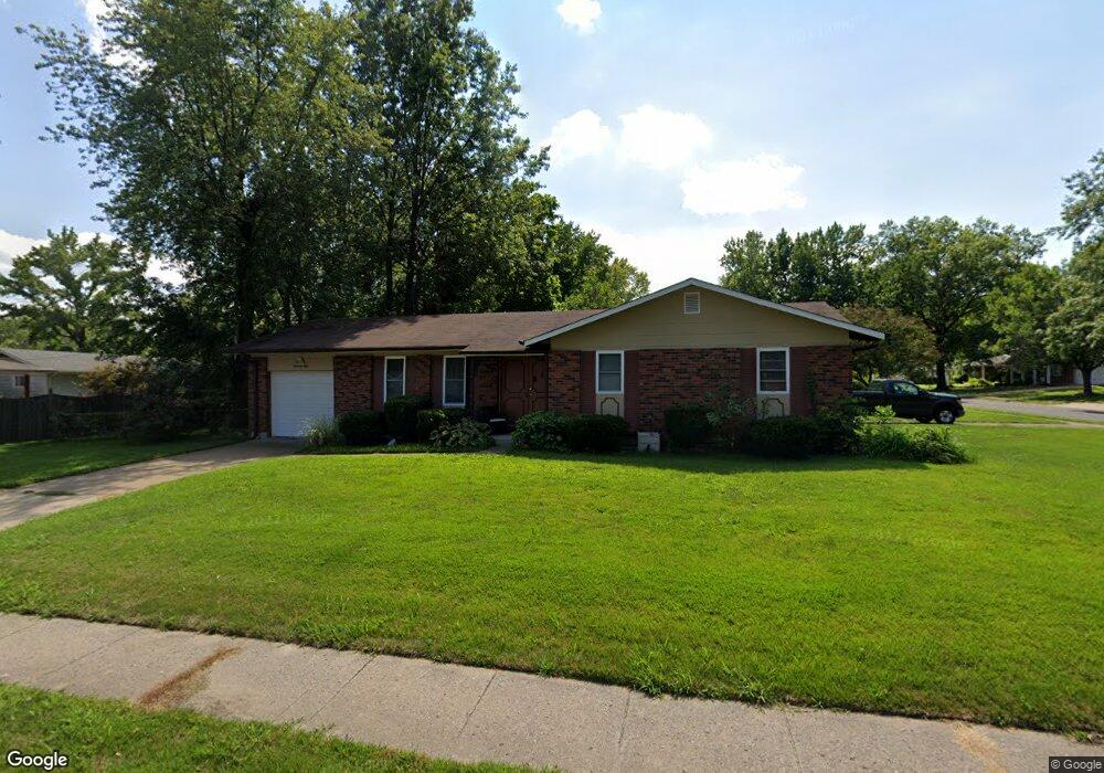
1350 Lindsay Ln Florissant, MO 63031
Estimated Value: $192,000 - $221,000
3
Beds
2
Baths
1,522
Sq Ft
$134/Sq Ft
Est. Value
About This Home
This home is located at 1350 Lindsay Ln, Florissant, MO 63031 and is currently estimated at $203,508, approximately $133 per square foot. 1350 Lindsay Ln is a home located in St. Louis County with nearby schools including Lawson Elementary School, Northwest Middle School, and Hazelwood West High School.
Ownership History
Date
Name
Owned For
Owner Type
Purchase Details
Closed on
Apr 26, 2013
Sold by
Cox Thelma F
Bought by
Deuschle Samuel
Current Estimated Value
Home Financials for this Owner
Home Financials are based on the most recent Mortgage that was taken out on this home.
Original Mortgage
$93,279
Outstanding Balance
$65,543
Interest Rate
3.37%
Mortgage Type
FHA
Estimated Equity
$137,965
Purchase Details
Closed on
Aug 7, 2007
Sold by
Cox Arthur E and Cox Thelma F
Bought by
Cox Arthur E and Cox Thelma F
Create a Home Valuation Report for This Property
The Home Valuation Report is an in-depth analysis detailing your home's value as well as a comparison with similar homes in the area
Home Values in the Area
Average Home Value in this Area
Purchase History
| Date | Buyer | Sale Price | Title Company |
|---|---|---|---|
| Deuschle Samuel | $95,000 | Integrity Land Title Co Inc | |
| Cox Arthur E | -- | None Available |
Source: Public Records
Mortgage History
| Date | Status | Borrower | Loan Amount |
|---|---|---|---|
| Open | Deuschle Samuel | $93,279 |
Source: Public Records
Tax History Compared to Growth
Tax History
| Year | Tax Paid | Tax Assessment Tax Assessment Total Assessment is a certain percentage of the fair market value that is determined by local assessors to be the total taxable value of land and additions on the property. | Land | Improvement |
|---|---|---|---|---|
| 2025 | $2,537 | $36,220 | $5,930 | $30,290 |
| 2024 | $2,537 | $28,370 | $2,700 | $25,670 |
| 2023 | $2,534 | $28,370 | $2,700 | $25,670 |
| 2022 | $2,468 | $24,650 | $3,900 | $20,750 |
| 2021 | $2,404 | $24,650 | $3,900 | $20,750 |
| 2020 | $2,288 | $22,040 | $3,400 | $18,640 |
| 2019 | $2,254 | $22,040 | $3,400 | $18,640 |
| 2018 | $2,055 | $18,470 | $2,910 | $15,560 |
| 2017 | $2,053 | $18,470 | $2,910 | $15,560 |
| 2016 | $2,010 | $17,830 | $2,910 | $14,920 |
| 2015 | $1,967 | $17,830 | $2,910 | $14,920 |
| 2014 | $1,986 | $18,560 | $3,910 | $14,650 |
Source: Public Records
Map
Nearby Homes
- 1405 Miller Dr
- 25 Francisca Dr
- 660 Herbst Dr
- 200 Francisca Dr
- 185 Eldorado Dr
- 1625 Charbonier Rd
- 1725 Gerald Ave
- 425 Gerald Ave
- 2128 Friendship Ct
- 2165 Jenkee Dr
- 400 Raymond Dr
- 1415 Boulder Dr
- 1825 Swallow Ln
- 1505 Swallow Ln
- 1155 Mullanphy Rd
- 1395 Bluebird Dr
- 1380 Thrush Ln
- 1815 Flordawn Dr
- 2484 Blue Heron Dr
- 1065 Keeven Ln
- 1330 Lindsay Ln
- 835 Paul Ave
- 1355 Lindsay Ln
- 1365 Lindsay Ln
- 1345 Lindsay Ln
- 1375 Lindsay Ln
- 825 Paul Ave
- 1410 Lindsay Ln
- 820 Gerald Ave
- 1325 Lindsay Ln
- 775 Gerald Ave
- 1395 Lindsay Ln
- 815 Paul Ave
- 810 Gerald Ave
- 765 Gerald Ave
- 1315 Lindsay Ln
- 1350 Del Rey Dr
- 1360 Del Rey Dr
- 1405 Lindsay Ln
- 1340 Del Rey Dr