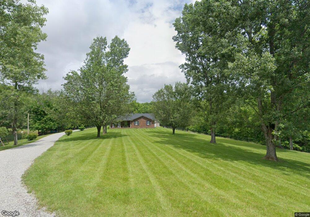
1350 Monick Branch Rd Loretto, KY 40037
Estimated Value: $133,000 - $297,463
4
Beds
2
Baths
1,356
Sq Ft
$173/Sq Ft
Est. Value
About This Home
This home is located at 1350 Monick Branch Rd, Loretto, KY 40037 and is currently estimated at $234,366, approximately $172 per square foot. 1350 Monick Branch Rd is a home located in Marion County with nearby schools including Marion County High School.
Ownership History
Date
Name
Owned For
Owner Type
Purchase Details
Closed on
Dec 23, 2021
Sold by
Blanford Ann C and Hagan George S
Bought by
Cissell Brad M and Cissell Jill M
Current Estimated Value
Home Financials for this Owner
Home Financials are based on the most recent Mortgage that was taken out on this home.
Original Mortgage
$110,000
Outstanding Balance
$93,282
Interest Rate
2.98%
Mortgage Type
Credit Line Revolving
Estimated Equity
$141,084
Purchase Details
Closed on
Dec 30, 2020
Sold by
Cissell Joseph Robert and Cissell Dana
Bought by
Cissell Brad and Cissell Jill
Purchase Details
Closed on
Jun 24, 2011
Sold by
Miles Leslie Michelle and Miles William Bradley
Bought by
Cissell Brad M
Home Financials for this Owner
Home Financials are based on the most recent Mortgage that was taken out on this home.
Original Mortgage
$138,341
Interest Rate
4.62%
Create a Home Valuation Report for This Property
The Home Valuation Report is an in-depth analysis detailing your home's value as well as a comparison with similar homes in the area
Purchase History
| Date | Buyer | Sale Price | Title Company |
|---|---|---|---|
| Cissell Brad M | $103,136 | Accurate Equity Group | |
| Cissell Brad | $10,000 | None Available | |
| Cissell Brad M | $133,500 | None Available | |
| Cissell Brad M | $133,500 | Spragens & Higdon Psc |
Source: Public Records
Mortgage History
| Date | Status | Borrower | Loan Amount |
|---|---|---|---|
| Open | Cissell Brad M | $110,000 | |
| Previous Owner | Cissell Brad M | $138,341 |
Source: Public Records
Tax History
| Year | Tax Paid | Tax Assessment Tax Assessment Total Assessment is a certain percentage of the fair market value that is determined by local assessors to be the total taxable value of land and additions on the property. | Land | Improvement |
|---|---|---|---|---|
| 2025 | $1,541 | $175,000 | $175,000 | $0 |
| 2024 | $1,332 | $150,000 | $150,000 | $0 |
| 2023 | $1,346 | $150,000 | $150,000 | $0 |
| 2022 | $1,356 | $150,000 | $150,000 | $0 |
| 2021 | $1,380 | $150,000 | $150,000 | $0 |
| 2020 | $1,237 | $133,500 | $133,500 | $0 |
| 2019 | $1,237 | $133,500 | $133,500 | $0 |
| 2018 | $1,250 | $133,500 | $133,500 | $0 |
| 2017 | $1,249 | $133,500 | $133,500 | $0 |
| 2015 | $1,180 | $133,500 | $133,500 | $0 |
| 2012 | $1,143 | $133,500 | $133,500 | $0 |
Source: Public Records
Map
Nearby Homes
- 453 Newton Rd
- 800 Hall Simpson Rd
- 280 Gandertown Rd
- Tract 1 Gandertown Rd
- 4620 Holy Cross Rd
- 270 Rodney Clark Rd
- 75 Bear Creek Way
- 6515 Loretto Rd
- 7050 Loretto Rd
- 5200 Block Holy Cross Rd
- 623 Borders Ln
- 101 Harry Rucker Rd
- 630 B Greer Ln
- 110 Norris Loop Rd
- 0 Oak Knoll Dr Unit Lot 29
- 29 Oak Knoll Dr Unit 29
- 1300 Oak Knoll Dr
- Tract 2 Shain Dr
- 259 260 26 Poplar Cir
- 55 Green St
- 1353 Monick Branch Rd
- 1645 Monick Branch Rd
- 1555 Monick Branch Rd
- 1475 Monick Branch Rd
- 1490 Monick Branch Rd
- 1699 Monick Branch Rd
- 506 Monick Branch Rd
- 980 Monick Branch Rd
- 1160 Monick Branch Rd
- 35 Monick Branch Rd
- 155 Monick Branch Rd
- 825 Monick Branch Rd
- 1015 Monick Branch Rd
- 1697 Monich Branch Rd
- 792 Botland Rd
Your Personal Tour Guide
Ask me questions while you tour the home.