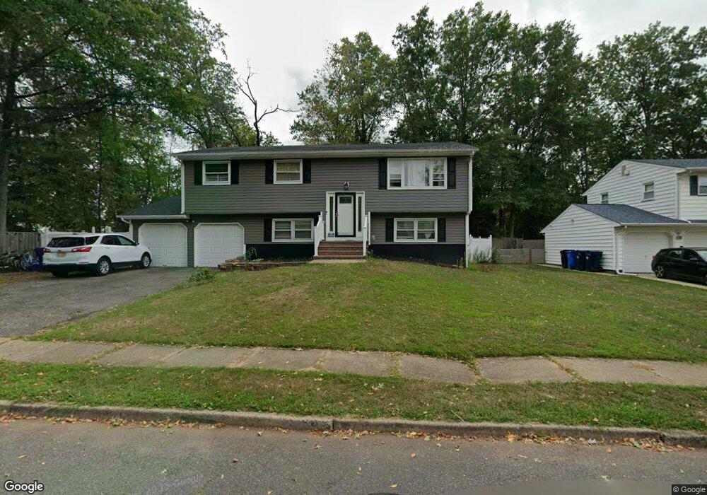
1350 Suwanee Dr North Brunswick, NJ 08902
Estimated Value: $631,000 - $662,000
5
Beds
3
Baths
2,074
Sq Ft
$314/Sq Ft
Est. Value
About This Home
This home is located at 1350 Suwanee Dr, North Brunswick, NJ 08902 and is currently estimated at $650,621, approximately $313 per square foot. 1350 Suwanee Dr is a home located in Middlesex County with nearby schools including John Adams Elementary School, Linwood Middle School, and North Brunswick Twp High School.
Ownership History
Date
Name
Owned For
Owner Type
Purchase Details
Closed on
Aug 30, 2005
Sold by
Schwartzberg Martin
Bought by
Richardson Bernie and Richardson Tamu
Current Estimated Value
Home Financials for this Owner
Home Financials are based on the most recent Mortgage that was taken out on this home.
Original Mortgage
$307,800
Outstanding Balance
$164,570
Interest Rate
5.84%
Estimated Equity
$486,051
Purchase Details
Closed on
Dec 5, 1998
Sold by
Phoenix Home Life
Bought by
Phl Opco Lp
Create a Home Valuation Report for This Property
The Home Valuation Report is an in-depth analysis detailing your home's value as well as a comparison with similar homes in the area
Home Values in the Area
Average Home Value in this Area
Purchase History
| Date | Buyer | Sale Price | Title Company |
|---|---|---|---|
| Richardson Bernie | $342,000 | -- | |
| Phl Opco Lp | $1,383,319 | -- |
Source: Public Records
Mortgage History
| Date | Status | Borrower | Loan Amount |
|---|---|---|---|
| Open | Richardson Bernie | $307,800 |
Source: Public Records
Tax History Compared to Growth
Tax History
| Year | Tax Paid | Tax Assessment Tax Assessment Total Assessment is a certain percentage of the fair market value that is determined by local assessors to be the total taxable value of land and additions on the property. | Land | Improvement |
|---|---|---|---|---|
| 2025 | $11,082 | $174,900 | $60,400 | $114,500 |
| 2024 | $10,882 | $174,900 | $60,400 | $114,500 |
| 2023 | $10,882 | $174,900 | $60,400 | $114,500 |
| 2022 | $10,511 | $174,900 | $60,400 | $114,500 |
| 2021 | $10,261 | $174,900 | $60,400 | $114,500 |
| 2020 | $10,120 | $174,900 | $60,400 | $114,500 |
| 2019 | $9,913 | $174,900 | $60,400 | $114,500 |
| 2018 | $9,710 | $174,900 | $60,400 | $114,500 |
| 2017 | $9,539 | $174,900 | $60,400 | $114,500 |
| 2016 | $9,340 | $174,900 | $60,400 | $114,500 |
| 2015 | $9,181 | $174,900 | $60,400 | $114,500 |
| 2014 | $9,077 | $174,900 | $60,400 | $114,500 |
Source: Public Records
Map
Nearby Homes
- 1209 Dakota Rd
- 1464 Columbia Dr
- 1365 Sioux Rd
- 210 N Oaks Blvd Unit 210
- 1010 N Oaks Blvd
- 1133 Livingston Ave Unit 11C
- 5208 N Oaks Blvd
- 936 Patton St
- 1314 N Oaks Blvd
- 1632 Hudson Ave
- 1499 La Rose Ave
- 1078 Newton St
- 89 Pennsylvania Way
- 63 Pennsylvania Way
- 32 Lafayette Ct
- 276 Constitution Cir
- 224 Pennsylvania Way
- 929 Hermann Rd
- 966 Bergen Ave
- 3807 Birchwood Ct
- 1358 Suwanee Dr
- 1351 Suwanee Dr
- 1366 Suwanee Dr
- 1369 Suwanee Dr
- 1207 E Peoria Place
- 1374 Suwanee Dr
- 1206 E Peoria Place
- 1377 Suwanee Dr
- 1215 E Peoria Place
- 1382 Suwanee Dr
- 1214 E Peoria Place
- 1201 W Peoria Place
- 1221 E Peoria Place
- 1209 W Peoria Place
- 1390 Suwanee Dr
- 1370 Peoria Place
- 148 Airport Rd
- 1215 W Peoria Place
- 1227 E Peoria Place
- 1376 Peoria Place