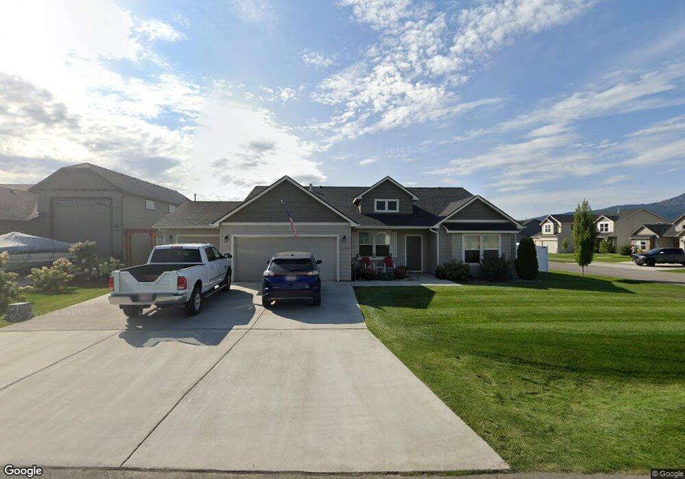
13509 Axle Ct Rathdrum, ID 83858
Estimated Value: $604,000 - $674,299
4
Beds
2
Baths
2,028
Sq Ft
$319/Sq Ft
Est. Value
About This Home
This home is located at 13509 Axle Ct, Rathdrum, ID 83858 and is currently estimated at $647,075, approximately $319 per square foot. 13509 Axle Ct is a home located in Kootenai County with nearby schools including Garwood Elementary School, Lakeland Middle School, and Lakeland Senior High School.
Ownership History
Date
Name
Owned For
Owner Type
Purchase Details
Closed on
Aug 26, 2022
Sold by
Louis Simpson Michael and Louis Sheryl Joimarie
Bought by
Simpson Family Trust
Current Estimated Value
Purchase Details
Closed on
Aug 25, 2022
Sold by
Willard Ii Thomas J and Willard Sandra D
Bought by
Simpson Michael Louis and Simpson Joimarie Sheryl
Purchase Details
Closed on
Jan 10, 2019
Sold by
Hayden Homes Llc
Bought by
Willard Thomas J and Willard Sandra D
Home Financials for this Owner
Home Financials are based on the most recent Mortgage that was taken out on this home.
Original Mortgage
$315,496
Interest Rate
4.4%
Mortgage Type
New Conventional
Create a Home Valuation Report for This Property
The Home Valuation Report is an in-depth analysis detailing your home's value as well as a comparison with similar homes in the area
Home Values in the Area
Average Home Value in this Area
Purchase History
| Date | Buyer | Sale Price | Title Company |
|---|---|---|---|
| Simpson Family Trust | -- | Accommodation/Courtesy Recordi | |
| Simpson Michael Louis | -- | Pioneer Title | |
| Willard Thomas J | -- | Alliance Title & Escrow Corp |
Source: Public Records
Mortgage History
| Date | Status | Borrower | Loan Amount |
|---|---|---|---|
| Previous Owner | Willard Thomas J | $315,496 |
Source: Public Records
Tax History Compared to Growth
Tax History
| Year | Tax Paid | Tax Assessment Tax Assessment Total Assessment is a certain percentage of the fair market value that is determined by local assessors to be the total taxable value of land and additions on the property. | Land | Improvement |
|---|---|---|---|---|
| 2025 | $2,609 | $634,050 | $175,000 | $459,050 |
| 2024 | $2,554 | $587,980 | $160,000 | $427,980 |
| 2023 | $2,554 | $559,280 | $175,000 | $384,280 |
| 2022 | $3,525 | $646,136 | $185,000 | $461,136 |
| 2021 | $3,394 | $413,976 | $100,355 | $313,621 |
| 2020 | $3,269 | $357,640 | $91,120 | $266,520 |
| 2019 | $1,050 | $327,860 | $77,880 | $249,980 |
| 2018 | $0 | $0 | $0 | $0 |
Source: Public Records
Map
Nearby Homes
- 6349 W Trestle St
- 11615 N Railway Ave
- 12175 N Meyer Rd
- 12750 N Cavanaugh Dr
- 12726 N Cavanaugh Dr
- 12981 Gondola
- 6632 W Portrush Dr
- 6089 W Theismann Rd
- 5748 W Theismann Rd
- 6105 W Bertelli Way
- 12676 N Krauss Cir
- 5987 W Quinn Way
- 12503 N Farley Way
- 6686 W Harmony St
- 6024 W Quinn Way
- 6024 W Irish Cir
- 6284 Bowmore Ln
- 15079 N Pristine Cir
- 6760 W Portrush Dr
- 6696 W Portrush Dr
- 13509 N Axle Ct
- 13493 Axle Ct
- 5743 W Quail Ridge
- 5659 W Quail Ridge
- 13475 Axle Ct
- 5715 W Quail Ridge St
- 13512 N Tender St
- 5687 W Quail Ridge St
- 5771 W Quail Ridge
- 13510 N Axle Ct
- 13494 N Axle Ct
- 5743 Quail
- 13510 Axle Ct
- 13486 N Tender St
- 5659 W Quail Ridge St
- 5635 W Quail Ridge
- 5771 Quail Ridge
- 13463 Axle Ct
- 13476 Axle Ct
- 5771 W Quail Ridge St