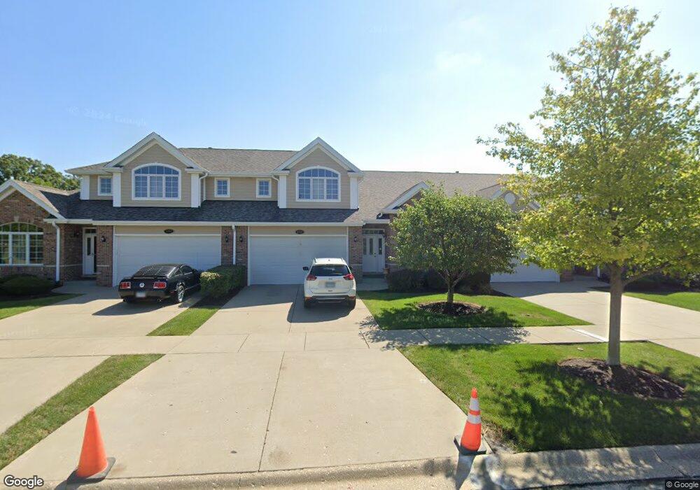
1351 Camelot Ln Lemont, IL 60439
Southeast Lemont NeighborhoodEstimated Value: $423,000 - $599,000
2
Beds
4
Baths
2,709
Sq Ft
$190/Sq Ft
Est. Value
About This Home
This home is located at 1351 Camelot Ln, Lemont, IL 60439 and is currently estimated at $513,574, approximately $189 per square foot. 1351 Camelot Ln is a home located in Cook County with nearby schools including Oakwood School, River Valley School, and Old Quarry Middle School.
Ownership History
Date
Name
Owned For
Owner Type
Purchase Details
Closed on
Sep 2, 2010
Sold by
Koziel Christopher
Bought by
Koziel Christopher and Koziel Barbara
Current Estimated Value
Purchase Details
Closed on
May 2, 2005
Sold by
Caruso Frank and Caruso Sherry
Bought by
Koziel Christopher
Home Financials for this Owner
Home Financials are based on the most recent Mortgage that was taken out on this home.
Original Mortgage
$275,000
Outstanding Balance
$145,316
Interest Rate
6.05%
Mortgage Type
Fannie Mae Freddie Mac
Estimated Equity
$368,258
Purchase Details
Closed on
Dec 13, 2004
Sold by
Dignan Development Llc
Bought by
Caruso Frank and Caruso Sherry
Create a Home Valuation Report for This Property
The Home Valuation Report is an in-depth analysis detailing your home's value as well as a comparison with similar homes in the area
Home Values in the Area
Average Home Value in this Area
Purchase History
| Date | Buyer | Sale Price | Title Company |
|---|---|---|---|
| Koziel Christopher | -- | Lsi | |
| Koziel Christopher | $345,000 | Premier Title | |
| Caruso Frank | $331,000 | Cti |
Source: Public Records
Mortgage History
| Date | Status | Borrower | Loan Amount |
|---|---|---|---|
| Open | Koziel Christopher | $275,000 |
Source: Public Records
Tax History Compared to Growth
Tax History
| Year | Tax Paid | Tax Assessment Tax Assessment Total Assessment is a certain percentage of the fair market value that is determined by local assessors to be the total taxable value of land and additions on the property. | Land | Improvement |
|---|---|---|---|---|
| 2024 | $8,455 | $44,000 | $2,801 | $41,199 |
| 2023 | $7,093 | $44,000 | $2,801 | $41,199 |
| 2022 | $7,093 | $32,636 | $2,478 | $30,158 |
| 2021 | $6,897 | $32,635 | $2,477 | $30,158 |
| 2020 | $7,024 | $32,635 | $2,477 | $30,158 |
| 2019 | $8,209 | $38,922 | $2,477 | $36,445 |
| 2018 | $8,073 | $38,922 | $2,477 | $36,445 |
| 2017 | $7,966 | $38,922 | $2,477 | $36,445 |
| 2016 | $6,709 | $30,914 | $2,046 | $28,868 |
| 2015 | $6,779 | $30,914 | $2,046 | $28,868 |
| 2014 | $6,857 | $30,914 | $2,046 | $28,868 |
| 2013 | $7,132 | $36,146 | $2,046 | $34,100 |
Source: Public Records
Map
Nearby Homes
- 14318 Mccarthy Rd
- 1297 Mccarthy Rd
- 14517 Albany Ave
- 12203 Walker Rd
- 1216 Country Ln
- 1249 Cronin Ct
- 1369 Notre Dame Dr
- 12652 Derby Rd
- 1156 Covington Dr
- 12723 Caruso Ct
- 12744 Caruso Ct
- 11716 Center Dr
- 13815 Mccarthy Rd
- 12 Woodland Dr
- Fremont Plan at Covington Knolls
- Eden Plan at Covington Knolls
- Danbury Plan at Covington Knolls
- Calysta Plan at Covington Knolls
- Briarcliffe Plan at Covington Knolls
- Amberwood Plan at Covington Knolls
- 1343 Camelot Ln
- 1357 Camelot Ln
- 1414 Amberwood Ln
- 1401 Covington Dr
- 1420 Amberwood Ln
- 1407 Covington Dr
- 1413 Covington Dr
- 1426 Amberwood Ln
- 1426 Amberwood Ln Unit 1
- 1421 Covington Dr
- 1427 Covington Dr
- 1432 Amberwood Ln
- 1433 Covington Dr
- 1438 Amberwood Ln
- 1363 Camelot Ln
- 12410 Walker Rd
- 1446 Amberwood Ln
- 1412 Covington Dr
- 12422 Walker Rd
- 1418 Covington Dr