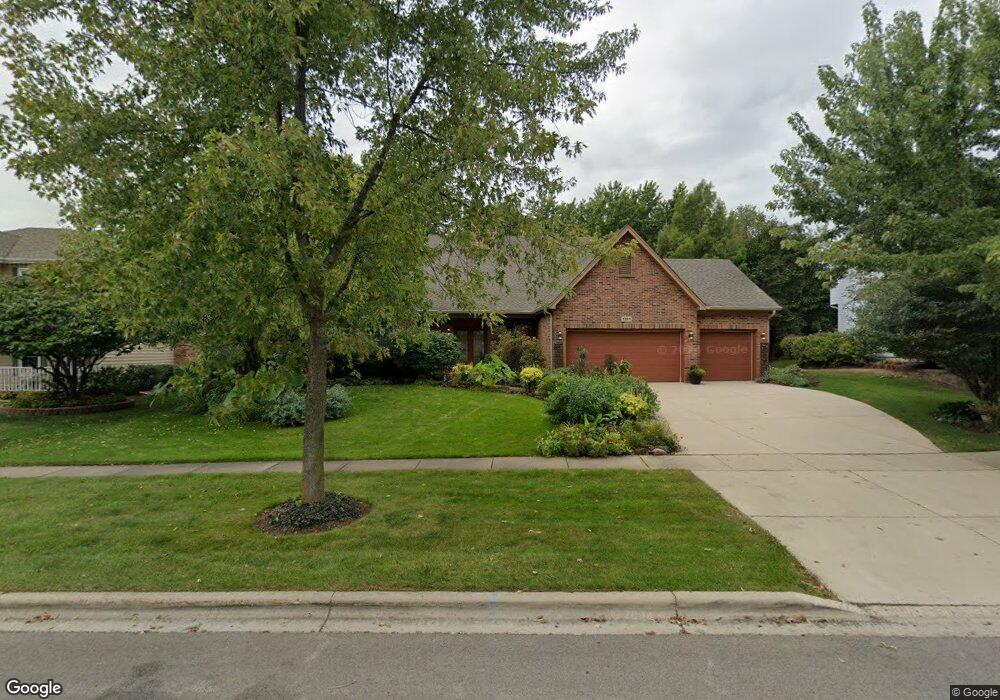
1351 Davey Dr Batavia, IL 60510
Southeast Batavia NeighborhoodEstimated Value: $578,597 - $713,000
3
Beds
--
Bath
2,752
Sq Ft
$235/Sq Ft
Est. Value
About This Home
This home is located at 1351 Davey Dr, Batavia, IL 60510 and is currently estimated at $647,399, approximately $235 per square foot. 1351 Davey Dr is a home located in Kane County with nearby schools including Hoover Wood Elementary School, Sam Rotolo Middle School, and Batavia Sr High School.
Ownership History
Date
Name
Owned For
Owner Type
Purchase Details
Closed on
May 5, 1995
Sold by
Rickershauser Peter J and Rickershauser Patricia A
Bought by
Zwemke Arthur C and Zwemke Gail D
Current Estimated Value
Home Financials for this Owner
Home Financials are based on the most recent Mortgage that was taken out on this home.
Original Mortgage
$225,600
Interest Rate
7.55%
Create a Home Valuation Report for This Property
The Home Valuation Report is an in-depth analysis detailing your home's value as well as a comparison with similar homes in the area
Home Values in the Area
Average Home Value in this Area
Purchase History
We collect this data history from publicly available records. To have your information removed, we recommend requesting removal directly through your county’s website.
| Date | Buyer | Sale Price | Title Company |
|---|---|---|---|
| Zwemke Arthur C | $251,000 | First American Title Insuran |
Source: Public Records
Mortgage History
We collect this data history from publicly available records. To have your information removed, we recommend requesting removal directly through your county’s website.
| Date | Status | Borrower | Loan Amount |
|---|---|---|---|
| Previous Owner | Zwemke Arthur C | $225,600 |
Source: Public Records
Tax History
| Year | Tax Paid | Tax Assessment Tax Assessment Total Assessment is a certain percentage of the fair market value that is determined by local assessors to be the total taxable value of land and additions on the property. | Land | Improvement |
|---|---|---|---|---|
| 2024 | $12,528 | $174,449 | $29,287 | $145,162 |
| 2023 | $12,213 | $158,331 | $26,581 | $131,750 |
| 2022 | $11,960 | $147,973 | $24,842 | $123,131 |
| 2021 | $11,264 | $140,338 | $23,560 | $116,778 |
| 2020 | $10,980 | $137,640 | $23,107 | $114,533 |
| 2019 | $10,788 | $132,767 | $22,289 | $110,478 |
| 2018 | $10,344 | $127,710 | $21,440 | $106,270 |
| 2017 | $10,081 | $121,499 | $20,733 | $100,766 |
| 2016 | $9,856 | $117,960 | $20,129 | $97,831 |
| 2015 | -- | $115,274 | $19,671 | $95,603 |
| 2014 | -- | $111,646 | $19,052 | $92,594 |
| 2013 | -- | $118,257 | $27,470 | $90,787 |
Source: Public Records
Map
Nearby Homes
- 492 Bond Dr
- 1109 Edwards Dr
- 34W246 Giese Rd Unit 1
- 601 Ridgelawn Trail
- 526 Ridgelawn Trail
- 1715 South Ct
- Lot 4 Manchester Ave
- 1897 Von Hoff Dr
- 908 Knox Ln
- 860 S River St
- 1311 Meadow Ln Unit 2
- 1692 Sauk Dr
- 1309 Fairfield Way
- 940 Orchard Ct
- 424 S Forest Ave
- 701 Viking Dr
- 221 Sauk Dr
- 847 Woodland Hills Rd
- 823 Columbia Cir
- 509 S Van Buren St
- 1381 Davey Dr
- 1331 Davey Dr
- 1311 Davey Dr
- 1350 Davey Dr
- 1380 Davey Dr Unit 2
- 1245 Davey Dr
- 1330 Davey Dr Unit 2
- 648 Tuggles Ct
- 655 Norcross Dr
- 1310 Davey Dr
- 645 Tuggles Ct
- 660 Norcross Dr
- 638 Tuggles Ct
- 1235 Davey Dr Unit 2
- 811 Norcross Dr
- 1240 Davey Dr Unit 2
- 641 Norcross Dr
- 806 Norcross Dr
- 828 Boyd Ct
- 1215 Davey Dr
Your Personal Tour Guide
Ask me questions while you tour the home.