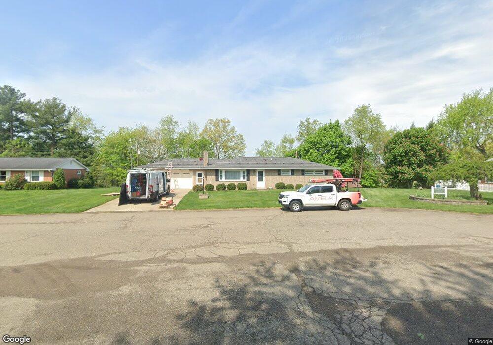
1351 Maple Heights Ln Coshocton, OH 43812
Estimated Value: $206,000 - $217,000
2
Beds
2
Baths
1,440
Sq Ft
$149/Sq Ft
Est. Value
About This Home
This home is located at 1351 Maple Heights Ln, Coshocton, OH 43812 and is currently estimated at $213,853, approximately $148 per square foot. 1351 Maple Heights Ln is a home located in Coshocton County with nearby schools including Coshocton High School, Coshocton Opportunity School, and Sacred Heart Elementary School.
Ownership History
Date
Name
Owned For
Owner Type
Purchase Details
Closed on
Dec 10, 2007
Sold by
Guess Chad E and Guess Heather J
Bought by
Jones James P and Jones Ednamae
Current Estimated Value
Purchase Details
Closed on
Dec 16, 2002
Sold by
Guess Chad E Jlrs
Bought by
Guess Chad E Living Trust
Purchase Details
Closed on
Dec 7, 2001
Sold by
Allen Joseph Edward
Bought by
Guess Chad E
Purchase Details
Closed on
Apr 17, 2001
Sold by
Allen Sara Frances
Bought by
Allen Sara Frances
Purchase Details
Closed on
Nov 2, 1998
Sold by
Talarico Armenia
Bought by
Allen Joseph Edward
Create a Home Valuation Report for This Property
The Home Valuation Report is an in-depth analysis detailing your home's value as well as a comparison with similar homes in the area
Home Values in the Area
Average Home Value in this Area
Purchase History
| Date | Buyer | Sale Price | Title Company |
|---|---|---|---|
| Jones James P | $135,000 | Fidelity Title Coshocton | |
| Guess Chad E Living Trust | -- | -- | |
| Guess Chad E | $105,000 | -- | |
| Guess Chad E Jlrs | $105,000 | -- | |
| Allen Sara Frances | -- | -- | |
| Allen Joseph Edward | $87,200 | -- |
Source: Public Records
Tax History Compared to Growth
Tax History
| Year | Tax Paid | Tax Assessment Tax Assessment Total Assessment is a certain percentage of the fair market value that is determined by local assessors to be the total taxable value of land and additions on the property. | Land | Improvement |
|---|---|---|---|---|
| 2024 | $2,030 | $58,980 | $11,740 | $47,240 |
| 2023 | $2,030 | $44,548 | $8,211 | $36,337 |
| 2022 | $2,119 | $44,548 | $8,211 | $36,337 |
| 2021 | $1,707 | $44,548 | $8,211 | $36,337 |
| 2020 | $1,797 | $45,249 | $8,012 | $37,237 |
| 2019 | $1,819 | $45,249 | $8,012 | $37,237 |
| 2018 | $1,685 | $45,249 | $8,012 | $37,237 |
| 2017 | $1,630 | $40,415 | $7,140 | $33,275 |
| 2016 | $1,560 | $40,415 | $7,140 | $33,275 |
| 2015 | $784 | $40,415 | $7,140 | $33,275 |
| 2014 | $1,395 | $39,267 | $9,832 | $29,435 |
Source: Public Records
Map
Nearby Homes
- Lot 8 Country Club Dr
- Lot 2 Country Club Dr
- Lot 1 Country Club Dr
- Lot 5 Country Club Dr
- Lot 4 Country Club Dr
- Lot 3 Country Club Dr
- Lot 6 Country Club Dr
- Lot 7 Country Club Dr
- 0 Ohio 541
- 1673 Flint Ln
- 1680 Bow Ln
- Lot# 7, S 12th St
- 1730 Otsego Ave
- 1333 Kenilworth Ave
- 935 S 7th St
- 922 Pine St
- 1693 Bayberry Ln
- 597 S 12th St
- 810 Pine St
- 720 Pine St
- 1345 Maple Heights Ln
- 1395 Maple Heights Ln
- 1221 Dehart Ave
- 1340 S 12th St
- 1360 S 12th St
- 1320 S 12th St
- 1364 Maple Heights Ln
- 1390 S 12th St
- 1301 S 13th St
- 1335 S 13th St
- 1400 S 12th St
- 1411 Maple Heights Ln
- 1270 Dehart Ave
- 1205 Dehart Ave
- 1365 S 13th St
- 1220 Dehart Ave
- 1410 S 12th St
- 1400 Maple Heights Ln
- 1200 Dehart Ave
- 1401 S 13th St