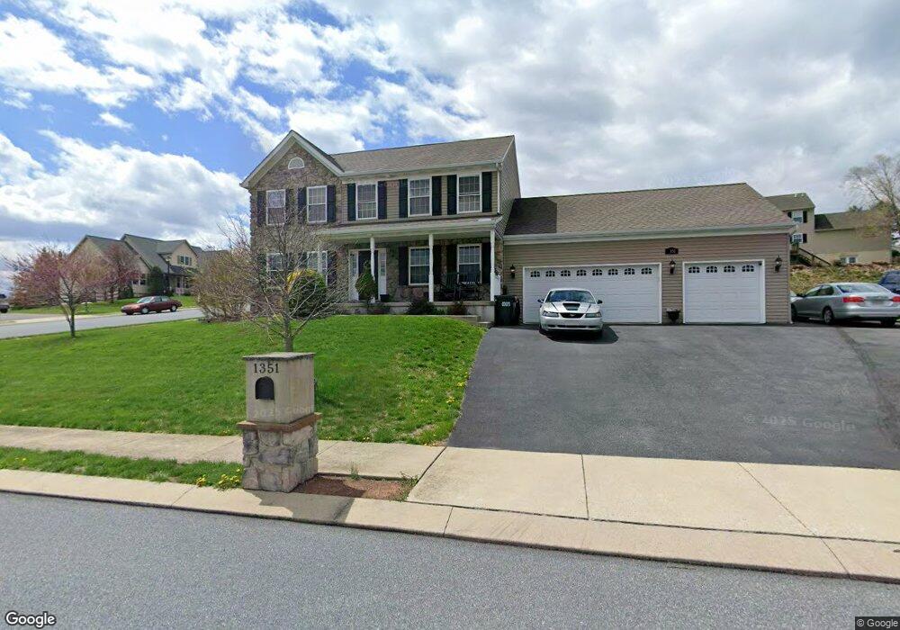
1351 Perry Dr Denver, PA 17517
Estimated Value: $437,000 - $594,000
4
Beds
3
Baths
2,040
Sq Ft
$241/Sq Ft
Est. Value
About This Home
This home is located at 1351 Perry Dr, Denver, PA 17517 and is currently estimated at $492,122, approximately $241 per square foot. 1351 Perry Dr is a home located in Lancaster County with nearby schools including Garden Spot Middle School, Garden Spot Senior High School, and Trostle Hill School.
Ownership History
Date
Name
Owned For
Owner Type
Purchase Details
Closed on
Nov 23, 2011
Sold by
Esh David H
Bought by
Weber Jr Jay A and Weber Michelle R
Current Estimated Value
Home Financials for this Owner
Home Financials are based on the most recent Mortgage that was taken out on this home.
Original Mortgage
$262,650
Outstanding Balance
$179,964
Interest Rate
4.12%
Mortgage Type
New Conventional
Estimated Equity
$312,158
Create a Home Valuation Report for This Property
The Home Valuation Report is an in-depth analysis detailing your home's value as well as a comparison with similar homes in the area
Home Values in the Area
Average Home Value in this Area
Purchase History
| Date | Buyer | Sale Price | Title Company |
|---|---|---|---|
| Weber Jr Jay A | $276,510 | None Available |
Source: Public Records
Mortgage History
| Date | Status | Borrower | Loan Amount |
|---|---|---|---|
| Open | Weber Jr Jay A | $262,650 |
Source: Public Records
Tax History Compared to Growth
Tax History
| Year | Tax Paid | Tax Assessment Tax Assessment Total Assessment is a certain percentage of the fair market value that is determined by local assessors to be the total taxable value of land and additions on the property. | Land | Improvement |
|---|---|---|---|---|
| 2025 | $4,433 | $257,600 | $60,400 | $197,200 |
| 2024 | $4,433 | $257,600 | $60,400 | $197,200 |
| 2023 | $4,342 | $257,600 | $60,400 | $197,200 |
| 2022 | $4,268 | $257,600 | $60,400 | $197,200 |
| 2021 | $4,054 | $257,600 | $60,400 | $197,200 |
| 2020 | $4,054 | $257,600 | $60,400 | $197,200 |
| 2019 | $4,006 | $257,600 | $60,400 | $197,200 |
| 2018 | $6,253 | $257,600 | $60,400 | $197,200 |
| 2017 | $4,420 | $232,100 | $44,100 | $188,000 |
| 2016 | $4,420 | $232,100 | $44,100 | $188,000 |
| 2015 | $929 | $232,100 | $44,100 | $188,000 |
| 2014 | $3,281 | $232,100 | $44,100 | $188,000 |
Source: Public Records
Map
Nearby Homes
- 114 Cedarwood Dr
- 4 Eagle Cir
- 154 W Maple Grove Rd
- 1395 Bowmansville Rd Unit 40
- 1286 Reading Rd Unit 10000
- 1286 Reading Rd Unit 2500
- 139 Shalom Dr
- 01 W Valley Rd
- 256 W Valley Rd
- 346 Aplomado St
- 117 Hawk Valley Ln Unit 105
- Westbrooke Plan at Hawk Valley Estates
- Callahan Plan at Hawk Valley Estates
- Silverbrooke Plan at Hawk Valley Estates
- Wesley Plan at Hawk Valley Estates
- Bridgemont Plan at Hawk Valley Estates
- Logan Plan at Hawk Valley Estates
- Brookfield Plan at Hawk Valley Estates
- Kingston Plan at Hawk Valley Estates
- Berkley Plan at Hawk Valley Estates
- 1365 Harvest Dr
- 1369 Harvest Dr
- 1357 Perry Dr
- 1352 Horning Rd
- 1356 Horning Rd
- 1352 Perry Dr
- 1352 Perry Dr Unit 13
- 0 Perry Dr
- 0 Perry Dr Unit 1000863463
- 1361 Harvest Dr
- 1358 Horning Rd
- 1356 Perry Dr
- 1373 Harvest Dr
- 1359 Perry Dr
- 1356 Harvest Dr
- 1357 Harvest Dr
- 1364 Perry Dr
- 176 Arrowhead Dr
- 1362 Horning Rd
- 172 Arrowhead Dr