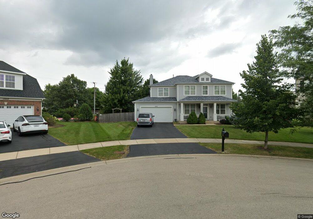
13511 Marigold Rd Plainfield, IL 60544
North Plainfield NeighborhoodEstimated Value: $539,000 - $578,000
4
Beds
3
Baths
3,124
Sq Ft
$178/Sq Ft
Est. Value
About This Home
This home is located at 13511 Marigold Rd, Plainfield, IL 60544 and is currently estimated at $556,608, approximately $178 per square foot. 13511 Marigold Rd is a home located in Will County with nearby schools including Walkers Grove Elementary School, Richard Ira Jones Middle School, and Plainfield North High School.
Ownership History
Date
Name
Owned For
Owner Type
Purchase Details
Closed on
Jun 28, 2007
Sold by
Hovstone Properties Illinois Llc
Bought by
Ottlinger Jim W
Current Estimated Value
Home Financials for this Owner
Home Financials are based on the most recent Mortgage that was taken out on this home.
Original Mortgage
$304,772
Outstanding Balance
$186,679
Interest Rate
6.12%
Mortgage Type
Purchase Money Mortgage
Estimated Equity
$369,929
Create a Home Valuation Report for This Property
The Home Valuation Report is an in-depth analysis detailing your home's value as well as a comparison with similar homes in the area
Home Values in the Area
Average Home Value in this Area
Purchase History
| Date | Buyer | Sale Price | Title Company |
|---|---|---|---|
| Ottlinger Jim W | $354,000 | Chicago Title Insurance Co |
Source: Public Records
Mortgage History
| Date | Status | Borrower | Loan Amount |
|---|---|---|---|
| Open | Ottlinger Jim W | $304,772 |
Source: Public Records
Tax History
| Year | Tax Paid | Tax Assessment Tax Assessment Total Assessment is a certain percentage of the fair market value that is determined by local assessors to be the total taxable value of land and additions on the property. | Land | Improvement |
|---|---|---|---|---|
| 2024 | $10,553 | $151,148 | $34,358 | $116,790 |
| 2023 | $10,553 | $136,513 | $31,031 | $105,482 |
| 2022 | $10,058 | $129,906 | $30,657 | $99,249 |
| 2021 | $9,501 | $121,407 | $28,651 | $92,756 |
| 2020 | $9,367 | $117,962 | $27,838 | $90,124 |
| 2019 | $9,037 | $112,398 | $26,525 | $85,873 |
| 2018 | $8,634 | $105,603 | $24,921 | $80,682 |
| 2017 | $8,367 | $100,354 | $23,682 | $76,672 |
| 2016 | $8,161 | $95,712 | $22,587 | $73,125 |
| 2015 | $7,714 | $89,660 | $21,159 | $68,501 |
| 2014 | $7,714 | $86,494 | $20,412 | $66,082 |
| 2013 | $7,714 | $86,494 | $20,412 | $66,082 |
Source: Public Records
Map
Nearby Homes
- 25004 Chelsea Ln
- 25216 Round Barn Rd Unit 11
- 2912 Savana Dr
- 2915 Savana Dr
- 2921 Savana Dr
- 2908 Savana Dr
- 2916 Savana Dr
- 2917 Savana Dr
- 13817 Meadow Ln
- 25255 Wheat Dr Unit 8
- 13204 Cinnamon Cir
- 25301 Pavilion Place
- 25764 Sunnymere Dr
- 12935 Summerhouse Dr
- 13018 S Sydney Cir
- 13203 Skyline Dr
- 12913 Waterford Ct Unit 1
- 12854 S Sydney Cir
- 12946 S Sydney Cir
- 12942 S Sydney Cir
- 13515 Marigold Rd
- 13507 Marigold Rd
- 13506 Savanna Dr
- 13519 Marigold Rd
- 13516 Savanna Dr
- 25057 Round Barn Rd
- 25065 Round Barn Rd
- 25047 Round Barn Rd
- 13526 Savanna Dr
- 25105 Round Barn Rd
- 25037 Round Barn Rd Unit 5
- 13523 Marigold Rd
- 13516 Marigold Rd
- 13511 Meadow Ln
- 13536 Savanna Dr
- 25027 Round Barn Rd
- 13500 Meadow Ln
- 25044 Chelsea Ln
- 13527 Marigold Rd
- 13522 Marigold Rd
Your Personal Tour Guide
Ask me questions while you tour the home.