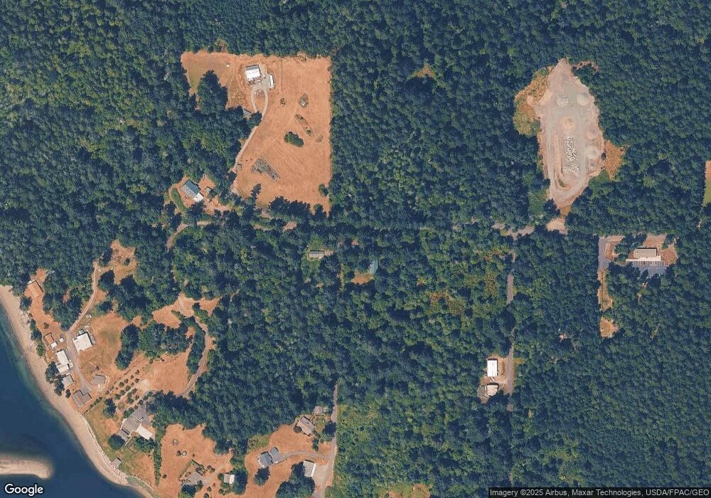
13516 Camus Rd Unit AI Anderson Island, WA 98303
Estimated Value: $460,000 - $538,334
3
Beds
3
Baths
960
Sq Ft
$511/Sq Ft
Est. Value
About This Home
This home is located at 13516 Camus Rd Unit AI, Anderson Island, WA 98303 and is currently estimated at $490,778, approximately $511 per square foot. 13516 Camus Rd Unit AI is a home located in Pierce County with nearby schools including Anderson Island Elementary School, Pioneer Middle School, and Steilacoom High School.
Ownership History
Date
Name
Owned For
Owner Type
Purchase Details
Closed on
Aug 11, 2005
Sold by
Hatton Ralph L
Bought by
Morrow Paul E and Powell Debra J
Current Estimated Value
Purchase Details
Closed on
Oct 5, 1994
Sold by
Stewart Brock
Bought by
Soikowski Frank C and Hamilton Cherri
Home Financials for this Owner
Home Financials are based on the most recent Mortgage that was taken out on this home.
Original Mortgage
$26,250
Interest Rate
8.5%
Create a Home Valuation Report for This Property
The Home Valuation Report is an in-depth analysis detailing your home's value as well as a comparison with similar homes in the area
Home Values in the Area
Average Home Value in this Area
Purchase History
| Date | Buyer | Sale Price | Title Company |
|---|---|---|---|
| Morrow Paul E | $110,000 | First American Title Ins Co | |
| Soikowski Frank C | $35,000 | -- |
Source: Public Records
Mortgage History
| Date | Status | Borrower | Loan Amount |
|---|---|---|---|
| Previous Owner | Soikowski Frank C | $26,250 |
Source: Public Records
Tax History Compared to Growth
Tax History
| Year | Tax Paid | Tax Assessment Tax Assessment Total Assessment is a certain percentage of the fair market value that is determined by local assessors to be the total taxable value of land and additions on the property. | Land | Improvement |
|---|---|---|---|---|
| 2025 | $4,070 | $416,200 | $106,900 | $309,300 |
| 2024 | $4,070 | $402,300 | $104,500 | $297,800 |
| 2023 | $4,070 | $383,200 | $107,800 | $275,400 |
| 2022 | $3,172 | $343,100 | $107,800 | $235,300 |
| 2021 | $3,408 | $264,000 | $73,600 | $190,400 |
| 2019 | $3,145 | $248,200 | $67,400 | $180,800 |
| 2018 | $3,282 | $237,100 | $68,900 | $168,200 |
| 2017 | $2,916 | $219,800 | $59,200 | $160,600 |
| 2016 | $3,032 | $208,100 | $51,700 | $156,400 |
| 2014 | $3,306 | $204,100 | $51,700 | $152,400 |
| 2013 | $3,306 | $209,800 | $51,800 | $158,000 |
Source: Public Records
Map
Nearby Homes
- 10611 Vantage Dr
- 10602 Vantage Dr
- 10412 Edgewood Dr
- 10508 Anchor Place
- 12805 108th St Unit AI
- 12801 108th St
- 10115 Edgewood Dr
- 10608 Edgewood Dr
- 10213 Edgewood Dr
- 10607 Edgewood Dr Unit lot4&5
- 12726 96th Street Ct
- 12727 96th Street Ct
- 14416 Sandberg Rd
- 10205 Eckenstam Johnson Rd
- 10217 Eckenstam Johnson Rd
- 9118 130th Avenue Ct
- 11106 Spruce Dr
- 10602 Madrona Dr
- 10824 Madrona Dr
- 12408 93rd St
- 84 Xxx Camus Rd
- 10606 136th Ave Unit AI
- 10222 Steffensen Rd
- 10514 Burton Rd
- 10211 Steffensen Rd
- 10211 Steffensen Rd
- 10622 136th Ave Unit AI
- 0 132nd Ave Unit 1451513
- 10702 136th Ave
- 13716 Camus Rd Unit AI
- 12601 Camus Rd
- 12721 & 12801 Camus Rd
- 12621 & 12625 Camus Rd
- 12807 Camus Rd
- 12726 Camus Rd
- 12816 Camus Rd
- 12820 Camus Rd
- 10101 Steffensen Rd
- 13820 Camus Rd
- 13828 Camus Rd Unit AI
