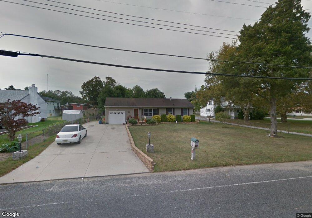
1352 N West Ave Vineland, NJ 08360
Estimated Value: $255,000 - $319,000
--
Bed
--
Bath
1,236
Sq Ft
$230/Sq Ft
Est. Value
About This Home
This home is located at 1352 N West Ave, Vineland, NJ 08360 and is currently estimated at $284,744, approximately $230 per square foot. 1352 N West Ave is a home located in Cumberland County with nearby schools including Marie D. Durand Elementary School, T.W. Wallace Middle School, and Vineland Senior High School.
Ownership History
Date
Name
Owned For
Owner Type
Purchase Details
Closed on
Sep 26, 2003
Sold by
Wilson Richard G
Bought by
Burton Joshua E
Current Estimated Value
Home Financials for this Owner
Home Financials are based on the most recent Mortgage that was taken out on this home.
Original Mortgage
$122,035
Outstanding Balance
$57,495
Interest Rate
6.35%
Estimated Equity
$227,249
Purchase Details
Closed on
Jun 19, 1996
Sold by
Pierce Frank L and Pierce Patricia A
Bought by
Wilson Richard
Home Financials for this Owner
Home Financials are based on the most recent Mortgage that was taken out on this home.
Original Mortgage
$68,500
Interest Rate
8.21%
Mortgage Type
FHA
Create a Home Valuation Report for This Property
The Home Valuation Report is an in-depth analysis detailing your home's value as well as a comparison with similar homes in the area
Home Values in the Area
Average Home Value in this Area
Purchase History
| Date | Buyer | Sale Price | Title Company |
|---|---|---|---|
| Burton Joshua E | $122,035 | -- | |
| -- | $122,000 | -- | |
| Wilson Richard | $82,000 | Landis Title Corporation |
Source: Public Records
Mortgage History
| Date | Status | Borrower | Loan Amount |
|---|---|---|---|
| Open | -- | $122,035 | |
| Previous Owner | Wilson Richard | $68,500 |
Source: Public Records
Tax History Compared to Growth
Tax History
| Year | Tax Paid | Tax Assessment Tax Assessment Total Assessment is a certain percentage of the fair market value that is determined by local assessors to be the total taxable value of land and additions on the property. | Land | Improvement |
|---|---|---|---|---|
| 2025 | $5,193 | $163,100 | $32,100 | $131,000 |
| 2024 | $5,193 | $163,100 | $32,100 | $131,000 |
| 2023 | $5,159 | $163,100 | $32,100 | $131,000 |
| 2022 | $5,006 | $163,100 | $32,100 | $131,000 |
| 2021 | $4,665 | $163,100 | $32,100 | $131,000 |
| 2020 | $4,774 | $163,100 | $32,100 | $131,000 |
| 2019 | $4,709 | $163,100 | $32,100 | $131,000 |
| 2018 | $4,585 | $163,100 | $32,100 | $131,000 |
| 2017 | $4,355 | $163,100 | $32,100 | $131,000 |
| 2016 | $4,201 | $163,100 | $32,100 | $131,000 |
| 2015 | $4,047 | $163,100 | $32,100 | $131,000 |
| 2014 | $3,826 | $163,100 | $32,100 | $131,000 |
Source: Public Records
Map
Nearby Homes
- 663 Wayne Ave
- 1489 N Delsea Dr
- 225 Laurel St
- 105 Oxford St
- 1887 N Delsea Dr Unit 135 HOLLY HOCK DR.
- 1887 N Delsea Dr Unit 19
- 1887 N Delsea Dr Unit 39
- 1020 W Oak Rd
- 1032 W Oak Rd
- 550 Northwest Ave
- 1050 W Oak Rd
- 317 Oxford St
- 1811 N Delsea Dr Unit 4
- 1267 N East Blvd Unit 16C
- 1252 W Oak Rd
- 1267 Northeast Blvd
- 509 Boody Dr
- 515 Boody Dr
- 1392 W Oak Rd
- 1111 N Orchard Rd
- 1366 N West Ave
- 1328 N West Ave
- 534 Westmont Ln
- 547 Wayne Ave
- 554 Westmont Ln
- 561 Wayne Ave
- 1361 N West Ave
- 523 Westmont Ln
- 1323 N West Ave
- 570 Westmont Ln
- 575 Wayne Ave
- 532 Wayne Ave
- 1398 N West Ave
- 548 Wayne Ave
- 1303 N West Ave
- 1385 N West Ave
- 573 Westmont Ln
- 562 Wayne Ave
- 1284 N West Ave
- 589 Wayne Ave