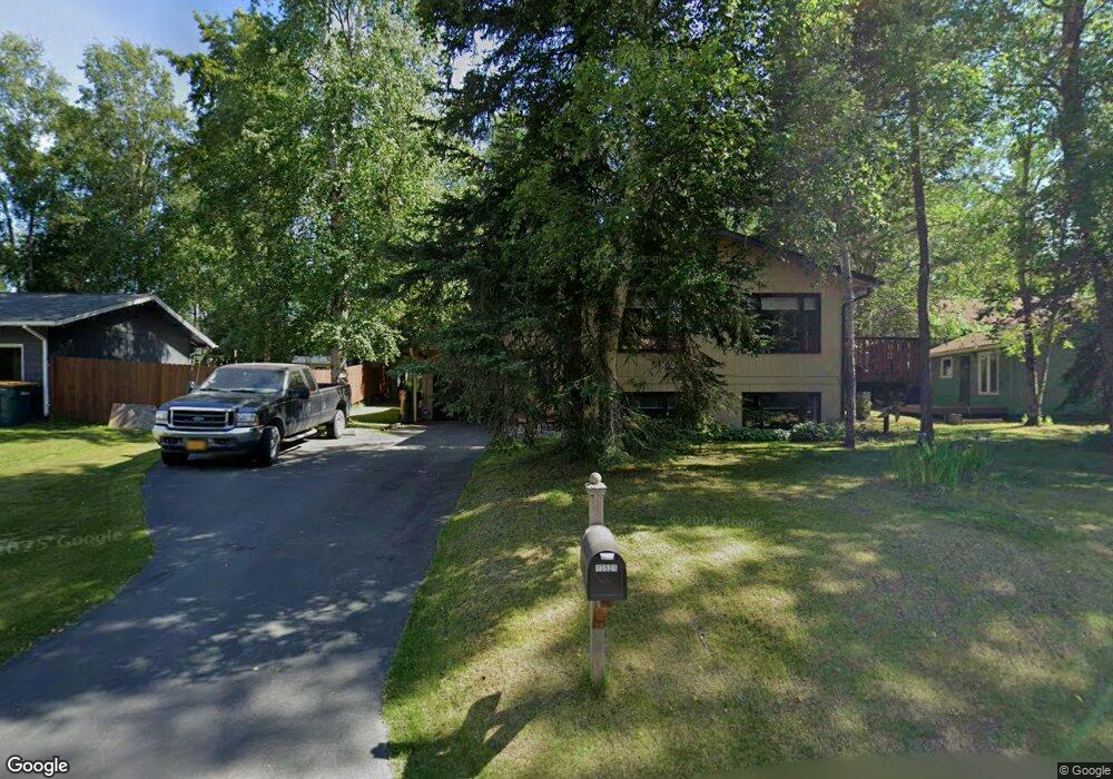
13521 Baywind Dr Anchorage, AK 99516
Huffman-O'Malley NeighborhoodEstimated Value: $289,000 - $487,000
4
Beds
2
Baths
957
Sq Ft
$435/Sq Ft
Est. Value
About This Home
This home is located at 13521 Baywind Dr, Anchorage, AK 99516 and is currently estimated at $416,399, approximately $435 per square foot. 13521 Baywind Dr is a home located in Anchorage Municipality with nearby schools including Rabbit Creek Elementary School, Goldenview Middle School, and South Anchorage High School.
Ownership History
Date
Name
Owned For
Owner Type
Purchase Details
Closed on
Aug 17, 2009
Sold by
Peterson John M and Peterson Katherine S
Bought by
Tilbury Robert C and Tilbury Annette C
Current Estimated Value
Home Financials for this Owner
Home Financials are based on the most recent Mortgage that was taken out on this home.
Original Mortgage
$245,000
Outstanding Balance
$159,415
Interest Rate
5.17%
Mortgage Type
Seller Take Back
Estimated Equity
$256,984
Create a Home Valuation Report for This Property
The Home Valuation Report is an in-depth analysis detailing your home's value as well as a comparison with similar homes in the area
Home Values in the Area
Average Home Value in this Area
Purchase History
| Date | Buyer | Sale Price | Title Company |
|---|---|---|---|
| Tilbury Robert C | -- | None Available |
Source: Public Records
Mortgage History
| Date | Status | Borrower | Loan Amount |
|---|---|---|---|
| Open | Tilbury Robert C | $245,000 |
Source: Public Records
Tax History Compared to Growth
Tax History
| Year | Tax Paid | Tax Assessment Tax Assessment Total Assessment is a certain percentage of the fair market value that is determined by local assessors to be the total taxable value of land and additions on the property. | Land | Improvement |
|---|---|---|---|---|
| 2025 | $2,754 | $417,800 | $127,100 | $290,700 |
| 2024 | $2,754 | $395,600 | $127,100 | $268,500 |
| 2023 | $6,282 | $368,900 | $127,100 | $241,800 |
| 2022 | $2,472 | $346,800 | $127,100 | $219,700 |
| 2021 | $6,042 | $335,300 | $127,100 | $208,200 |
| 2020 | $2,244 | $333,200 | $127,100 | $206,100 |
| 2019 | $2,173 | $332,800 | $127,100 | $205,700 |
| 2018 | $4,476 | $322,900 | $127,100 | $195,800 |
| 2017 | $4,786 | $325,600 | $127,100 | $198,500 |
| 2016 | $4,151 | $337,400 | $127,100 | $210,300 |
| 2015 | $4,151 | $321,800 | $127,100 | $194,700 |
| 2014 | $4,151 | $301,900 | $119,900 | $182,000 |
Source: Public Records
Map
Nearby Homes
- 13481 Baywind Dr
- 13470 Baywind Cir
- 13530 Westwind Dr
- 13540 Seachant Cir
- 3040 Chesapeake Cir
- 2701 Kempton Hills Dr
- 2940 E 142nd Ave
- 14121 Sunview Dr
- 2000 Jarvis Ave
- 2020 Steeple Dr
- 3833 Eastwind Dr
- 14231 Hancock Dr
- 13105 Stephenson St
- 3540 E 142nd Ave
- 13322 Diggins Dr
- 3700 de Armoun Rd
- 1800 Hamilton Dr
- 2048 Meander Dr
- 3025 Huffman Rd
- 000 Wildien Dr
- 13581 Westwind Dr
- 13501 Baywind Dr
- 13570 Seabreeze Cir
- 13591 Westwind Dr
- 13495 Baywind Dr
- 13540 Baywind Dr
- 13550 Seabreeze Cir
- 13500 Baywind Dr
- 13590 Westwind Dr
- 13500 Westwind Dr
- 13530 Seabreeze Cir
- 13551 Westwind Dr
- 13470 Baywind Dr
- 13491 Baywind Cir
- 13570 Westwind Dr
- 13531 Westwind Dr
- 13450 Baywind Dr
- 13450 Baywind Cir
- 13551 Seabreeze Cir
- 13621 Westwind Dr