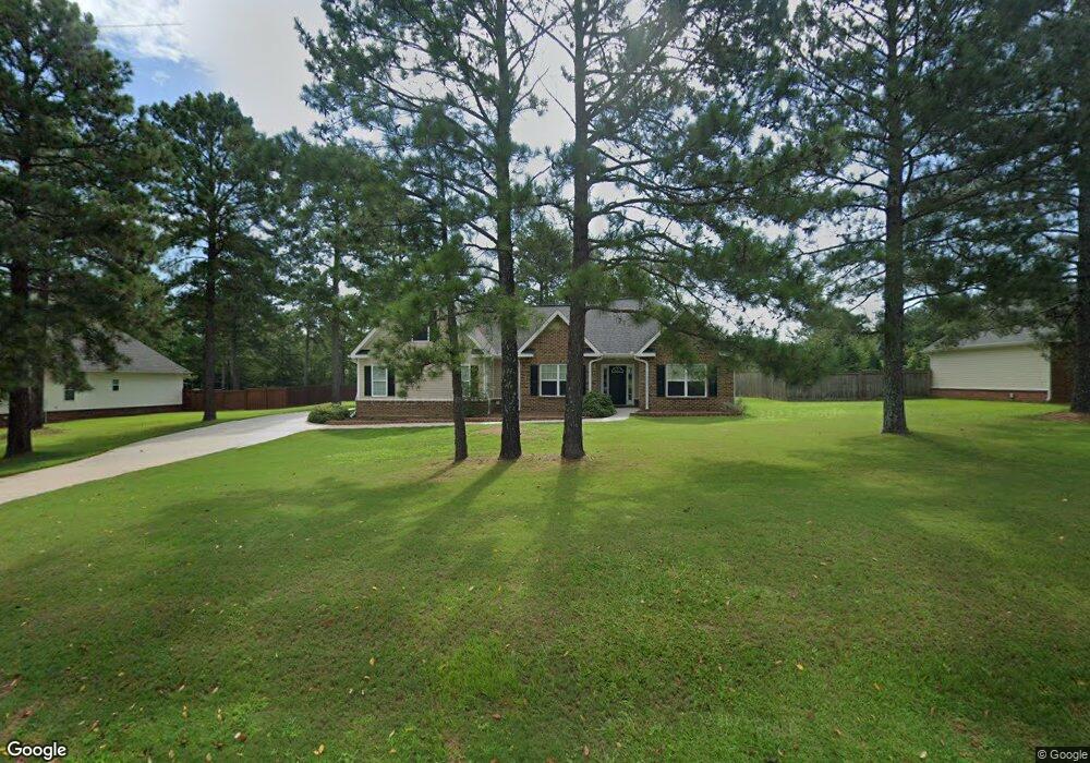
1353 Barnes Ferry Rd Macon, GA 31216
Estimated Value: $247,000 - $271,000
3
Beds
2
Baths
1,696
Sq Ft
$152/Sq Ft
Est. Value
About This Home
This home is located at 1353 Barnes Ferry Rd, Macon, GA 31216 and is currently estimated at $257,148, approximately $151 per square foot. 1353 Barnes Ferry Rd is a home located in Bibb County with nearby schools including Heard Elementary School, Rutland Middle School, and Rutland High School.
Ownership History
Date
Name
Owned For
Owner Type
Purchase Details
Closed on
Dec 21, 2011
Sold by
Snyder Keith C and Snyder Tonya D
Bought by
Snyder Keith C
Current Estimated Value
Home Financials for this Owner
Home Financials are based on the most recent Mortgage that was taken out on this home.
Original Mortgage
$123,300
Outstanding Balance
$84,281
Interest Rate
4.07%
Mortgage Type
New Conventional
Estimated Equity
$172,867
Purchase Details
Closed on
Dec 28, 2006
Sold by
Jp & Associates Homebuilders Llc
Bought by
Snyder Keith C and Snyder Tonya D
Home Financials for this Owner
Home Financials are based on the most recent Mortgage that was taken out on this home.
Original Mortgage
$135,200
Interest Rate
6.06%
Mortgage Type
Purchase Money Mortgage
Purchase Details
Closed on
Jul 25, 2006
Purchase Details
Closed on
May 17, 2005
Create a Home Valuation Report for This Property
The Home Valuation Report is an in-depth analysis detailing your home's value as well as a comparison with similar homes in the area
Purchase History
| Date | Buyer | Sale Price | Title Company |
|---|---|---|---|
| Snyder Keith C | -- | First Title & Escrow | |
| Snyder Keith C | $169,000 | None Available | |
| -- | -- | -- | |
| -- | $111,600 | -- |
Source: Public Records
Mortgage History
| Date | Status | Borrower | Loan Amount |
|---|---|---|---|
| Open | Snyder Keith C | $123,300 | |
| Closed | Snyder Keith C | $135,200 |
Source: Public Records
Tax History
| Year | Tax Paid | Tax Assessment Tax Assessment Total Assessment is a certain percentage of the fair market value that is determined by local assessors to be the total taxable value of land and additions on the property. | Land | Improvement |
|---|---|---|---|---|
| 2025 | $1,736 | $77,631 | $8,000 | $69,631 |
| 2024 | $1,794 | $77,631 | $8,000 | $69,631 |
| 2023 | $1,234 | $73,602 | $6,000 | $67,602 |
| 2022 | $1,940 | $63,023 | $8,000 | $55,023 |
| 2021 | $1,745 | $52,917 | $8,000 | $44,917 |
| 2020 | $1,783 | $52,917 | $8,000 | $44,917 |
| 2019 | $1,797 | $52,917 | $8,000 | $44,917 |
| 2018 | $2,764 | $50,109 | $8,000 | $42,109 |
| 2017 | $1,615 | $50,109 | $8,000 | $42,109 |
| 2016 | $1,491 | $50,109 | $8,000 | $42,109 |
| 2015 | $2,111 | $50,109 | $8,000 | $42,109 |
| 2014 | $2,885 | $65,811 | $15,280 | $50,531 |
Source: Public Records
Map
Nearby Homes
- 412 Gray Wolf Dr
- 319 Hawk Ct
- 317 Hawk Ct
- 312 Hawk Ct
- 1419 Griffin Rd
- 1850 Barnes Ferry Rd
- 120 Abberley Ln
- 7070 Sofkee Place
- 137 Abberley Ln
- 341 Stockton Cir
- 301 Stockton Cir
- 337 Stockton Cir
- 2165 Griffin Rd
- 2154 Allen Rd
- 4057 Liberty Estates Dr
- 297 Amanda Dr
- 8410 Hawkinsville Rd Unit LOT 42
- 268 Amanda Dr
- 261 Amanda Dr
- 344 Browning Pointe Rd
- 1351 Barnes Ferry Rd
- 1355 Barnes Ferry Rd
- 1357 Barnes Ferry Rd
- 1349 Barnes Ferry Rd
- 1349 Barnes Ferry Rd Unit 61
- 1347 Barnes Ferry Rd
- 314 Buckskin Dr
- 202 Natchez Trace
- 0 Buckskin Dr Unit 7460806
- 312 Buckskin Dr Unit 250
- 310 Buckskin Dr
- 306 Buckskin Dr
- 212 Natchez Trace Unit 58
- 212 Natchez Trace
- 304 Buckskin Dr
- 320 Buckskin Dr
- 319 Buckskin Dr
- 201 Natchez Trace
- 203 Natchez Trace
- 207 Natchez Trace
Your Personal Tour Guide
Ask me questions while you tour the home.