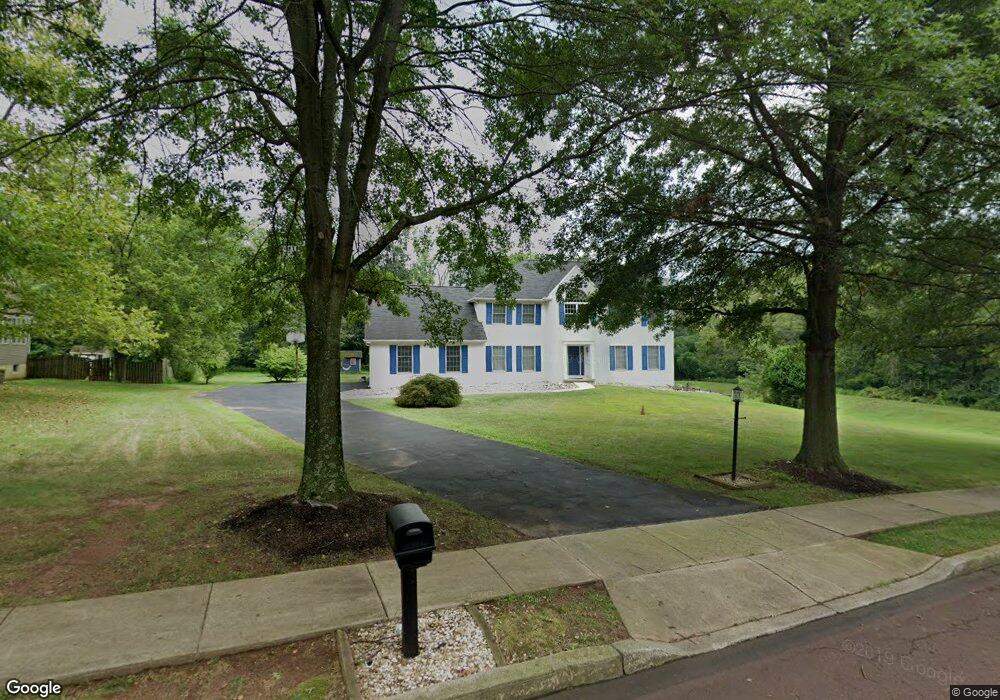
1353 Michael Way Lansdale, PA 19446
Estimated Value: $816,000 - $901,000
5
Beds
3
Baths
3,020
Sq Ft
$285/Sq Ft
Est. Value
About This Home
This home is located at 1353 Michael Way, Lansdale, PA 19446 and is currently estimated at $860,738, approximately $285 per square foot. 1353 Michael Way is a home located in Montgomery County with nearby schools including Walton Farm El School, Pennfield Middle School, and North Penn Senior High School.
Ownership History
Date
Name
Owned For
Owner Type
Purchase Details
Closed on
Oct 18, 1991
Bought by
Shieh Abraham J C and Shieh Ann S
Current Estimated Value
Create a Home Valuation Report for This Property
The Home Valuation Report is an in-depth analysis detailing your home's value as well as a comparison with similar homes in the area
Home Values in the Area
Average Home Value in this Area
Purchase History
| Date | Buyer | Sale Price | Title Company |
|---|---|---|---|
| Shieh Abraham J C | $328,400 | -- |
Source: Public Records
Tax History Compared to Growth
Tax History
| Year | Tax Paid | Tax Assessment Tax Assessment Total Assessment is a certain percentage of the fair market value that is determined by local assessors to be the total taxable value of land and additions on the property. | Land | Improvement |
|---|---|---|---|---|
| 2025 | $12,907 | $318,670 | $134,430 | $184,240 |
| 2024 | $12,907 | $318,670 | $134,430 | $184,240 |
| 2023 | $12,360 | $318,670 | $134,430 | $184,240 |
| 2022 | $11,602 | $318,670 | $134,430 | $184,240 |
| 2021 | $11,266 | $318,670 | $134,430 | $184,240 |
| 2020 | $10,756 | $318,670 | $134,430 | $184,240 |
| 2019 | $10,569 | $318,670 | $134,430 | $184,240 |
| 2018 | $2,268 | $318,670 | $134,430 | $184,240 |
| 2017 | $10,148 | $318,670 | $134,430 | $184,240 |
| 2016 | $10,023 | $318,670 | $134,430 | $184,240 |
| 2015 | $9,604 | $318,670 | $134,430 | $184,240 |
| 2014 | $9,604 | $318,670 | $134,430 | $184,240 |
Source: Public Records
Map
Nearby Homes
- 1217A Crosshill Ct
- 912B Stockton Ct
- 1017 Winfield Ct
- 506 Clarella Ct
- 2110 Marshall Ct
- 2212 Mulberry Ct
- 2225 Mulberry Ct
- 2415 Hillock Ct
- 25 Chestnut Ct E
- 1653 Bridle Path Dr
- 30 Greenbriar Ct
- 1116 Dogwood Ct
- 19 Wildbriar Ct
- 10 Bentwood Ct W
- 1825 Flintlock Cir
- 24 Newbury Way
- 803 Poplar Ct
- 11 Elder Ct
- 2 Newbury Way
- 14 Ash Ct
- 1351 Michael Way
- 1342 Michael Way
- 1349 Michael Way
- 1340 Michael Way
- 1489 Sumneytown Pike
- 1355 Michael Way
- 1338 Michael Way
- 1499 Sumneytown Pike
- 1347 Michael Way
- 1491 Sumneytown Pike
- 1491 Maxwell Ct
- 1487 Sumneytown Pike
- 1487 Maxwell Ct
- 1344 Michael Way
- 1336 Michael Way
- 1305 Tyler Way
- 1357 Michael Way
- 1493 Maxwell Ct
- 1411 Cheswold Dr Unit 6