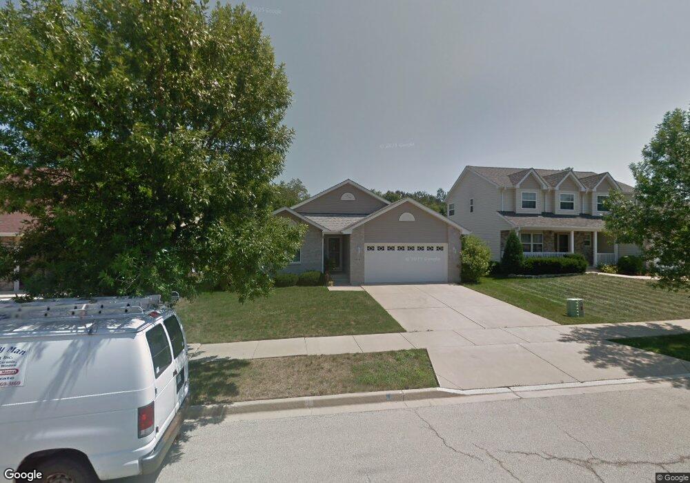
1354 Anthony Ct Waukegan, IL 60087
Estimated Value: $328,000 - $364,000
4
Beds
2
Baths
2,045
Sq Ft
$170/Sq Ft
Est. Value
About This Home
This home is located at 1354 Anthony Ct, Waukegan, IL 60087 and is currently estimated at $347,893, approximately $170 per square foot. 1354 Anthony Ct is a home located in Lake County with nearby schools including Oak Crest School, Beach Park Middle School, and Zion-Benton Township High School.
Ownership History
Date
Name
Owned For
Owner Type
Purchase Details
Closed on
Feb 5, 2003
Sold by
Bank Of Waukegan
Bought by
Baker Sylvia A
Current Estimated Value
Home Financials for this Owner
Home Financials are based on the most recent Mortgage that was taken out on this home.
Original Mortgage
$193,000
Interest Rate
5.71%
Create a Home Valuation Report for This Property
The Home Valuation Report is an in-depth analysis detailing your home's value as well as a comparison with similar homes in the area
Home Values in the Area
Average Home Value in this Area
Purchase History
| Date | Buyer | Sale Price | Title Company |
|---|---|---|---|
| Baker Sylvia A | $243,000 | Chicago Title Insurance Comp |
Source: Public Records
Mortgage History
| Date | Status | Borrower | Loan Amount |
|---|---|---|---|
| Previous Owner | Baker Sylvia A | $193,000 |
Source: Public Records
Tax History Compared to Growth
Tax History
| Year | Tax Paid | Tax Assessment Tax Assessment Total Assessment is a certain percentage of the fair market value that is determined by local assessors to be the total taxable value of land and additions on the property. | Land | Improvement |
|---|---|---|---|---|
| 2024 | $6,065 | $101,788 | $6,059 | $95,729 |
| 2023 | $6,833 | $88,996 | $5,849 | $83,147 |
| 2022 | $6,833 | $86,220 | $5,714 | $80,506 |
| 2021 | $7,250 | $84,027 | $5,569 | $78,458 |
| 2020 | $7,493 | $80,186 | $5,314 | $74,872 |
| 2019 | $7,807 | $76,078 | $5,042 | $71,036 |
| 2018 | $8,874 | $68,430 | $6,009 | $62,421 |
| 2017 | $9,469 | $64,375 | $5,653 | $58,722 |
| 2016 | $9,253 | $61,286 | $5,382 | $55,904 |
| 2015 | $8,984 | $56,205 | $4,936 | $51,269 |
| 2014 | $8,569 | $56,155 | $12,477 | $43,678 |
| 2012 | $8,595 | $58,355 | $12,966 | $45,389 |
Source: Public Records
Map
Nearby Homes
- 3810 Cedar Ave
- 1113 Tewes Ln
- 10867 W Beach Rd
- 38169 N North Shore Ave
- 38697 N Cedar Ave
- 38362 N Manor Ave
- 38119 N Wilson Ave
- 1730 W Beach Rd
- 38383 N Tewes Ct
- 37905 N Loyola Ave
- 37966 N Cornell Rd
- 11471 W Leland Ave
- 11342-11364 W Wadsworth Rd
- 1636 Rice St
- 10038 W Beach Rd
- 10160 W Fairbanks Ave
- 38842-60 Sheridan Rd
- 10241 W Bairstow Ave
- 39161 N Holdridge Ave
- 39285 N Garnett Ave
- 1350 Anthony Ct
- 1358 Anthony Ct
- 1346 Anthony Ct
- 1371 Anthony Ct
- 1331 Anthony Ct
- 1342 Anthony Ct
- 1375 Anthony Ct
- 1327 Anthony Ct
- 1338 Anthony Ct
- 1334 Anthony Ct
- 38404 N North Shore Ave
- 38422 N North Shore Ave
- 38386 N North Shore Ave
- 1330 Anthony Ct
- 1372 Anthony Ct
- 38376 N North Shore Ave
- 1326 Anthony Ct
- 38364 N North Shore Ave
- 1325 W Beach Rd
- 1306 Anthony Ct