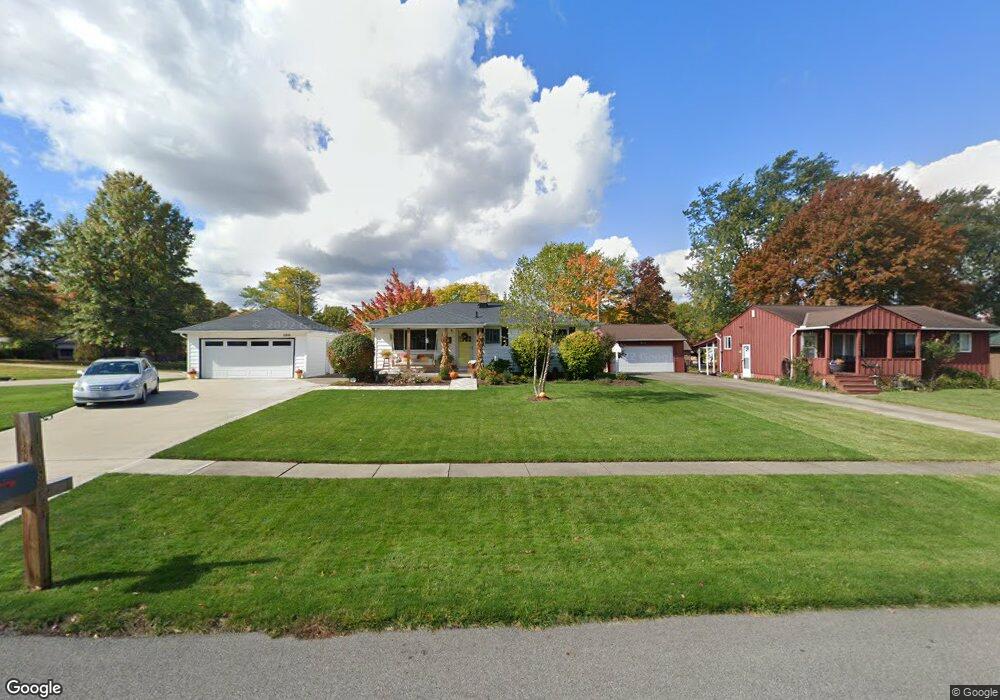
13548 Richards Dr Strongsville, OH 44149
Estimated Value: $210,000 - $246,000
3
Beds
1
Bath
988
Sq Ft
$234/Sq Ft
Est. Value
About This Home
This home is located at 13548 Richards Dr, Strongsville, OH 44149 and is currently estimated at $230,753, approximately $233 per square foot. 13548 Richards Dr is a home located in Cuyahoga County with nearby schools including Strongsville High School, Strongsville Academy, and Sts Joseph & John Interparochial School.
Ownership History
Date
Name
Owned For
Owner Type
Purchase Details
Closed on
May 21, 1993
Sold by
Anderson David W
Bought by
Anderson David W
Current Estimated Value
Purchase Details
Closed on
Aug 24, 1990
Sold by
Depaulo Betty T
Bought by
Anderson David W
Purchase Details
Closed on
Mar 5, 1985
Sold by
Depaulo Joseph V
Bought by
Depaulo Betty T
Purchase Details
Closed on
Feb 1, 1985
Sold by
Depaulo Joseph V
Bought by
Depaulo Joseph
Purchase Details
Closed on
Oct 5, 1978
Sold by
Potter Anne M
Bought by
Depaulo Joseph
Purchase Details
Closed on
Jan 1, 1975
Bought by
Potter Anne M
Create a Home Valuation Report for This Property
The Home Valuation Report is an in-depth analysis detailing your home's value as well as a comparison with similar homes in the area
Home Values in the Area
Average Home Value in this Area
Purchase History
| Date | Buyer | Sale Price | Title Company |
|---|---|---|---|
| Anderson David W | -- | -- | |
| Anderson David W | $85,000 | -- | |
| Depaulo Betty T | -- | -- | |
| Depaulo Joseph | -- | -- | |
| Depaulo Joseph | $18,000 | -- | |
| Potter Anne M | -- | -- |
Source: Public Records
Tax History Compared to Growth
Tax History
| Year | Tax Paid | Tax Assessment Tax Assessment Total Assessment is a certain percentage of the fair market value that is determined by local assessors to be the total taxable value of land and additions on the property. | Land | Improvement |
|---|---|---|---|---|
| 2024 | $3,410 | $72,625 | $14,385 | $58,240 |
| 2023 | $3,500 | $55,900 | $14,980 | $40,920 |
| 2022 | $3,475 | $55,900 | $14,980 | $40,920 |
| 2021 | $3,447 | $55,900 | $14,980 | $40,920 |
| 2020 | $3,194 | $45,820 | $12,290 | $33,530 |
| 2019 | $3,100 | $130,900 | $35,100 | $95,800 |
| 2018 | $2,814 | $45,820 | $12,290 | $33,530 |
| 2017 | $2,742 | $41,340 | $10,500 | $30,840 |
| 2016 | $2,720 | $41,340 | $10,500 | $30,840 |
| 2015 | $2,679 | $41,340 | $10,500 | $30,840 |
| 2014 | $2,679 | $40,150 | $10,190 | $29,960 |
Source: Public Records
Map
Nearby Homes
- 13236 Tomson Dr
- 12651 Alameda Dr
- 14400 Prospect Rd
- 22125 Olde Creek Trail
- 12694 Ionia Ct
- 12647 Edgepark Cir
- 20078 Trapper Trail
- 14896 Britannia Ct
- 19620 Porters Ln Unit 15F
- 14112 Settlers Way
- 14890 Prospect Rd
- 22235 North Trail
- 13156 Olympus Way
- 13066 Olympus Way
- 15017 Regency Dr
- 12385 Corinth Ct
- 13099 Olympus Way
- 12539 Olympus Way
- 15001 Scarlet Oak Trail
- 21469 Woodview Cir
- 13504 Richards Dr
- 13462 Richards Dr
- 13505 Atlantic Rd
- 20625 Westwood Park Blvd
- 13557 Atlantic Rd
- 13549 Richards Dr
- 13463 Atlantic Rd
- 20587 Westwood Park Blvd
- 13418 Richards Dr
- 13505 Richards Dr
- 13599 Atlantic Rd
- 20559 Westwood Park Blvd
- 13419 Atlantic Rd
- 13463 Richards Dr
- 13374 Richards Dr
- 20529 Westwood Park Blvd
- 13643 Atlantic Rd
- 13419 Richards Dr
- 13375 Atlantic Rd
- 20499 Westwood Park Blvd