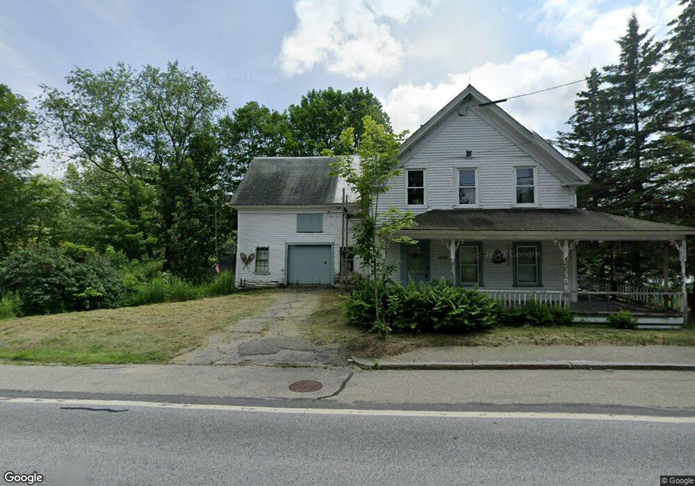
1355 Route 2 Rumford, ME 04276
Estimated Value: $81,000 - $262,000
Studio
--
Bath
936
Sq Ft
$163/Sq Ft
Est. Value
About This Home
This home is located at 1355 Route 2, Rumford, ME 04276 and is currently estimated at $152,630, approximately $163 per square foot. 1355 Route 2 is a home with nearby schools including Rumford Elementary School, Meroby Elementary School, and Mountain Valley Middle School.
Ownership History
Date
Name
Owned For
Owner Type
Purchase Details
Closed on
Jun 17, 2024
Sold by
Mchugh Richard B Est and Mchugh
Bought by
Kingsland Jane F Est
Current Estimated Value
Purchase Details
Closed on
Nov 4, 2014
Sold by
Mahoosuc Land T Inc
Bought by
Kingsland Jane F and Mchugh Richard B
Create a Home Valuation Report for This Property
The Home Valuation Report is an in-depth analysis detailing your home's value as well as a comparison with similar homes in the area
Home Values in the Area
Average Home Value in this Area
Purchase History
| Date | Buyer | Sale Price | Title Company |
|---|---|---|---|
| Kingsland Jane F Est | -- | None Available | |
| Kingsland Jane F Est | -- | None Available | |
| Kingsland Jane F | -- | -- | |
| Mahoosuc Land T Inc | -- | -- | |
| Mahoosuc Land T Inc | -- | -- | |
| Mahoosuc Land T Inc | -- | -- |
Source: Public Records
Tax History
| Year | Tax Paid | Tax Assessment Tax Assessment Total Assessment is a certain percentage of the fair market value that is determined by local assessors to be the total taxable value of land and additions on the property. | Land | Improvement |
|---|---|---|---|---|
| 2025 | $1,380 | $73,700 | $17,300 | $56,400 |
| 2024 | $1,225 | $73,700 | $17,300 | $56,400 |
| 2023 | $1,169 | $52,700 | $12,400 | $40,300 |
| 2022 | $1,169 | $52,700 | $12,400 | $40,300 |
| 2021 | $1,183 | $52,700 | $12,400 | $40,300 |
| 2020 | $1,191 | $52,700 | $12,400 | $40,300 |
| 2019 | $1,159 | $37,986 | $5,500 | $32,486 |
| 2018 | $1,130 | $37,986 | $5,500 | $32,486 |
| 2017 | $1,096 | $37,986 | $5,500 | $32,486 |
| 2016 | $1,064 | $37,986 | $5,500 | $32,486 |
| 2015 | $1,043 | $37,986 | $5,500 | $32,486 |
| 2014 | $1,091 | $40,490 | $7,500 | $32,990 |
Source: Public Records
Map
Nearby Homes
- 1359 Route 2
- 1019 U S Highway 2
- 1318 U S 2
- 1257 Route 2 Unit 1-5
- 1257 Route 2 Unit 23
- Map 240 Lot 1 Map 239 Lot 4
- 018 Bear Ln
- 019 upper Bear Ln
- 019 lower Bear Ln
- 19 Bear Ln
- 18 Bear Ln
- 509 Blackberry Ln
- Lot 17 S Rumford Rd
- Map 402 Lot 8 Rd
- 19 Hawk Ln
- 159 Martin Rd
- 003 Western View Ln
- Lot #016 Isthmus Rd
- Lot 18-1 Isthmus Rd
- 688 Prospect Ave
Your Personal Tour Guide
Ask me questions while you tour the home.