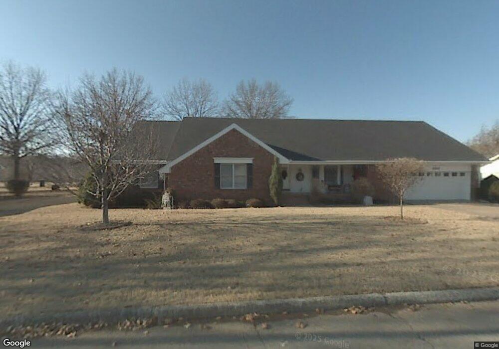
13553 Saint Andrews Dr Siloam Springs, AR 72761
Estimated Value: $404,119 - $438,000
--
Bed
3
Baths
2,867
Sq Ft
$146/Sq Ft
Est. Value
About This Home
This home is located at 13553 Saint Andrews Dr, Siloam Springs, AR 72761 and is currently estimated at $418,280, approximately $145 per square foot. 13553 Saint Andrews Dr is a home located in Benton County with nearby schools including Northside Elementary School, Delbert Pete & Pat Allen Elementary School, and Southside Elementary School.
Ownership History
Date
Name
Owned For
Owner Type
Purchase Details
Closed on
Nov 6, 2015
Sold by
Pyle Kathy
Bought by
Pyle Kathy
Current Estimated Value
Purchase Details
Closed on
Jan 27, 2014
Sold by
Foreman William J
Bought by
Pyle Kathy
Purchase Details
Closed on
Nov 30, 2012
Sold by
Adair Carol M
Bought by
Foreman William J
Purchase Details
Closed on
Jun 13, 1996
Bought by
Adair Tr
Purchase Details
Closed on
Mar 27, 1987
Bought by
Adair
Purchase Details
Closed on
Jul 19, 1976
Bought by
Mcnulty
Create a Home Valuation Report for This Property
The Home Valuation Report is an in-depth analysis detailing your home's value as well as a comparison with similar homes in the area
Home Values in the Area
Average Home Value in this Area
Purchase History
| Date | Buyer | Sale Price | Title Company |
|---|---|---|---|
| Pyle Kathy | -- | Attorney | |
| Pyle Kathy | -- | None Available | |
| Foreman William J | $216,000 | Waco Title Company | |
| Adair Tr | -- | -- | |
| N | -- | -- | |
| Adair | $110,000 | -- | |
| Mcnulty | $7,000 | -- |
Source: Public Records
Tax History Compared to Growth
Tax History
| Year | Tax Paid | Tax Assessment Tax Assessment Total Assessment is a certain percentage of the fair market value that is determined by local assessors to be the total taxable value of land and additions on the property. | Land | Improvement |
|---|---|---|---|---|
| 2025 | $3,318 | $73,111 | $4,600 | $68,511 |
| 2024 | $3,114 | $73,111 | $4,600 | $68,511 |
| 2023 | $2,831 | $55,150 | $2,600 | $52,550 |
| 2022 | $2,613 | $55,150 | $2,600 | $52,550 |
| 2021 | $2,389 | $55,150 | $2,600 | $52,550 |
| 2020 | $2,177 | $41,790 | $1,800 | $39,990 |
| 2019 | $2,177 | $41,790 | $1,800 | $39,990 |
| 2018 | $2,177 | $41,790 | $1,800 | $39,990 |
| 2017 | $1,966 | $41,790 | $1,800 | $39,990 |
| 2016 | $1,966 | $41,790 | $1,800 | $39,990 |
| 2015 | $1,787 | $34,300 | $1,800 | $32,500 |
| 2014 | $1,787 | $34,300 | $1,800 | $32,500 |
Source: Public Records
Map
Nearby Homes
- 21660 Seminole Ct
- 13491 Saint Andrews Dr
- 13831 Canterbury Dr
- Lot CMN 5 Cascade Ln Cascade Dr
- 19378 Dawn Hill Rd E
- Lot 12 Blk 5 Dawn Hi Dawn Hill Rd E
- lot 10 Block 5 Casca Dawn Hill Rd E
- Lot 9 Blk 5 Cascade Dawn Hill Rd E
- 2020 Taylor Orchard Rd
- 13308 Cozy Corner Rd
- 13992 Cozy Corners Rd
- 13980 Muirfield Dr
- 20944 Shady Grove Rd
- 13295 Taylor Orchard Rd
- 21036 Richard Ct
- 0 Tbd Davidson Rd
- 2016 Taylor Orchard Rd
- 2104 Marion Lee Rd
- 2105 Marion Lee Rd
- 2100 Marion Lee Rd
- 13553 St Andrews Dr
- 13563 Saint Andrews Dr
- 13543 Saint Andrews Dr
- 13563 St Andrews Dr
- 13558 Saint Andrews Dr
- 13558 St Andrews Dr
- 21671 Seminole Ct
- 21633 Troon Ln
- 0 Seminole Ct
- 21677 Troon Ln
- 13575 Saint Andrews Dr
- 13575 St Andrews Dr
- 21637 Seminole Ct
- 21690 Pinehurst Ct
- 21723 Troon Ln
- 0 St Andrews Dr Unit 1240382
- 0 St Andrews Dr Unit 1012581
- 0 St Andrews Dr Unit 1042255
- 0 St Andrews Dr Unit 1075432
- 13605 Saint Andrews Dr