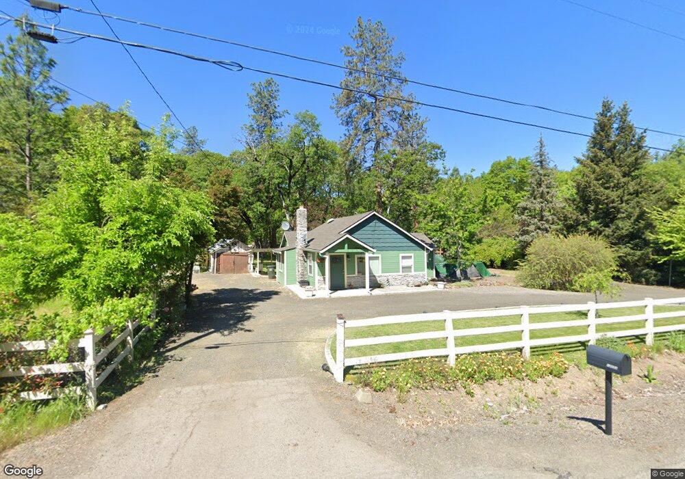
13553 Table Rock Rd Central Point, OR 97502
Estimated Value: $262,585 - $451,000
2
Beds
2
Baths
1,310
Sq Ft
$264/Sq Ft
Est. Value
About This Home
This home is located at 13553 Table Rock Rd, Central Point, OR 97502 and is currently estimated at $346,195, approximately $264 per square foot. 13553 Table Rock Rd is a home located in Jackson County with nearby schools including Sams Valley Elementary School, Hanby Middle School, and Crater High School.
Ownership History
Date
Name
Owned For
Owner Type
Purchase Details
Closed on
Feb 27, 2018
Sold by
Taylor Linda S and Nelson John F
Bought by
Snyder Creek Properties Llc
Current Estimated Value
Home Financials for this Owner
Home Financials are based on the most recent Mortgage that was taken out on this home.
Original Mortgage
$90,000
Outstanding Balance
$71,643
Interest Rate
4.04%
Mortgage Type
Commercial
Estimated Equity
$274,552
Purchase Details
Closed on
Feb 20, 2018
Sold by
Taylor Linda S and Nelson John F
Bought by
Snyder Creek Proeprties Llc
Home Financials for this Owner
Home Financials are based on the most recent Mortgage that was taken out on this home.
Original Mortgage
$90,000
Outstanding Balance
$71,643
Interest Rate
4.04%
Mortgage Type
Commercial
Estimated Equity
$274,552
Purchase Details
Closed on
May 24, 2001
Sold by
Nelson John W and Nelson Pearl N
Bought by
Nelson John F and Nelson Brenda L
Create a Home Valuation Report for This Property
The Home Valuation Report is an in-depth analysis detailing your home's value as well as a comparison with similar homes in the area
Home Values in the Area
Average Home Value in this Area
Purchase History
| Date | Buyer | Sale Price | Title Company |
|---|---|---|---|
| Snyder Creek Properties Llc | $140,000 | Amerititle | |
| Snyder Creek Proeprties Llc | $140,000 | Amerititle | |
| Nelson John F | $5,000 | -- |
Source: Public Records
Mortgage History
| Date | Status | Borrower | Loan Amount |
|---|---|---|---|
| Open | Snyder Creek Properties Llc | $90,000 | |
| Closed | Snyder Creek Proeprties Llc | $90,000 |
Source: Public Records
Tax History Compared to Growth
Tax History
| Year | Tax Paid | Tax Assessment Tax Assessment Total Assessment is a certain percentage of the fair market value that is determined by local assessors to be the total taxable value of land and additions on the property. | Land | Improvement |
|---|---|---|---|---|
| 2025 | $2,000 | $161,320 | $96,520 | $64,800 |
| 2024 | $2,000 | $156,630 | $89,820 | $66,810 |
| 2023 | $1,936 | $152,070 | $87,210 | $64,860 |
| 2022 | $1,896 | $152,070 | $87,210 | $64,860 |
| 2021 | $1,844 | $147,650 | $84,660 | $62,990 |
| 2020 | $1,793 | $143,350 | $82,200 | $61,150 |
| 2019 | $1,753 | $135,130 | $77,490 | $57,640 |
| 2018 | $1,701 | $131,200 | $75,240 | $55,960 |
| 2017 | $1,402 | $131,200 | $75,240 | $55,960 |
| 2016 | $1,363 | $123,670 | $70,920 | $52,750 |
| 2015 | $1,315 | $123,670 | $70,920 | $52,750 |
| 2014 | $1,285 | $116,580 | $66,850 | $49,730 |
Source: Public Records
Map
Nearby Homes
- 11515 Michael Rd
- 11615 Michael Rd
- 3388 McMartin Ln
- 10695 Kildee Ave
- 10695 Killdee Ave
- 250 Robleda Dr
- 395 Robleda Dr
- 0 Duggan Rd Unit 220198974
- 11441 Meadows Rd
- 13007 Perry Rd
- 13355 Weowna Way
- 180 Glass Ln
- 1000 Juliet St
- 3659 Highway 234
- 377 Pelton Ln
- 12214 Modoc Rd
- 700 Rogue Wood Dr
- 5209 Beagle Rd
- 12240 Modoc Rd Unit A
- 12240 Modoc Rd Unit B
- 13577 Table Rock Rd
- 13455 Table Rock Rd
- 13618 Table Rock Rd
- 13663 Table Rock Rd
- 13705 Table Rock Rd
- 13300 Table Rock Rd
- 13500 Table Rock Rd
- 13188 Table Rock Rd
- 7121 Highway 234
- 7121 Hwy 234
- 13113 Table Rock Rd
- 14000 Table Rock Rd
- 13400 Table Rock Rd
- 13290 Table Rock Rd
- 11756 Dixie Rd
- 13540 Table Rock Rd
- 0 Dixie Rd
- 11759 Dixie Rd
- 2946 McMartin Rd
- 11750 Dixie Rd