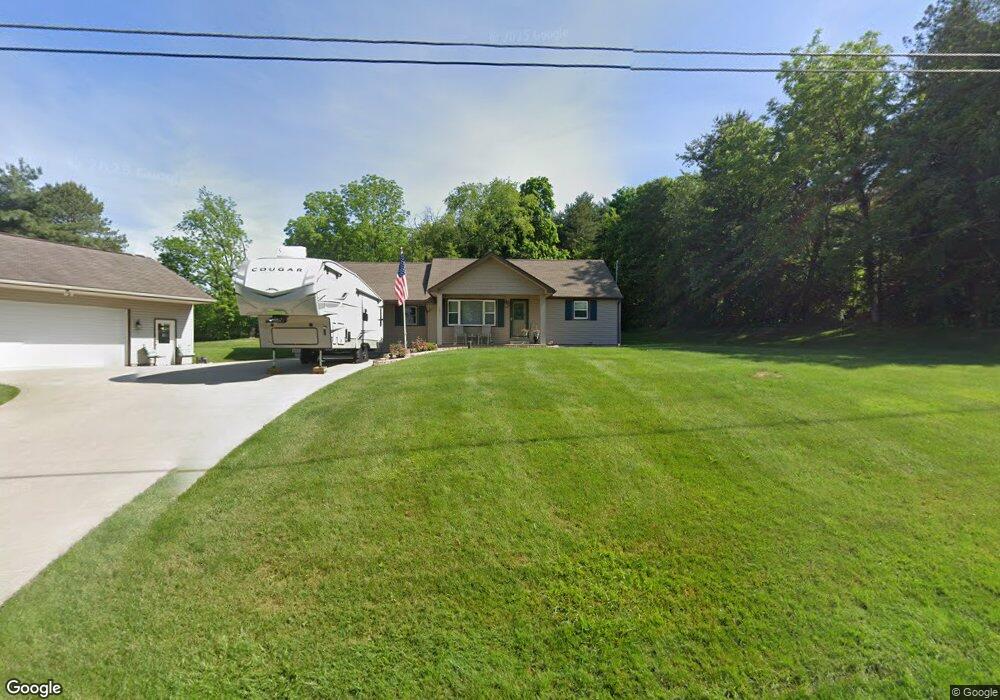
13555 Kimmens Rd SW Massillon, OH 44647
Estimated Value: $258,304 - $389,000
3
Beds
2
Baths
1,964
Sq Ft
$164/Sq Ft
Est. Value
About This Home
This home is located at 13555 Kimmens Rd SW, Massillon, OH 44647 and is currently estimated at $323,076, approximately $164 per square foot. 13555 Kimmens Rd SW is a home located in Stark County with nearby schools including Tuslaw Elementary School, Tuslaw Middle School, and Tuslaw High School.
Ownership History
Date
Name
Owned For
Owner Type
Purchase Details
Closed on
Nov 17, 2006
Sold by
Hardie Howard L and Hardie Heather M
Bought by
Horne Daniel K and Horne Stacey R
Current Estimated Value
Home Financials for this Owner
Home Financials are based on the most recent Mortgage that was taken out on this home.
Original Mortgage
$177,422
Outstanding Balance
$105,829
Interest Rate
6.36%
Mortgage Type
VA
Estimated Equity
$217,247
Create a Home Valuation Report for This Property
The Home Valuation Report is an in-depth analysis detailing your home's value as well as a comparison with similar homes in the area
Home Values in the Area
Average Home Value in this Area
Purchase History
| Date | Buyer | Sale Price | Title Company |
|---|---|---|---|
| Horne Daniel K | $184,000 | Attorney |
Source: Public Records
Mortgage History
| Date | Status | Borrower | Loan Amount |
|---|---|---|---|
| Open | Horne Daniel K | $177,422 |
Source: Public Records
Tax History Compared to Growth
Tax History
| Year | Tax Paid | Tax Assessment Tax Assessment Total Assessment is a certain percentage of the fair market value that is determined by local assessors to be the total taxable value of land and additions on the property. | Land | Improvement |
|---|---|---|---|---|
| 2025 | -- | $73,750 | $11,800 | $61,950 |
| 2024 | -- | $73,750 | $11,800 | $61,950 |
| 2023 | $2,299 | $58,660 | $8,190 | $50,470 |
| 2022 | $2,297 | $58,660 | $8,190 | $50,470 |
| 2021 | $2,330 | $58,660 | $8,190 | $50,470 |
| 2020 | $2,019 | $47,850 | $6,720 | $41,130 |
| 2019 | $1,950 | $47,850 | $6,720 | $41,130 |
| 2018 | $1,919 | $47,850 | $6,720 | $41,130 |
| 2017 | $1,903 | $44,660 | $7,280 | $37,380 |
| 2016 | $1,925 | $44,660 | $7,280 | $37,380 |
| 2015 | $1,784 | $40,880 | $7,280 | $33,600 |
| 2014 | $1,767 | $38,760 | $6,900 | $31,860 |
| 2013 | $891 | $38,760 | $6,900 | $31,860 |
Source: Public Records
Map
Nearby Homes
- 13020 Kimmens Rd SW
- 1174 Manchester Ave SW
- 982 Lanedale St NW
- 1310 Alabama Ave SW
- 1220 Ben Fulton Ave NW
- 1109 Howell Ave NW
- 14656 Lincoln St
- 1252 Gabrielle Cir NW
- 12128 Barrs St SW
- 1350 Alpha St NW
- 2480 Deerford Ave SW
- 4745 Sippo Reserves Dr NW
- 15299 Lincoln Way W
- 15113 Stanwood St
- 822 32nd St NW
- 4420 Lockhart Cir NW
- 3130 Lincoln Way W
- 350 Noble Place NW
- 1855 Alpha St NW
- 3069 Castle West Cir NW
- 13575 Kimmens Rd SW
- 13471 Kimmens Rd SW
- 13596 Kimmens Rd SW
- 13464 Kimmens Rd SW
- 13488 Kimmens Rd SW
- 13380 Kimmens Rd SW
- 13680 Kimmens Rd SW
- 13681 Kimmens Rd SW
- 13666 Kimmens Rd SW
- 13400 Kimmens Rd SW
- 13306 Kimmens Rd SW
- 0 Kimmens Rd SW Unit 3430141
- 0 Kimmens Rd SW Unit 3670536
- 13280 Kimmens Rd SW
- 2075 Manchester Ave SW
- 2139 Manchester Ave SW
- 2043 Manchester Ave SW
- 2243 Manchester Ave SW
- 1959 Manchester Ave SW
- 2341 Manchester Ave SW