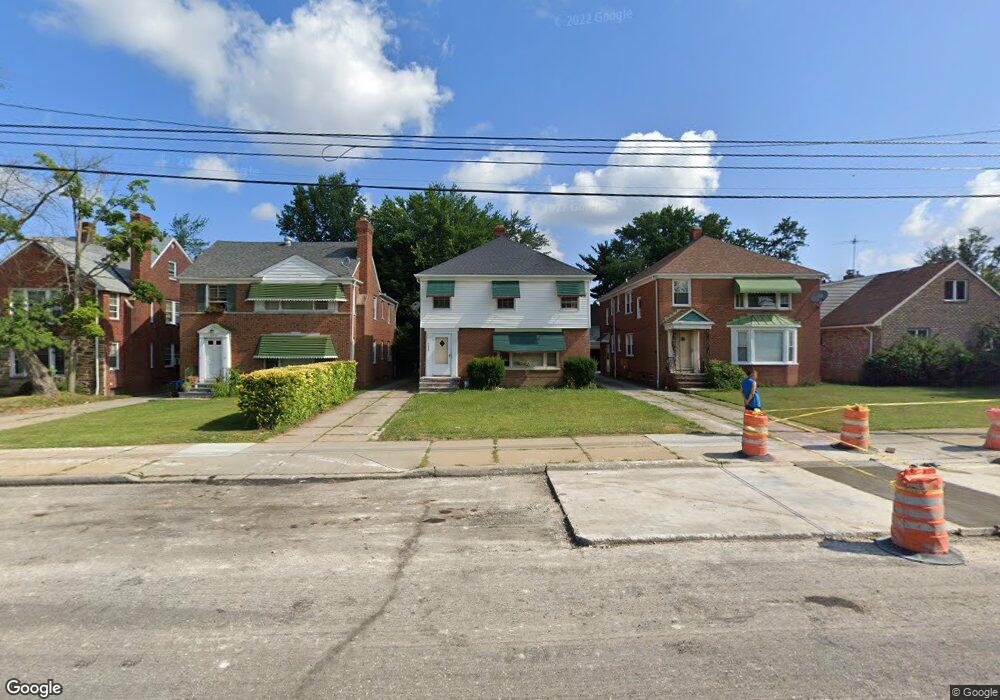
13557 Cedar Rd University Heights, OH 44118
Estimated Value: $214,000 - $281,000
4
Beds
2
Baths
2,553
Sq Ft
$99/Sq Ft
Est. Value
About This Home
This home is located at 13557 Cedar Rd, University Heights, OH 44118 and is currently estimated at $253,131, approximately $99 per square foot. 13557 Cedar Rd is a home located in Cuyahoga County with nearby schools including Canterbury Elementary School, Roxboro Middle School, and Cleveland Heights High School.
Ownership History
Date
Name
Owned For
Owner Type
Purchase Details
Closed on
Apr 3, 1998
Sold by
Consumer Properties Inc
Bought by
Kwok Fiu
Current Estimated Value
Home Financials for this Owner
Home Financials are based on the most recent Mortgage that was taken out on this home.
Original Mortgage
$102,000
Interest Rate
7.75%
Mortgage Type
Purchase Money Mortgage
Purchase Details
Closed on
Mar 10, 1997
Sold by
Borensztein Sam
Bought by
Consumer Properties Inc
Home Financials for this Owner
Home Financials are based on the most recent Mortgage that was taken out on this home.
Original Mortgage
$61,875
Interest Rate
7.93%
Mortgage Type
New Conventional
Purchase Details
Closed on
Jun 10, 1981
Sold by
Borensztein Mortko and Borensztein Szendla
Bought by
Borensztein Sonia
Purchase Details
Closed on
Jan 1, 1975
Bought by
Borensztein Mortko and Borensztein Szendla
Create a Home Valuation Report for This Property
The Home Valuation Report is an in-depth analysis detailing your home's value as well as a comparison with similar homes in the area
Home Values in the Area
Average Home Value in this Area
Purchase History
| Date | Buyer | Sale Price | Title Company |
|---|---|---|---|
| Kwok Fiu | $136,000 | Independence Title Agency In | |
| Consumer Properties Inc | $82,500 | -- | |
| Borensztein Sonia | -- | -- | |
| Borensztein Mortko | -- | -- |
Source: Public Records
Mortgage History
| Date | Status | Borrower | Loan Amount |
|---|---|---|---|
| Closed | Kwok Fiu | $102,000 | |
| Previous Owner | Consumer Properties Inc | $61,875 |
Source: Public Records
Tax History Compared to Growth
Tax History
| Year | Tax Paid | Tax Assessment Tax Assessment Total Assessment is a certain percentage of the fair market value that is determined by local assessors to be the total taxable value of land and additions on the property. | Land | Improvement |
|---|---|---|---|---|
| 2024 | $6,472 | $74,375 | $9,730 | $64,645 |
| 2023 | $5,331 | $46,590 | $7,770 | $38,820 |
| 2022 | $5,197 | $46,585 | $7,770 | $38,815 |
| 2021 | $5,095 | $46,590 | $7,770 | $38,820 |
| 2020 | $5,029 | $41,580 | $6,930 | $34,650 |
| 2019 | $4,804 | $118,800 | $19,800 | $99,000 |
| 2018 | $2,887 | $50,330 | $6,930 | $43,400 |
| 2017 | $5,717 | $46,340 | $5,530 | $40,810 |
| 2016 | $5,644 | $46,340 | $5,530 | $40,810 |
| 2015 | $5,255 | $46,340 | $5,530 | $40,810 |
| 2014 | $5,255 | $45,440 | $5,430 | $40,010 |
Source: Public Records
Map
Nearby Homes
- 3554 Raymont Blvd
- 13605 Cedar Rd
- 3494 Raymont Blvd
- 3621 Cedarbrook Rd
- 13629 Cedar Rd
- 2087 Wynn Rd Unit 1
- 2085 Wynn Rd Unit 2
- 2186 Jackson Blvd
- 2083 Wynn Rd Unit 3
- 2203 Brockway Rd
- 13677 Cedar Rd
- 3485 Silsby Rd
- 2119 Rossmoor Rd
- 3540 Silsby Rd
- 2192 Barrington Rd
- 2227 Cranston Rd
- 2216 Barrington Rd
- 2272 S Taylor Rd
- 13726 Cedar Rd
- 2187 Barrington Rd
- 13561 Cedar Rd
- 13549 Cedar Rd
- 13565 Cedar Rd Unit 6II
- 3558 Raymont Blvd
- 3562 Raymont Blvd
- 3550 Raymont Blvd
- 13541 Cedar Rd
- 3546 Raymont Blvd
- 13577 Cedar Rd
- 13537 Cedar Rd
- 13537 Cedar Rd Unit 1
- 3542 Raymont Blvd
- 13558 Cedar Rd
- 13562 Cedar Rd
- 13556 Cedar Rd
- 13566 Cedar Rd
- 13566 Cedar Rd Unit 2
- 13566 Cedar Rd
- 13566 Cedar Rd Unit UP
- 13566 Cedar Rd Unit Upper