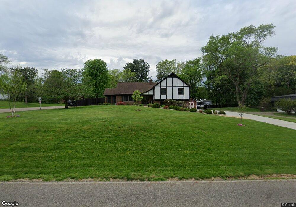
13559 Mogadore Ave NW Uniontown, OH 44685
Estimated Value: $305,000 - $346,896
3
Beds
3
Baths
1,880
Sq Ft
$176/Sq Ft
Est. Value
About This Home
This home is located at 13559 Mogadore Ave NW, Uniontown, OH 44685 and is currently estimated at $330,632, approximately $175 per square foot. 13559 Mogadore Ave NW is a home located in Stark County with nearby schools including Lake Middle/High School and Lake Center Christian School.
Ownership History
Date
Name
Owned For
Owner Type
Purchase Details
Closed on
Mar 28, 2012
Sold by
Behrend Scott A and Behrend Pamela L
Bought by
Behrend Pamela L and Pamela L Behrend Trust
Current Estimated Value
Purchase Details
Closed on
Jun 5, 2003
Sold by
Asente Charles M and Asente Lynn A
Bought by
Behrend Scott A and Behrend Pamela L
Home Financials for this Owner
Home Financials are based on the most recent Mortgage that was taken out on this home.
Original Mortgage
$144,500
Interest Rate
5.88%
Mortgage Type
Purchase Money Mortgage
Create a Home Valuation Report for This Property
The Home Valuation Report is an in-depth analysis detailing your home's value as well as a comparison with similar homes in the area
Home Values in the Area
Average Home Value in this Area
Purchase History
| Date | Buyer | Sale Price | Title Company |
|---|---|---|---|
| Behrend Pamela L | -- | Attorney | |
| Behrend Scott A | $170,000 | American Certified Title |
Source: Public Records
Mortgage History
| Date | Status | Borrower | Loan Amount |
|---|---|---|---|
| Closed | Behrend Scott A | $144,500 |
Source: Public Records
Tax History Compared to Growth
Tax History
| Year | Tax Paid | Tax Assessment Tax Assessment Total Assessment is a certain percentage of the fair market value that is determined by local assessors to be the total taxable value of land and additions on the property. | Land | Improvement |
|---|---|---|---|---|
| 2025 | -- | $117,260 | $20,970 | $96,290 |
| 2024 | -- | $117,260 | $20,970 | $96,290 |
| 2023 | $4,930 | $94,160 | $15,300 | $78,860 |
| 2022 | $5,414 | $94,160 | $15,300 | $78,860 |
| 2021 | $5,466 | $94,160 | $15,300 | $78,860 |
| 2020 | $5,293 | $81,140 | $13,200 | $67,940 |
| 2019 | $5,255 | $77,360 | $13,200 | $64,160 |
| 2018 | $5,042 | $77,360 | $13,200 | $64,160 |
| 2017 | $4,829 | $68,150 | $11,380 | $56,770 |
| 2016 | $4,837 | $68,150 | $11,380 | $56,770 |
| 2015 | $4,836 | $68,150 | $11,380 | $56,770 |
| 2014 | $532 | $65,040 | $10,890 | $54,150 |
| 2013 | $2,266 | $65,040 | $10,890 | $54,150 |
Source: Public Records
Map
Nearby Homes
- 2944 Pontius St NW
- 3100 Linden St NW
- 91 Pontius Rd
- 13341 Sugar Bush Ave NW
- 3310 Linden St NW
- 2498 Foxfire St NW
- 0 Pontius Rd Unit 5163828
- 2025 Portage Line Rd
- 13792 Amodio Ave NW
- 0 Pine St NW
- 3796 Sweitzer St NW
- 2693 Ledgestone Dr NW
- 12494 Bridgemont Ave NW
- 835 Brodie Ct
- 843 Brodie Ct
- 2399 Ledgestone Dr NW
- 2455 Ledgestone Dr NW
- 2439 Ledgestone Dr NW
- 2411 Ledgestone Dr NW
- 3221 Killian Rd
- 13579 Mogadore Ave NW
- 2895 Linden St NW
- 13527 Mogadore Ave NW
- 13601 Mogadore Ave NW
- 2880 Linden St NW
- 2919 Linden St NW
- 2888 Linden St NW
- 13495 Mogadore Ave NW
- 13619 Mogadore Ave NW
- 13616 Mogadore Ave NW
- 13620 Mogadore Ave NW
- 2904 Linden St NW
- 2929 Linden St NW
- 13492 Mogadore Ave NW
- 2930 Linden St NW
- 13544 Theeland Ave NW
- 13518 Theeland Ave NW
- 13484 Mogadore Ave NW
- 2945 Linden St NW
- 13477 Mogadore Ave NW