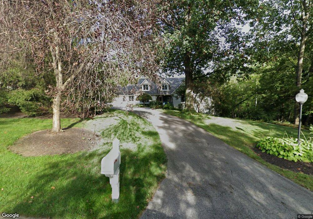
13565 Brentwood Ln Carmel, IN 46033
East Carmel NeighborhoodEstimated Value: $985,000 - $1,339,000
4
Beds
5
Baths
5,080
Sq Ft
$227/Sq Ft
Est. Value
About This Home
This home is located at 13565 Brentwood Ln, Carmel, IN 46033 and is currently estimated at $1,155,226, approximately $227 per square foot. 13565 Brentwood Ln is a home located in Hamilton County with nearby schools including Mohawk Trails Elementary School, Clay Middle School, and Carmel High School.
Ownership History
Date
Name
Owned For
Owner Type
Purchase Details
Closed on
Apr 27, 2007
Sold by
Turney Bozell William D and Turney Bozell James Wayde
Bought by
Berger Thomas C and Berger Jennifer S
Current Estimated Value
Home Financials for this Owner
Home Financials are based on the most recent Mortgage that was taken out on this home.
Original Mortgage
$560,000
Outstanding Balance
$341,374
Interest Rate
6.21%
Mortgage Type
Unknown
Estimated Equity
$813,852
Purchase Details
Closed on
Oct 19, 2006
Sold by
Bozell William D and Turney James Wayde
Bought by
Turney Bozell William D and Turney Bozell James Wayde
Purchase Details
Closed on
Mar 15, 2006
Sold by
Harris John D and Harris Lilly S
Bought by
Bozell William D and Turney James Wayde
Home Financials for this Owner
Home Financials are based on the most recent Mortgage that was taken out on this home.
Original Mortgage
$544,000
Interest Rate
9.6%
Mortgage Type
Fannie Mae Freddie Mac
Create a Home Valuation Report for This Property
The Home Valuation Report is an in-depth analysis detailing your home's value as well as a comparison with similar homes in the area
Home Values in the Area
Average Home Value in this Area
Purchase History
| Date | Buyer | Sale Price | Title Company |
|---|---|---|---|
| Berger Thomas C | -- | None Available | |
| Turney Bozell William D | -- | Archer Land Title Llc | |
| Bozell William D | -- | The Talon Group |
Source: Public Records
Mortgage History
| Date | Status | Borrower | Loan Amount |
|---|---|---|---|
| Open | Berger Thomas C | $560,000 | |
| Previous Owner | Bozell William D | $544,000 |
Source: Public Records
Tax History Compared to Growth
Tax History
| Year | Tax Paid | Tax Assessment Tax Assessment Total Assessment is a certain percentage of the fair market value that is determined by local assessors to be the total taxable value of land and additions on the property. | Land | Improvement |
|---|---|---|---|---|
| 2024 | $9,112 | $751,200 | $321,300 | $429,900 |
| 2023 | $9,112 | $751,200 | $321,300 | $429,900 |
| 2022 | $8,160 | $678,400 | $195,600 | $482,800 |
| 2021 | $6,953 | $579,300 | $195,600 | $383,700 |
| 2020 | $6,331 | $547,300 | $163,600 | $383,700 |
| 2019 | $6,283 | $543,400 | $163,600 | $379,800 |
| 2018 | $6,226 | $543,400 | $163,600 | $379,800 |
| 2017 | $6,039 | $527,500 | $163,600 | $363,900 |
| 2016 | $6,424 | $570,100 | $163,600 | $406,500 |
| 2014 | $6,422 | $569,500 | $163,600 | $405,900 |
| 2013 | $6,422 | $569,500 | $163,600 | $405,900 |
Source: Public Records
Map
Nearby Homes
- 13615 Smokey Hollow Place
- 651 Hawthorne Dr
- 128 1st Ct
- 3248 Smokey Ridge Way
- 781 Dayton Dr
- 14011 Grisham Dr
- 2913 Twain Dr
- 728 E Main St
- 2945 Millgate Dr
- 1483 Spruce Dr
- 131 Blairsden Ave
- 311 2nd St NE
- 423 Jenny Ln
- 1816 Spruce Dr
- 1504 Dorchester Place
- 428 Jenny Ln
- 1129 Fairbanks Dr
- 542 Ash Dr
- 231 1st Ave NE
- 612 Ash Dr
- 13585 Brentwood Ln
- 13555 Brentwood Ln
- 13566 Brentwood Ln
- 13535 Brentwood Ln
- 13580 Brentwood Ln
- 13544 Brentwood Ln
- 13515 Brentwood Ln
- 3227 E 136th St
- 13596 Brentwood Ln
- 13534 Brentwood Ln
- 13540 Brentwood Ln
- 13528 Brentwood Ln
- 13511 Brentwood Ln
- 13522 Brentwood Ln
- 0 E 136th St Unit MBR2013895
- 13501 Brentwood Ln
- 13613 Smokey Ridge Place
- 3259 Smokey Ridge Ct
- 13516 Brentwood Ln
- 13504 Brentwood Ln